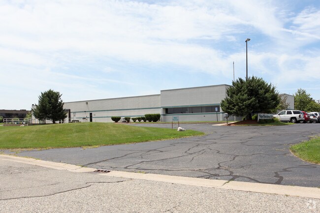
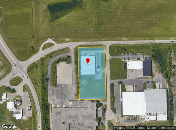
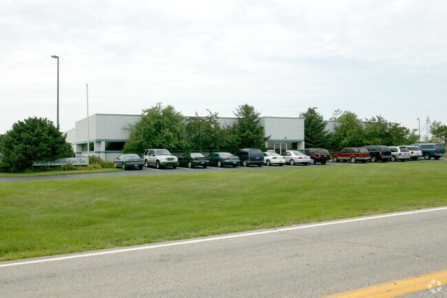
Property Record
184 W 64Th St, Holland, MI 49423
NEARBY LISTINGS FOR SALE OR LEASE
Property Detail
184 W 64Th St
53-02-17-100-008
PT OF NW 1/4 BEG AT A PT ON N LN OF SEC 17 DIST N 88DEG40'28E 400.76' FROM NW COR OF SEC 17 & PROCEEDING TH N 88DEG40'28W 265.00'; TH S 01DEG23'13E 555.22'; TH S 88DEG40'01W 265.00'; TH N 01DEG23'13W 555.26' TO POB EXC N 33' FOR ST SEC 17 T4N R15W TA
Scientificpharmaceuticalmedicalresearchfacility
Allegan
X
Michigan
26005C0176G
3.20 AC
2024
NE Allegan/Holland
2025
West Michigan
032401
Holland, MI
25,513 SF
DEMOGRAPHICS near 184 W 64Th St
1 Mile
3 Mile
5 Mile
2024 Total Population
172
22,677
56,096
2029 Population
174
23,384
58,385
Pop Growth 2024-2029
+ 1.16%
+ 3.12%
+ 4.08%
Average Age
41
40
40
2024 Total Households
65
8,801
21,263
HH Growth 2024-2029
0.00%
+ 3.05%
+ 4.18%
Median Household Inc
$67,500
$67,955
$72,073
Avg Household Size
2.40
2.50
2.50
2024 Avg HH Vehicles
2.00
2.00
2.00
Median Home Value
$256,249
$210,796
$244,396
Median Year Built
1987
1967
1973
Nearby Places
Map Layers
Map Styles
 Street
 Aerial
- Restaurants
- Banks
- Shops
- Fitness
- Groceries
PUBLIC TRANSPORTATION
COMMUTER RAIL
DRIVE
WALK
Distance
11 min
4.7 mi
AIRPORT
Gerald R Ford International
DRIVE
WALK
Distance
Gerald R Ford International
51 min
38.7 mi
Nearby Properties
Address
Land Use
TOTAL SIZE
Lot Size
Zoning
Address
Land Use
TOTAL SIZE
Lot Size
Zoning
1,599,294 SF
Address
Land Use
TOTAL SIZE
Lot Size
Zoning
1,788,352 SF
173.33 AC
Address
Land Use
TOTAL SIZE
Lot Size
Zoning
682,378 SF
99.60 AC
NA
Address
Land Use
TOTAL SIZE
Lot Size
Zoning
198,712 SF
Address
Land Use
TOTAL SIZE
Lot Size
Zoning
630,943 SF
28.50 AC
Address
Land Use
TOTAL SIZE
Lot Size
Zoning
556,819 SF
85.45 AC
Address
Land Use
TOTAL SIZE
Lot Size
Zoning
674,052 SF
79.30 AC
Address
Land Use
TOTAL SIZE
Lot Size
Zoning
154,107 SF
Address
Land Use
TOTAL SIZE
Lot Size
Zoning
239,465 SF
Address
Land Use
TOTAL SIZE
Lot Size
Zoning
118,444 SF
4.39 AC
Address
Land Use
TOTAL SIZE
Lot Size
Zoning
589,649 SF
92.65 AC
Address
Land Use
TOTAL SIZE
Lot Size
Zoning
150,822 SF
Address
Land Use
TOTAL SIZE
Lot Size
Zoning
114,088 SF
10.79 AC
PRD
Address
Land Use
TOTAL SIZE
Lot Size
Zoning
181,754 SF
13.44 AC
R3
Address
Land Use
TOTAL SIZE
Lot Size
Zoning
391,842 SF
28.34 AC
Address
Land Use
TOTAL SIZE
Lot Size
Zoning
372,017 SF
17.60 AC
R-2
Address
Land Use
TOTAL SIZE
Lot Size
Zoning
357,000 SF
23.35 AC
Address
Land Use
TOTAL SIZE
Lot Size
Zoning
73,700 SF
Address
Land Use
TOTAL SIZE
Lot Size
Zoning
397,258 SF
36.66 AC
I2
Address
Land Use
TOTAL SIZE
Lot Size
Zoning
158,661 SF
17.28 AC
Address
Land Use
TOTAL SIZE
Lot Size
Zoning
122,026 SF
15.03 AC
R3
Address
Land Use
TOTAL SIZE
Lot Size
Zoning
146,357 SF
20.04 AC
Address
Land Use
TOTAL SIZE
Lot Size
Zoning
73,663 SF
4.66 AC
Address
Land Use
TOTAL SIZE
Lot Size
Zoning
252,065 SF
13.98 AC
Address
Land Use
TOTAL SIZE
Lot Size
Zoning
404,600 SF
23.23 AC
I2
Address
Land Use
TOTAL SIZE
Lot Size
Zoning
132,108 SF
9.97 AC
I-1
Address
Land Use
TOTAL SIZE
Lot Size
Zoning
281,775 SF
Address
Land Use
TOTAL SIZE
Lot Size
Zoning
124,176 SF
7.88 AC
I
Address
Land Use
TOTAL SIZE
Lot Size
Zoning
55,088 SF
Address
Land Use
TOTAL SIZE
Lot Size
Zoning
300,000 SF
The World's #1 Commercial Real Estate Marketplace
Connect with us
© 2025 CoStar Group
The information above has been obtained from sources believed reliable. While we do not doubt its accuracy we have not verified it and make no guarantee, warranty or representation about it. It is your responsibility to independently confirm its accuracy and completeness. Any projections, opinions, assumptions, or estimates used are for example only and do not represent the current or future performance of the property. The value of this transaction to you depends on tax and other factors which should be evaluated by your tax, financial, and legal advisors. You and your advisors should conduct a careful, independent investigation of the property to determine to your satisfaction the suitability of the property for your needs.