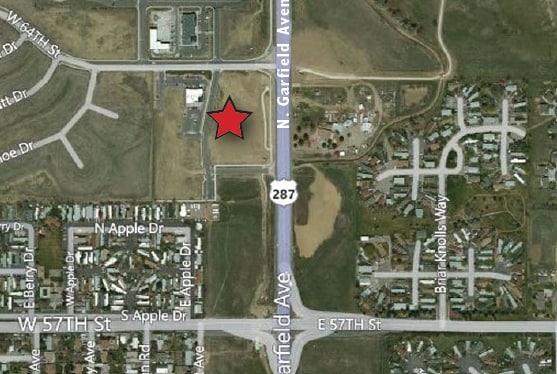
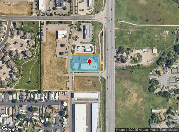
Property Record
184 W 64Th St, Loveland, CO 80538
NEARBY LISTINGS FOR SALE OR LEASE
Property Detail
184 W 64Th St
Fort Collins-Loveland, CO
Peakview Commercial Park 1St
96264-18-004
LOT 4, BLK1, AMD LOTS 4 & 5, BLK 1, OF AMD PLAT, PEAKVIEW COMMERCIAL PARK 1ST SUB, LOV (20140033618)
Commercialnec
Larimer
X
Colorado
08069C1200F
4,5
2024
1.21 AC
2025
Fort Collins/Loveland
001813
Denver
9,961 SF
DEMOGRAPHICS near 184 W 64Th St
1 mile
3 mile
5 mile
2024 Total Population
7,251
43,689
105,769
2029 Population
7,745
46,179
111,568
Pop Growth 2024-2029
+ 6.81%
+ 5.70%
+ 5.48%
Average Age
41
43
42
2024 Total Households
2,913
17,506
43,650
HH Growth 2024-2029
+ 7.14%
+ 6.00%
+ 5.76%
Median Household Inc
$63,595
$80,028
$82,123
Avg Household Size
2.50
2.50
2.40
2024 Avg HH Vehicles
2.00
2.00
2.00
Median Home Value
$390,970
$441,703
$460,672
Median Year Built
1999
1995
1994
Nearby Places
Map Layers
Map Styles
 Street
 Aerial
Transit
 Traffic
 Biking
Places
Listings with unknown addresses are not visible on the map
- Restaurants
- Banks
- Shops
- Fitness
- Groceries
SALE & LEASE HISTORY
LISTING DATE
SALE/LEASE

Sep 25, 2016
For Lease
Nearby Properties
Address
Land Use
TOTAL SIZE
Lot Size
Zoning
Address
Land Use
TOTAL SIZE
Lot Size
Zoning
201,500 SF
28.43 AC
R1E
Address
Land Use
TOTAL SIZE
Lot Size
Zoning
573.74 AC
FA1
Address
Land Use
TOTAL SIZE
Lot Size
Zoning
117,434 SF
29.34 AC
R1
Address
Land Use
TOTAL SIZE
Lot Size
Zoning
137,225 SF
25.76 AC
R1
Address
Land Use
TOTAL SIZE
Lot Size
Zoning
222,636 SF
26.89 AC
P65
Address
Land Use
TOTAL SIZE
Lot Size
Zoning
109,911 SF
6.74 AC
Address
Land Use
TOTAL SIZE
Lot Size
Zoning
82,749 SF
25.54 AC
R2
Address
Land Use
TOTAL SIZE
Lot Size
Zoning
117,157 SF
117.61 AC
Address
Land Use
TOTAL SIZE
Lot Size
Zoning
75,000 SF
2.96 AC
B
Address
Land Use
TOTAL SIZE
Lot Size
Zoning
123,130 SF
4.17 AC
Address
Land Use
TOTAL SIZE
Lot Size
Zoning
332,645 SF
14.16 AC
BUD
Address
Land Use
TOTAL SIZE
Lot Size
Zoning
162,703 SF
14.92 AC
B
Address
Land Use
TOTAL SIZE
Lot Size
Zoning
117,496 SF
6.24 AC
Address
Land Use
TOTAL SIZE
Lot Size
Zoning
125,250 SF
9.55 AC
P93
Address
Land Use
TOTAL SIZE
Lot Size
Zoning
56,724 SF
9.11 AC
Address
Land Use
TOTAL SIZE
Lot Size
Zoning
54,300 SF
4.05 AC
FA1
Address
Land Use
TOTAL SIZE
Lot Size
Zoning
41,580 SF
1.83 AC
B
Address
Land Use
TOTAL SIZE
Lot Size
Zoning
3,571 SF
60.67 AC
Address
Land Use
TOTAL SIZE
Lot Size
Zoning
48,000 SF
10 AC
P58
Address
Land Use
TOTAL SIZE
Lot Size
Zoning
164,619 SF
11.54 AC
Address
Land Use
TOTAL SIZE
Lot Size
Zoning
58,901 SF
3.64 AC
B
Address
Land Use
TOTAL SIZE
Lot Size
Zoning
54,950 SF
12.37 AC
P73
Address
Land Use
TOTAL SIZE
Lot Size
Zoning
387,075 SF
17.61 AC
Address
Land Use
TOTAL SIZE
Lot Size
Zoning
3,792 SF
13.75 AC
Address
Land Use
TOTAL SIZE
Lot Size
Zoning
51,000 SF
4.21 AC
I
Address
Land Use
TOTAL SIZE
Lot Size
Zoning
107,715 SF
5.23 AC
Address
Land Use
TOTAL SIZE
Lot Size
Zoning
33,500 SF
7.18 AC
R1
Address
Land Use
TOTAL SIZE
Lot Size
Zoning
5,721 SF
23.63 AC
Address
Land Use
TOTAL SIZE
Lot Size
Zoning
47,322 SF
17.09 AC
FA1
Address
Land Use
TOTAL SIZE
Lot Size
Zoning
97,225 SF
4.60 AC
P55
The World's #1 Commercial Real Estate Marketplace
Connect with us
© 2026 CoStar Group
The information above has been obtained from sources believed reliable. While we do not doubt its accuracy we have not verified it and make no guarantee, warranty or representation about it. It is your responsibility to independently confirm its accuracy and completeness. Any projections, opinions, assumptions, or estimates used are for example only and do not represent the current or future performance of the property. The value of this transaction to you depends on tax and other factors which should be evaluated by your tax, financial, and legal advisors. You and your advisors should conduct a careful, independent investigation of the property to determine to your satisfaction the suitability of the property for your needs.