Property Record
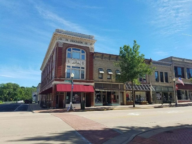
184 W Main St, Stoughton, WI 53589

Property Detail
184 W Main St
Madison, WI
ORIGINAL PLAT BLOCK 21 PRT LOT 5 W 22 FT OF E 44 FT THF EXC N 12 FT THF SUBJ TO PARTY WALL AGRMT DESR IN M5/361 & M19/160
0511-082-1570-8
DANE
Commercialnec
Wisconsin
B and X Area of moderate flood hazard, usually the area between the limits of the 100-year and 500-year floods.
5
2025
0.06 AC
2025
Outlying Dane East
012201
Milwaukee/Madison
NEARBY LISTINGS FOR SALE OR LEASE
DEMOGRAPHICS near 184 W Main St
1 mile
3 mile
5 mile
2025 Total Population
7,513
16,247
19,525
2030 Population
7,722
16,784
20,168
Pop Growth 2025-2030
+ 2.78%
+ 3.31%
+ 3.29%
Average Age
42
43
43
2025 Total Households
3,102
6,672
8,042
HH Growth 2025-2030
+ 3.03%
+ 3.52%
+ 3.52%
Median Household Inc
$73,900
$85,689
$90,100
Avg Household Size
2.30
2.40
2.40
2025 Avg HH Vehicles
2.00
2.00
2.00
Median Home Value
$313,226
$340,021
$355,615
Median Year Built
1970
1981
1979
Nearby Places
Map Layers
Map Styles
 Street
 Aerial
Layers
 Traffic
 Biking
Places
Listings with unknown addresses are not visible on the map
- Restaurants
- Banks
- Shops
- Fitness
- Groceries
PUBLIC TRANSPORTATION
AIRPORT
Dane County Regional/Truax Field
Drive
Walk
Distance
Dane County Regional/Truax Field
30 min
20.0 mi
Freight Ports
Port Milwaukee
Drive
Walk
Distance
Port Milwaukee
101 min
83.3 mi
Nearby Properties
Address
Land Use
TOTAL SIZE
Lot Size
Zoning
Address
Land Use
TOTAL SIZE
Lot Size
Zoning
97.38 AC
Address
Land Use
TOTAL SIZE
Lot Size
Zoning
4.24 AC
Address
Land Use
TOTAL SIZE
Lot Size
Zoning
18.01 AC
Address
Land Use
TOTAL SIZE
Lot Size
Zoning
Address
Land Use
TOTAL SIZE
Lot Size
Zoning
12.30 AC
Address
Land Use
TOTAL SIZE
Lot Size
Zoning
2.34 AC
Address
Land Use
TOTAL SIZE
Lot Size
Zoning
2.48 AC
Address
Land Use
TOTAL SIZE
Lot Size
Zoning
3.23 AC
Address
Land Use
TOTAL SIZE
Lot Size
Zoning
2.32 AC
Address
Land Use
TOTAL SIZE
Lot Size
Zoning
Address
Land Use
TOTAL SIZE
Lot Size
Zoning
4.75 AC
Address
Land Use
TOTAL SIZE
Lot Size
Zoning
2.57 AC
Address
Land Use
TOTAL SIZE
Lot Size
Zoning
2.64 AC
Address
Land Use
TOTAL SIZE
Lot Size
Zoning
9.37 AC
Address
Land Use
TOTAL SIZE
Lot Size
Zoning
3.23 AC
Address
Land Use
TOTAL SIZE
Lot Size
Zoning
2.06 AC
Address
Land Use
TOTAL SIZE
Lot Size
Zoning
Address
Land Use
TOTAL SIZE
Lot Size
Zoning
Address
Land Use
TOTAL SIZE
Lot Size
Zoning
1.36 AC
Address
Land Use
TOTAL SIZE
Lot Size
Zoning
3.88 AC
Address
Land Use
TOTAL SIZE
Lot Size
Zoning
4.98 AC
Address
Land Use
TOTAL SIZE
Lot Size
Zoning
6.98 AC
Address
Land Use
TOTAL SIZE
Lot Size
Zoning
Address
Land Use
TOTAL SIZE
Lot Size
Zoning
Address
Land Use
TOTAL SIZE
Lot Size
Zoning
1.82 AC
Address
Land Use
TOTAL SIZE
Lot Size
Zoning
1.71 AC
Address
Land Use
TOTAL SIZE
Lot Size
Zoning
1.17 AC
Address
Land Use
TOTAL SIZE
Lot Size
Zoning
Address
Land Use
TOTAL SIZE
Lot Size
Zoning
8.04 AC
C-2
Address
Land Use
TOTAL SIZE
Lot Size
Zoning
0.98 AC
The World's #1 Commercial Real Estate Marketplace
Connect with us
© 2026 CoStar Group
The information above has been obtained from sources believed reliable. While we do not doubt its accuracy we have not verified it and make no guarantee, warranty or representation about it. It is your responsibility to independently confirm its accuracy and completeness. Any projections, opinions, assumptions, or estimates used are for example only and do not represent the current or future performance of the property. The value of this transaction to you depends on tax and other factors which should be evaluated by your tax, financial, and legal advisors. You and your advisors should conduct a careful, independent investigation of the property to determine to your satisfaction the suitability of the property for your needs.