Property Record
184 Wire Dr, Andrews, SC 29510
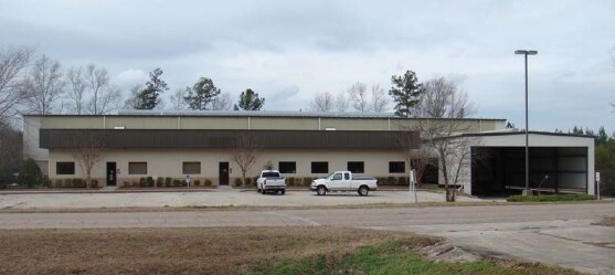

Property Detail
184 Wire Dr
02-0416-016-06-00
PARCEL #2- ST HWY 20 SLD 559-2; SLD 748-4; PLT 2529-225
Commercialnec
GEORGETOWN
B and X Area of moderate flood hazard, usually the area between the limits of the 100-year and 500-year floods.
South Carolina
2025
6.60
2025
12.41 AC
920202
Other Market Areas
32,800 SF
Murrells Inlet, SC
NEARBY LISTINGS FOR SALE OR LEASE
-
-
View all Andrews listings for sale on LoopNet.com
DEMOGRAPHICS near 184 Wire Dr
1 mile
3 mile
5 mile
2025 Total Population
529
4,620
6,558
2030 Population
549
4,753
6,703
Pop Growth 2025-2030
+ 3.78%
+ 2.88%
+ 2.21%
Average Age
42
41
41
2025 Total Households
218
1,850
2,610
HH Growth 2025-2030
+ 3.67%
+ 2.76%
+ 2.11%
Median Household Inc
$39,230
$47,484
$47,937
Avg Household Size
2.40
2.50
2.50
2025 Avg HH Vehicles
2.00
2.00
2.00
Median Home Value
$147,619
$144,076
$144,208
Median Year Built
1990
1983
1985
Nearby Places
Map Layers
Map Styles
 Street
 Aerial
Layers
 Traffic
 Biking
Places
Listings with unknown addresses are not visible on the map
- Restaurants
- Banks
- Shops
- Fitness
- Groceries
Nearby Properties
Address
Land Use
TOTAL SIZE
Lot Size
Zoning
Address
Land Use
TOTAL SIZE
Lot Size
Zoning
55.50 AC
Address
Land Use
TOTAL SIZE
Lot Size
Zoning
55.50 AC
Address
Land Use
TOTAL SIZE
Lot Size
Zoning
116,849 SF
55.50 AC
Address
Land Use
TOTAL SIZE
Lot Size
Zoning
1,806.43 AC
Address
Land Use
TOTAL SIZE
Lot Size
Zoning
Address
Land Use
TOTAL SIZE
Lot Size
Zoning
9.50 AC
Address
Land Use
TOTAL SIZE
Lot Size
Zoning
37.18 AC
Address
Land Use
TOTAL SIZE
Lot Size
Zoning
1 SF
43.80 AC
Address
Land Use
TOTAL SIZE
Lot Size
Zoning
19,720 SF
1 AC
Address
Land Use
TOTAL SIZE
Lot Size
Zoning
10,298 SF
1 AC
Address
Land Use
TOTAL SIZE
Lot Size
Zoning
5,075 SF
1.58 AC
Address
Land Use
TOTAL SIZE
Lot Size
Zoning
40,320 SF
7.43 AC
Address
Land Use
TOTAL SIZE
Lot Size
Zoning
91.60 AC
Address
Land Use
TOTAL SIZE
Lot Size
Zoning
Address
Land Use
TOTAL SIZE
Lot Size
Zoning
426.12 AC
Address
Land Use
TOTAL SIZE
Lot Size
Zoning
4.23 AC
Address
Land Use
TOTAL SIZE
Lot Size
Zoning
6,870 SF
1 AC
Address
Land Use
TOTAL SIZE
Lot Size
Zoning
31,051 SF
1 AC
Address
Land Use
TOTAL SIZE
Lot Size
Zoning
3.90 AC
Address
Land Use
TOTAL SIZE
Lot Size
Zoning
11,510 SF
6.80 AC
Address
Land Use
TOTAL SIZE
Lot Size
Zoning
Address
Land Use
TOTAL SIZE
Lot Size
Zoning
Address
Land Use
TOTAL SIZE
Lot Size
Zoning
3,239 SF
1.66 AC
Address
Land Use
TOTAL SIZE
Lot Size
Zoning
187.40 AC
Address
Land Use
TOTAL SIZE
Lot Size
Zoning
3,234 SF
3 AC
Address
Land Use
TOTAL SIZE
Lot Size
Zoning
1 SF
3.70 AC
Address
Land Use
TOTAL SIZE
Lot Size
Zoning
2,432 SF
1.04 AC
Address
Land Use
TOTAL SIZE
Lot Size
Zoning
7,328 SF
3 AC
Address
Land Use
TOTAL SIZE
Lot Size
Zoning
3,500 SF
3 AC
Address
Land Use
TOTAL SIZE
Lot Size
Zoning
2,300 SF
1 AC
The World's #1 Commercial Real Estate Marketplace
Connect with us
© 2026 CoStar Group
The information above has been obtained from sources believed reliable. While we do not doubt its accuracy we have not verified it and make no guarantee, warranty or representation about it. It is your responsibility to independently confirm its accuracy and completeness. Any projections, opinions, assumptions, or estimates used are for example only and do not represent the current or future performance of the property. The value of this transaction to you depends on tax and other factors which should be evaluated by your tax, financial, and legal advisors. You and your advisors should conduct a careful, independent investigation of the property to determine to your satisfaction the suitability of the property for your needs.