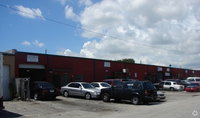
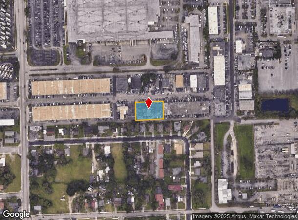
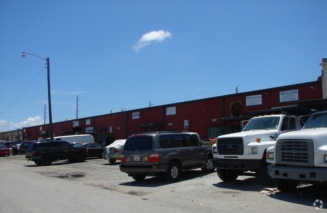
Property Record
1840 Nw 29Th St, Oakland Park, FL 33311

NEARBY LISTINGS FOR SALE OR LEASE
Property Detail
1840 Nw 29Th St
Fort Lauderdale-Pompano Beach-Deerfield Beach, FL
Smith Sub 76-1 B
49-42-28-17-0200
SMITH SUB 76-1 B LOT 19 THRU 22
Warehouse
Broward
AE
Florida
12011C0366J
19-22
2024
0.60 AC
2025
Central Broward
050800
South Florida
18,000 SF
DEMOGRAPHICS near 1840 Nw 29Th St
1 Mile
3 Mile
5 Mile
2024 Total Population
11,262
176,382
483,600
2029 Population
11,112
177,432
488,784
Pop Growth 2024-2029
(1.33%)
+ 0.60%
+ 1.07%
Average Age
41
40
42
2024 Total Households
4,630
70,864
202,035
HH Growth 2024-2029
(1.79%)
+ 0.45%
+ 1.13%
Median Household Inc
$55,919
$49,745
$58,953
Avg Household Size
2.30
2.40
2.30
2024 Avg HH Vehicles
2.00
1.00
2.00
Median Home Value
$292,116
$277,318
$335,829
Median Year Built
1973
1973
1974
Nearby Places
Map Layers
Map Styles
 Street
 Aerial
- Restaurants
- Banks
- Shops
- Fitness
- Groceries
PUBLIC TRANSPORTATION
COMMUTER RAIL
Fort Lauderdale (Tri-County Commuter - South Florida Regional Transportation Authority (Tri-Rail))
DRIVE
WALK
Distance
Fort Lauderdale (Tri-County Commuter - South Florida Regional Transportation Authority (Tri-Rail))
10 min
5.0 mi
Cypress Creek (Tri-County Commuter - South Florida Regional Transportation Authority (Tri-Rail))
DRIVE
WALK
Distance
Cypress Creek (Tri-County Commuter - South Florida Regional Transportation Authority (Tri-Rail))
10 min
5.0 mi
AIRPORT
Fort Lauderdale/Hollywood International
DRIVE
WALK
Distance
Fort Lauderdale/Hollywood International
17 min
9.9 mi
Miami International
DRIVE
WALK
Distance
Miami International
52 min
38.3 mi
Freight Ports
Port Everglades
DRIVE
WALK
Distance
Port Everglades
1 min
5.4 mi
Nearby Properties
Address
Land Use
TOTAL SIZE
Lot Size
Zoning
Address
Land Use
TOTAL SIZE
Lot Size
Zoning
202,260 SF
443 AC
GAA
Address
Land Use
TOTAL SIZE
Lot Size
Zoning
606,213 SF
3.75 AC
RAC-UV
Address
Land Use
TOTAL SIZE
Lot Size
Zoning
734,444 SF
5.26 AC
RAC-CC
Address
Land Use
TOTAL SIZE
Lot Size
Zoning
453,314 SF
2.01 AC
RAC-UV
Address
Land Use
TOTAL SIZE
Lot Size
Zoning
478,587 SF
1.36 AC
RAC-CC
Address
Land Use
TOTAL SIZE
Lot Size
Zoning
479,072 SF
2.02 AC
RAC-UV
Address
Land Use
TOTAL SIZE
Lot Size
Zoning
483,069 SF
23.09 AC
CF
Address
Land Use
TOTAL SIZE
Lot Size
Zoning
481,895 SF
1.86 AC
RAC-UV
Address
Land Use
TOTAL SIZE
Lot Size
Zoning
424,412 SF
2.39 AC
RAC-UV
Address
Land Use
TOTAL SIZE
Lot Size
Zoning
302,696 SF
42.40 AC
Address
Land Use
TOTAL SIZE
Lot Size
Zoning
287,591 SF
9.23 AC
MR
Address
Land Use
TOTAL SIZE
Lot Size
Zoning
377,156 SF
1.71 AC
RAC-UV
Address
Land Use
TOTAL SIZE
Lot Size
Zoning
435,442 SF
0.96 AC
RAC-CC
Address
Land Use
TOTAL SIZE
Lot Size
Zoning
464,170 SF
43.19 AC
CF
Address
Land Use
TOTAL SIZE
Lot Size
Zoning
597,732 SF
55.47 AC
CF
Address
Land Use
TOTAL SIZE
Lot Size
Zoning
528,271 SF
72.23 AC
CF
Address
Land Use
TOTAL SIZE
Lot Size
Zoning
309,879 SF
7.78 AC
TND-PUD
Address
Land Use
TOTAL SIZE
Lot Size
Zoning
213,768 SF
10.23 AC
RM-25
Address
Land Use
TOTAL SIZE
Lot Size
Zoning
383,848 SF
2.54 AC
PUD
Address
Land Use
TOTAL SIZE
Lot Size
Zoning
216,569 SF
6.82 AC
TOC EAST
Address
Land Use
TOTAL SIZE
Lot Size
Zoning
296,703 SF
1.62 AC
RAC-CC
Address
Land Use
TOTAL SIZE
Lot Size
Zoning
307,727 SF
17.53 AC
I
Address
Land Use
TOTAL SIZE
Lot Size
Zoning
692,139 SF
24.33 AC
RM-45
Address
Land Use
TOTAL SIZE
Lot Size
Zoning
158,703 SF
7 AC
AIP
Address
Land Use
TOTAL SIZE
Lot Size
Zoning
134,706 SF
86.54 AC
P
Address
Land Use
TOTAL SIZE
Lot Size
Zoning
294,917 SF
25.52 AC
CF
Address
Land Use
TOTAL SIZE
Lot Size
Zoning
281,912 SF
12.69 AC
B-4
Address
Land Use
TOTAL SIZE
Lot Size
Zoning
400,154 SF
9.69 AC
RM-45
Address
Land Use
TOTAL SIZE
Lot Size
Zoning
155,760 SF
5.69 AC
RAC-UV
Address
Land Use
TOTAL SIZE
Lot Size
Zoning
223,809 SF
18.56 AC
B-2
The World's #1 Commercial Real Estate Marketplace
Connect with us
© 2025 CoStar Group
The information above has been obtained from sources believed reliable. While we do not doubt its accuracy we have not verified it and make no guarantee, warranty or representation about it. It is your responsibility to independently confirm its accuracy and completeness. Any projections, opinions, assumptions, or estimates used are for example only and do not represent the current or future performance of the property. The value of this transaction to you depends on tax and other factors which should be evaluated by your tax, financial, and legal advisors. You and your advisors should conduct a careful, independent investigation of the property to determine to your satisfaction the suitability of the property for your needs.