Property Record
1840 Highway 81 E, Mcdonough, GA 30252
NEARBY LISTINGS FOR SALE OR LEASE
-
-
View all Mcdonough listings for sale on LoopNet.com
Property Detail
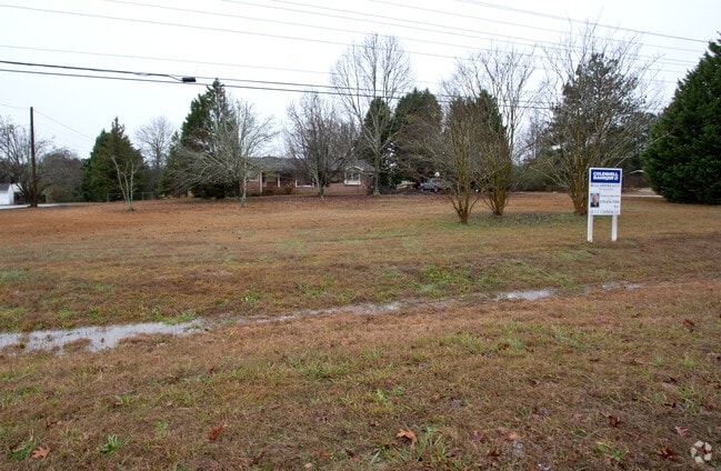
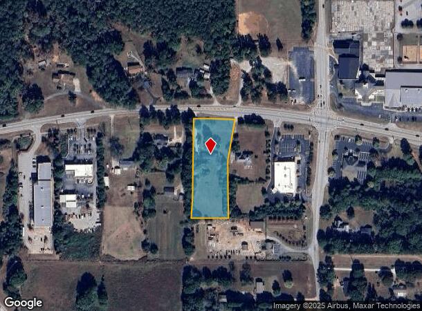
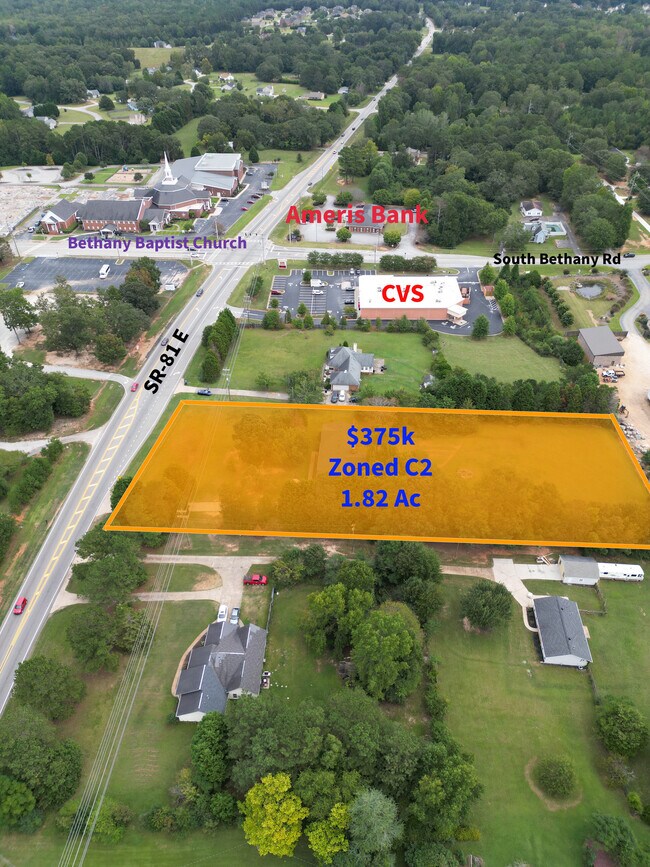
1840 Highway 81 E
Atlanta-Sandy Springs-Roswell, GA
Michael Keith Dease & Mitza Ga
0124-01-009-006
Henry
Sfr
Georgia
X
1.77 AC
13151C0190D
South Clayton/Henry Cnty
1,850 SF
Atlanta
DEMOGRAPHICS near 1840 Highway 81 E
1 Mile
3 Mile
5 Mile
2024 Total Population
1,743
23,541
63,654
2029 Population
1,883
25,634
69,549
Pop Growth 2024-2029
+ 8.03%
+ 8.89%
+ 9.26%
Average Age
40
38
37
2024 Total Households
591
8,056
22,057
HH Growth 2024-2029
+ 8.12%
+ 8.96%
+ 9.37%
Median Household Inc
$96,130
$84,144
$75,978
Avg Household Size
2.90
2.90
2.80
2024 Avg HH Vehicles
3.00
2.00
2.00
Median Home Value
$253,021
$271,451
$259,328
Median Year Built
1992
2002
2002
Nearby Places
Map Layers
Map Styles
 Street
 Aerial
- Restaurants
- Banks
- Shops
- Fitness
- Groceries
PUBLIC TRANSPORTATION
AIRPORT
Hartsfield - Jackson Atlanta International
DRIVE
WALK
Distance
Hartsfield - Jackson Atlanta International
40 min
29.9 mi
Freight Ports
Georgia Ports - Savannah
DRIVE
WALK
Distance
Georgia Ports - Savannah
251 min
223.7 mi
SALE & LEASE HISTORY
LISTING DATE
SALE/LEASE

Oct 03, 2023
For Sale
Nearby Properties
Address
Land Use
TOTAL SIZE
Lot Size
Zoning
Address
Land Use
TOTAL SIZE
Lot Size
Zoning
1,573,998 SF
84.31 AC
M2
Address
Land Use
TOTAL SIZE
Lot Size
Zoning
1,226,687 SF
100.81 AC
M2
Address
Land Use
TOTAL SIZE
Lot Size
Zoning
27,336 SF
27.95 AC
Address
Land Use
TOTAL SIZE
Lot Size
Zoning
21,880 SF
22.04 AC
RMH
Address
Land Use
TOTAL SIZE
Lot Size
Zoning
40,500 SF
27.66 AC
RA
Address
Land Use
TOTAL SIZE
Lot Size
Zoning
25,622 SF
17.43 AC
RMH
Address
Land Use
TOTAL SIZE
Lot Size
Zoning
1,456,864 SF
82.62 AC
Address
Land Use
TOTAL SIZE
Lot Size
Zoning
3,877,368 SF
44.93 AC
M2
Address
Land Use
TOTAL SIZE
Lot Size
Zoning
40,246 SF
13.73 AC
Address
Land Use
TOTAL SIZE
Lot Size
Zoning
532,585 SF
67.79 AC
M2
Address
Land Use
TOTAL SIZE
Lot Size
Zoning
63,279 SF
52.18 AC
C1
Address
Land Use
TOTAL SIZE
Lot Size
Zoning
123,864 SF
94.78 AC
Address
Land Use
TOTAL SIZE
Lot Size
Zoning
429,447 SF
40.07 AC
M2
Address
Land Use
TOTAL SIZE
Lot Size
Zoning
652,452 SF
55.99 AC
M2
Address
Land Use
TOTAL SIZE
Lot Size
Zoning
124,652 SF
25 AC
Address
Land Use
TOTAL SIZE
Lot Size
Zoning
73,785 SF
12.40 AC
C2
Address
Land Use
TOTAL SIZE
Lot Size
Zoning
101,196 SF
17.01 AC
RA
Address
Land Use
TOTAL SIZE
Lot Size
Zoning
3,204 SF
7.26 AC
RM
Address
Land Use
TOTAL SIZE
Lot Size
Zoning
64,646 SF
5.13 AC
M1
Address
Land Use
TOTAL SIZE
Lot Size
Zoning
68,354 SF
8.03 AC
C1
Address
Land Use
TOTAL SIZE
Lot Size
Zoning
63,713 SF
16.65 AC
Address
Land Use
TOTAL SIZE
Lot Size
Zoning
168,254 SF
10.65 AC
C
Address
Land Use
TOTAL SIZE
Lot Size
Zoning
1,142 SF
52.99 AC
M2
Address
Land Use
TOTAL SIZE
Lot Size
Zoning
20,217 SF
41.18 AC
Address
Land Use
TOTAL SIZE
Lot Size
Zoning
41,852 SF
1.76 AC
C2
Address
Land Use
TOTAL SIZE
Lot Size
Zoning
79,748 SF
4.47 AC
C2
Address
Land Use
TOTAL SIZE
Lot Size
Zoning
3,600 SF
15.60 AC
C1
Address
Land Use
TOTAL SIZE
Lot Size
Zoning
14,980 SF
1.90 AC
C2
Address
Land Use
TOTAL SIZE
Lot Size
Zoning
50,580 SF
13.06 AC
The World's #1 Commercial Real Estate Marketplace
Connect with us
© 2025 CoStar Group
The information above has been obtained from sources believed reliable. While we do not doubt its accuracy we have not verified it and make no guarantee, warranty or representation about it. It is your responsibility to independently confirm its accuracy and completeness. Any projections, opinions, assumptions, or estimates used are for example only and do not represent the current or future performance of the property. The value of this transaction to you depends on tax and other factors which should be evaluated by your tax, financial, and legal advisors. You and your advisors should conduct a careful, independent investigation of the property to determine to your satisfaction the suitability of the property for your needs.