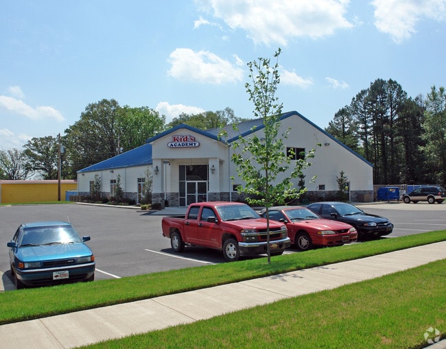
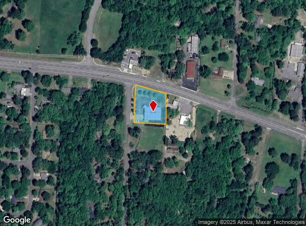
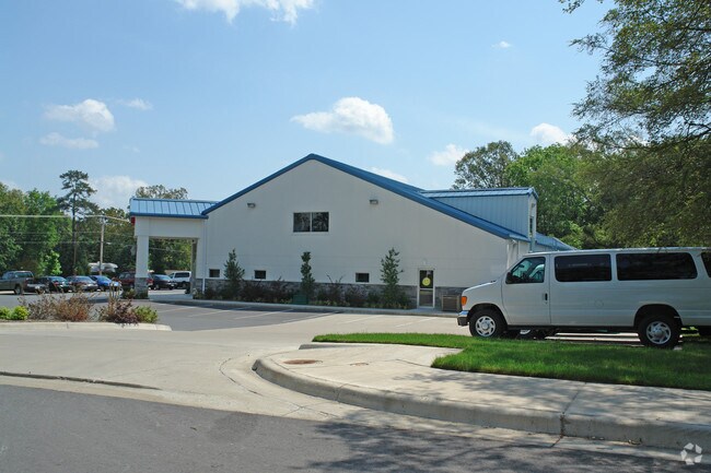
Property Record
18401 Cantrell Rd, Little Rock, AR 72223
NEARBY LISTINGS FOR SALE OR LEASE
Property Detail
18401 Cantrell Rd
53L-014-00-013-02
PT NW SW COM SE COR NW SW N1*0'51"E E826.35' FOR POB TH N88*17'9"W205' TO E R/W NORTON RD TH N01*0'51"E 244 19' TO S R/W HWY 10 S76*7'26"E AL R/W 210.26' S1*0'61"W199.89' TO POB EXC .16 AC FOR HWY 10 R/W 14-2N-14W
Daycare
Pulaski
X
Arkansas
05119C0311H
1.01 AC
2025
West
2025
Little Rock/N Little Rock
004229
Little Rock-North Little Rock-Conway, AR
8,648 SF
DEMOGRAPHICS near 18401 Cantrell Rd
1 mile
3 mile
5 mile
2024 Total Population
3,945
19,320
52,510
2029 Population
3,906
19,363
52,298
Pop Growth 2024-2029
(0.99%)
+ 0.22%
(0.40%)
Average Age
42
42
42
2024 Total Households
1,775
7,790
21,993
HH Growth 2024-2029
(1.07%)
+ 0.18%
(0.44%)
Median Household Inc
$110,476
$132,891
$100,971
Avg Household Size
2.20
2.40
2.30
2024 Avg HH Vehicles
2.00
2.00
2.00
Median Home Value
$363,394
$378,575
$333,489
Median Year Built
2004
2002
1995
Nearby Places
Map Layers
Map Styles
 Street
 Aerial
Transit
 Traffic
 Biking
Places
Listings with unknown addresses are not visible on the map
- Restaurants
- Banks
- Shops
- Fitness
- Groceries
PUBLIC TRANSPORTATION
AIRPORT
Bill and Hillary Clinton Ntl/Adams Field
Drive
Walk
Distance
Bill and Hillary Clinton Ntl/Adams Field
30 min
19.2 mi
Nearby Properties
Address
Land Use
TOTAL SIZE
Lot Size
Zoning
Address
Land Use
TOTAL SIZE
Lot Size
Zoning
361,360 SF
20.01 AC
Address
Land Use
TOTAL SIZE
Lot Size
Zoning
126,536 SF
25.98 AC
Address
Land Use
TOTAL SIZE
Lot Size
Zoning
267,343 SF
52.19 AC
Address
Land Use
TOTAL SIZE
Lot Size
Zoning
82,176 SF
14.83 AC
Address
Land Use
TOTAL SIZE
Lot Size
Zoning
125,107 SF
22.09 AC
Address
Land Use
TOTAL SIZE
Lot Size
Zoning
168,221 SF
12.02 AC
Address
Land Use
TOTAL SIZE
Lot Size
Zoning
58,828 SF
15.22 AC
Address
Land Use
TOTAL SIZE
Lot Size
Zoning
115,062 SF
10.04 AC
Address
Land Use
TOTAL SIZE
Lot Size
Zoning
86,186 SF
13.24 AC
Address
Land Use
TOTAL SIZE
Lot Size
Zoning
160,068 SF
18.91 AC
Address
Land Use
TOTAL SIZE
Lot Size
Zoning
114,269 SF
12.85 AC
Address
Land Use
TOTAL SIZE
Lot Size
Zoning
217,088 SF
26.89 AC
Address
Land Use
TOTAL SIZE
Lot Size
Zoning
40,803 SF
18.48 AC
Address
Land Use
TOTAL SIZE
Lot Size
Zoning
30,040 SF
10.80 AC
Address
Land Use
TOTAL SIZE
Lot Size
Zoning
93,175 SF
4.74 AC
Address
Land Use
TOTAL SIZE
Lot Size
Zoning
102,990 SF
10.43 AC
Address
Land Use
TOTAL SIZE
Lot Size
Zoning
42,686 SF
22.11 AC
Address
Land Use
TOTAL SIZE
Lot Size
Zoning
30,193 SF
74.37 AC
Address
Land Use
TOTAL SIZE
Lot Size
Zoning
103,169 SF
8.32 AC
Address
Land Use
TOTAL SIZE
Lot Size
Zoning
85,980 SF
32.29 AC
Address
Land Use
TOTAL SIZE
Lot Size
Zoning
206,671 SF
26.16 AC
Address
Land Use
TOTAL SIZE
Lot Size
Zoning
91,822 SF
14 AC
Address
Land Use
TOTAL SIZE
Lot Size
Zoning
173,120 SF
67.23 AC
Address
Land Use
TOTAL SIZE
Lot Size
Zoning
99,581 SF
8.11 AC
Address
Land Use
TOTAL SIZE
Lot Size
Zoning
119,868 SF
12.91 AC
Address
Land Use
TOTAL SIZE
Lot Size
Zoning
3,470 SF
3.69 AC
Address
Land Use
TOTAL SIZE
Lot Size
Zoning
58,854 SF
7.11 AC
Address
Land Use
TOTAL SIZE
Lot Size
Zoning
61,458 SF
5.50 AC
Address
Land Use
TOTAL SIZE
Lot Size
Zoning
38,617 SF
4.62 AC
Address
Land Use
TOTAL SIZE
Lot Size
Zoning
37,229 SF
4.06 AC
The World's #1 Commercial Real Estate Marketplace
Connect with us
© 2026 CoStar Group
The information above has been obtained from sources believed reliable. While we do not doubt its accuracy we have not verified it and make no guarantee, warranty or representation about it. It is your responsibility to independently confirm its accuracy and completeness. Any projections, opinions, assumptions, or estimates used are for example only and do not represent the current or future performance of the property. The value of this transaction to you depends on tax and other factors which should be evaluated by your tax, financial, and legal advisors. You and your advisors should conduct a careful, independent investigation of the property to determine to your satisfaction the suitability of the property for your needs.