Property Record
1841 Columbia Ave, Lancaster, PA 17603
Current Lease Availabilities
NEARBY LISTINGS FOR SALE OR LEASE
Property Detail
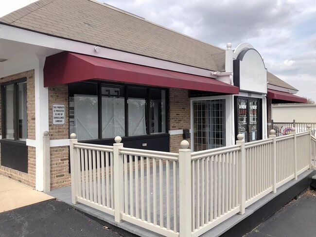
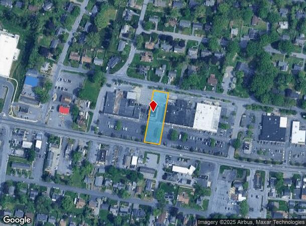
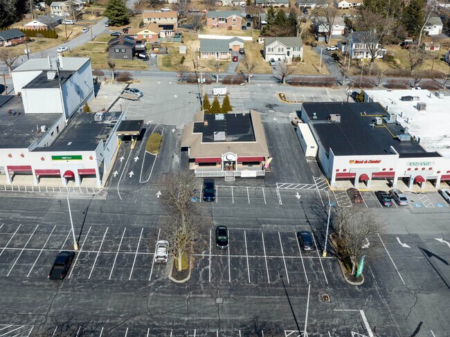
1841 Columbia Ave
290-06304-1-0002
Wheatland Shopping Center West
Commercialcondominium
1841 COLUMBIA AVE
X
Lancaster
42071C0361F
Pennsylvania
2024
0.66 AC
2025
Lancaster County
011701
Philadelphia
3,182 SF
Lancaster, PA
DEMOGRAPHICS near 1841 Columbia Ave
1 Mile
3 Mile
5 Mile
2024 Total Population
8,819
95,393
179,551
2029 Population
8,890
96,062
180,899
Pop Growth 2024-2029
+ 0.81%
+ 0.70%
+ 0.75%
Average Age
44
39
40
2024 Total Households
3,520
37,299
68,351
HH Growth 2024-2029
+ 0.82%
+ 0.61%
+ 0.67%
Median Household Inc
$77,633
$68,532
$73,899
Avg Household Size
2.40
2.40
2.40
2024 Avg HH Vehicles
2.00
2.00
2.00
Median Home Value
$212,002
$217,380
$236,976
Median Year Built
1968
1962
1968
Nearby Places
- Restaurants
- Banks
- Shops
- Fitness
- Groceries
PUBLIC TRANSPORTATION
COMMUTER RAIL
Lancaster (Keystone Service - Amtrak, Pennsylvanian - Amtrak)
DRIVE
WALK
Distance
Lancaster (Keystone Service - Amtrak, Pennsylvanian - Amtrak)
9 min
3.6 mi
AIRPORT
Harrisburg International
DRIVE
WALK
Distance
Harrisburg International
43 min
31.4 mi
Freight Ports
Port of Wilmington, RI
DRIVE
WALK
Distance
Port of Wilmington, RI
100 min
56.1 mi
Nearby Properties
Address
Land Use
TOTAL SIZE
Lot Size
Zoning
Address
Land Use
TOTAL SIZE
Lot Size
Zoning
822,920 SF
97.54 AC
HCD
Address
Land Use
TOTAL SIZE
Lot Size
Zoning
1,603,151 SF
104.89 AC
C3
Address
Land Use
TOTAL SIZE
Lot Size
Zoning
1,003,686 SF
127.66 AC
HR
Address
Land Use
TOTAL SIZE
Lot Size
Zoning
206,666 SF
1 AC
CB1
Address
Land Use
TOTAL SIZE
Lot Size
Zoning
712,737 SF
52.50 AC
R2
Address
Land Use
TOTAL SIZE
Lot Size
Zoning
269,860 SF
0.90 AC
CB1
Address
Land Use
TOTAL SIZE
Lot Size
Zoning
610,085 SF
57.70 AC
R1A
Address
Land Use
TOTAL SIZE
Lot Size
Zoning
941,905 SF
141.50 AC
I
Address
Land Use
TOTAL SIZE
Lot Size
Zoning
224,054 SF
71 AC
Address
Land Use
TOTAL SIZE
Lot Size
Zoning
642,651 SF
2.16 AC
CA
Address
Land Use
TOTAL SIZE
Lot Size
Zoning
308,727 SF
11.37 AC
Address
Land Use
TOTAL SIZE
Lot Size
Zoning
307,696 SF
29 AC
R1
Address
Land Use
TOTAL SIZE
Lot Size
Zoning
178,234 SF
0.78 AC
CB
Address
Land Use
TOTAL SIZE
Lot Size
Zoning
193,864 SF
9 AC
Address
Land Use
TOTAL SIZE
Lot Size
Zoning
288,628 SF
27.80 AC
R1A
Address
Land Use
TOTAL SIZE
Lot Size
Zoning
99,894 SF
21.88 AC
Address
Land Use
TOTAL SIZE
Lot Size
Zoning
269,890 SF
57.10 AC
SR
Address
Land Use
TOTAL SIZE
Lot Size
Zoning
135,998 SF
28.64 AC
HR
Address
Land Use
TOTAL SIZE
Lot Size
Zoning
223,327 SF
21.80 AC
B-4
Address
Land Use
TOTAL SIZE
Lot Size
Zoning
203,942 SF
21.22 AC
B-4
Address
Land Use
TOTAL SIZE
Lot Size
Zoning
691,290 SF
3 AC
Address
Land Use
TOTAL SIZE
Lot Size
Zoning
372,708 SF
50.40 AC
HR
Address
Land Use
TOTAL SIZE
Lot Size
Zoning
128,939 SF
27.39 AC
Address
Land Use
TOTAL SIZE
Lot Size
Zoning
101,558 SF
28.14 AC
AH
Address
Land Use
TOTAL SIZE
Lot Size
Zoning
199,107 SF
26.20 AC
CC
Address
Land Use
TOTAL SIZE
Lot Size
Zoning
138,618 SF
9.53 AC
Address
Land Use
TOTAL SIZE
Lot Size
Zoning
385,561 SF
27.20 AC
Address
Land Use
TOTAL SIZE
Lot Size
Zoning
256,905 SF
1.57 AC
CB1
Address
Land Use
TOTAL SIZE
Lot Size
Zoning
299,600 SF
63 AC
HR
Address
Land Use
TOTAL SIZE
Lot Size
Zoning
10 SF
14.11 AC
CM
The World's #1 Commercial Real Estate Marketplace
Connect with us
© 2025 CoStar Group
The information above has been obtained from sources believed reliable. While we do not doubt its accuracy we have not verified it and make no guarantee, warranty or representation about it. It is your responsibility to independently confirm its accuracy and completeness. Any projections, opinions, assumptions, or estimates used are for example only and do not represent the current or future performance of the property. The value of this transaction to you depends on tax and other factors which should be evaluated by your tax, financial, and legal advisors. You and your advisors should conduct a careful, independent investigation of the property to determine to your satisfaction the suitability of the property for your needs.