Property Record
1841 Shoshone Dr, Lafayette, IN 47909


NEARBY LISTINGS FOR SALE OR LEASE
Property Detail
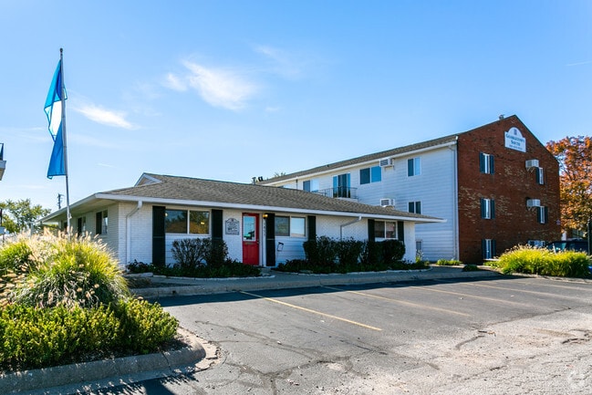
1841 Shoshone Dr
Lafayette-West Lafayette, IN
Tecumseh 2Nd Addn
79-07-33-404-025.000-004
TECUMSEH 2ND ADDN BUS AREA2.6 A & STRIP 100 X 250 FT COMBINED WITH A PT OF BUSIN ESS AREA A INTECUMSEH 2ND ADDN & PT OF BUSINESS AREA A INTECUMSEH 2ND ADDN
Apartment
Tippecanoe
X
Indiana
18157C0163E
1
2024
3.80 AC
2024
Lafayette/Kokomo
001300
Other Market Areas
118,322 SF
DEMOGRAPHICS near 1841 Shoshone Dr
1 Mile
3 Mile
5 Mile
2024 Total Population
11,307
79,150
126,332
2029 Population
11,588
81,623
130,295
Pop Growth 2024-2029
+ 2.49%
+ 3.12%
+ 3.14%
Average Age
37
35
35
2024 Total Households
4,804
34,279
50,710
HH Growth 2024-2029
+ 2.66%
+ 3.32%
+ 3.50%
Median Household Inc
$53,255
$44,380
$47,496
Avg Household Size
2.30
2.20
2.20
2024 Avg HH Vehicles
2.00
2.00
2.00
Median Home Value
$122,307
$152,799
$173,906
Median Year Built
1962
1979
1980
Nearby Places
Map Layers
Map Styles
 Street
 Aerial
- Restaurants
- Banks
- Shops
- Fitness
- Groceries
PUBLIC TRANSPORTATION
COMMUTER RAIL
Lafayette Amtrak Station (Cardinal - Amtrak)
DRIVE
WALK
Distance
Lafayette Amtrak Station (Cardinal - Amtrak)
6 min
2.9 mi
Freight Ports
Port Milwaukee
DRIVE
WALK
Distance
Port Milwaukee
253 min
210.0 mi
Nearby Properties
Address
Land Use
TOTAL SIZE
Lot Size
Zoning
Address
Land Use
TOTAL SIZE
Lot Size
Zoning
469,872 SF
0.85 AC
Address
Land Use
TOTAL SIZE
Lot Size
Zoning
68,943 SF
0.01 AC
Address
Land Use
TOTAL SIZE
Lot Size
Zoning
385,162 SF
1 AC
Address
Land Use
TOTAL SIZE
Lot Size
Zoning
401,345 SF
1.64 AC
Address
Land Use
TOTAL SIZE
Lot Size
Zoning
249,214 SF
1.93 AC
Address
Land Use
TOTAL SIZE
Lot Size
Zoning
117,351 SF
44 SF
Address
Land Use
TOTAL SIZE
Lot Size
Zoning
210,829 SF
87 SF
Address
Land Use
TOTAL SIZE
Lot Size
Zoning
32.01 AC
Address
Land Use
TOTAL SIZE
Lot Size
Zoning
232,565 SF
1.15 AC
Address
Land Use
TOTAL SIZE
Lot Size
Zoning
270,827 SF
34.90 AC
Address
Land Use
TOTAL SIZE
Lot Size
Zoning
1,449,360 SF
0.01 AC
Address
Land Use
TOTAL SIZE
Lot Size
Zoning
205,701 SF
1.27 AC
Address
Land Use
TOTAL SIZE
Lot Size
Zoning
77,226 SF
0.01 AC
Address
Land Use
TOTAL SIZE
Lot Size
Zoning
27,300 SF
22.52 AC
Address
Land Use
TOTAL SIZE
Lot Size
Zoning
164,234 SF
0.88 AC
Address
Land Use
TOTAL SIZE
Lot Size
Zoning
184,441 SF
44 SF
Address
Land Use
TOTAL SIZE
Lot Size
Zoning
222,276 SF
0.31 AC
Address
Land Use
TOTAL SIZE
Lot Size
Zoning
203,830 SF
18.73 AC
Address
Land Use
TOTAL SIZE
Lot Size
Zoning
267,379 SF
87 SF
Address
Land Use
TOTAL SIZE
Lot Size
Zoning
518,808 SF
174 SF
Address
Land Use
TOTAL SIZE
Lot Size
Zoning
140,973 SF
131 SF
Address
Land Use
TOTAL SIZE
Lot Size
Zoning
118,066 SF
0.80 AC
Address
Land Use
TOTAL SIZE
Lot Size
Zoning
135,090 SF
0.80 AC
Address
Land Use
TOTAL SIZE
Lot Size
Zoning
340,790 SF
131 SF
Address
Land Use
TOTAL SIZE
Lot Size
Zoning
70,686 SF
25.67 AC
Address
Land Use
TOTAL SIZE
Lot Size
Zoning
1,409,410 SF
170.04 AC
Address
Land Use
TOTAL SIZE
Lot Size
Zoning
295,530 SF
87 SF
Address
Land Use
TOTAL SIZE
Lot Size
Zoning
286,889 SF
17.89 AC
Address
Land Use
TOTAL SIZE
Lot Size
Zoning
109,515 SF
0.85 AC
The World's #1 Commercial Real Estate Marketplace
Connect with us
© 2026 CoStar Group
The information above has been obtained from sources believed reliable. While we do not doubt its accuracy we have not verified it and make no guarantee, warranty or representation about it. It is your responsibility to independently confirm its accuracy and completeness. Any projections, opinions, assumptions, or estimates used are for example only and do not represent the current or future performance of the property. The value of this transaction to you depends on tax and other factors which should be evaluated by your tax, financial, and legal advisors. You and your advisors should conduct a careful, independent investigation of the property to determine to your satisfaction the suitability of the property for your needs.