Property Record
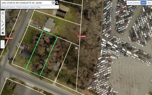
1842 Starita Rd, Charlotte, NC 28206

This Property Is For Sale
NEARBY LISTINGS FOR SALE OR LEASE
Property Detail
1842 Starita Rd
Charlotte-Concord-Gastonia, NC-SC
Woodland Park
077-151-11
L3 B1 M3-186
Industrialgeneral
Mecklenburg
X
North Carolina
3710455500L
3
2024
0.22 AC
2025
Plaza Midwood/NoDa
005100
Charlotte
780 SF
DEMOGRAPHICS near 1842 Starita Rd
1 Mile
3 Mile
5 Mile
2024 Total Population
2,577
89,526
261,911
2029 Population
2,726
95,893
279,654
Pop Growth 2024-2029
+ 5.78%
+ 7.11%
+ 6.77%
Average Age
38
37
36
2024 Total Households
952
36,688
114,163
HH Growth 2024-2029
+ 5.78%
+ 7.39%
+ 6.97%
Median Household Inc
$47,651
$49,801
$60,983
Avg Household Size
2.70
2.30
2.20
2024 Avg HH Vehicles
2.00
2.00
2.00
Median Home Value
$136,486
$235,074
$274,561
Median Year Built
1979
1989
1995
Nearby Places
Map Layers
Map Styles
 Street
 Aerial
- Restaurants
- Banks
- Shops
- Fitness
- Groceries
PUBLIC TRANSPORTATION
COMMUTER RAIL
Charlotte Amtrak Station (Carolinian - Amtrak, Crescent - Amtrak, Piedmont - Amtrak)
DRIVE
WALK
Distance
Charlotte Amtrak Station (Carolinian - Amtrak, Crescent - Amtrak, Piedmont - Amtrak)
7 min
2.9 mi
AIRPORT
Charlotte/Douglas International
DRIVE
WALK
Distance
Charlotte/Douglas International
22 min
11.1 mi
Concord-Padgett Regional
DRIVE
WALK
Distance
Concord-Padgett Regional
19 min
12.1 mi
Freight Ports
North Charleston Terminal
DRIVE
WALK
Distance
North Charleston Terminal
234 min
203.3 mi
Nearby Properties
Address
Land Use
TOTAL SIZE
Lot Size
Zoning
Address
Land Use
TOTAL SIZE
Lot Size
Zoning
955,273 SF
1.83 AC
Address
Land Use
TOTAL SIZE
Lot Size
Zoning
71.86 AC
UR-3
Address
Land Use
TOTAL SIZE
Lot Size
Zoning
643,185 SF
2.34 AC
UMUD
Address
Land Use
TOTAL SIZE
Lot Size
Zoning
533,477 SF
3.15 AC
I2
Address
Land Use
TOTAL SIZE
Lot Size
Zoning
499,729 SF
3.90 AC
I2
Address
Land Use
TOTAL SIZE
Lot Size
Zoning
584,543 SF
4.42 AC
I2
Address
Land Use
TOTAL SIZE
Lot Size
Zoning
285,032 SF
9.43 AC
UR2CD
Address
Land Use
TOTAL SIZE
Lot Size
Zoning
500,761 SF
3.18 AC
TOD-CC
Address
Land Use
TOTAL SIZE
Lot Size
Zoning
388,364 SF
3.26 AC
I2
Address
Land Use
TOTAL SIZE
Lot Size
Zoning
603,789 SF
1.74 AC
Address
Land Use
TOTAL SIZE
Lot Size
Zoning
465,134 SF
3.65 AC
I2
Address
Land Use
TOTAL SIZE
Lot Size
Zoning
337,775 SF
0.67 AC
UMUD
Address
Land Use
TOTAL SIZE
Lot Size
Zoning
333,683 SF
24.11 AC
RE2
Address
Land Use
TOTAL SIZE
Lot Size
Zoning
499,296 SF
6.04 AC
Address
Land Use
TOTAL SIZE
Lot Size
Zoning
373,451 SF
3.06 AC
I2
Address
Land Use
TOTAL SIZE
Lot Size
Zoning
378,072 SF
2.11 AC
TOD-NC
Address
Land Use
TOTAL SIZE
Lot Size
Zoning
426,404 SF
4.20 AC
Address
Land Use
TOTAL SIZE
Lot Size
Zoning
436,898 SF
3.20 AC
Address
Land Use
TOTAL SIZE
Lot Size
Zoning
125,413 SF
15.50 AC
UR3
Address
Land Use
TOTAL SIZE
Lot Size
Zoning
344,404 SF
3.57 AC
MUDDO
Address
Land Use
TOTAL SIZE
Lot Size
Zoning
402,661 SF
2.91 AC
I2
Address
Land Use
TOTAL SIZE
Lot Size
Zoning
322,996 SF
10.45 AC
I2
Address
Land Use
TOTAL SIZE
Lot Size
Zoning
17,192 SF
3.50 AC
I-2
Address
Land Use
TOTAL SIZE
Lot Size
Zoning
308,793 SF
47.41 AC
R5
Address
Land Use
TOTAL SIZE
Lot Size
Zoning
68,352 SF
3.83 AC
TOD-M(O)
Address
Land Use
TOTAL SIZE
Lot Size
Zoning
441,665 SF
3.24 AC
MUDDO
Address
Land Use
TOTAL SIZE
Lot Size
Zoning
339,762 SF
2.46 AC
I2
Address
Land Use
TOTAL SIZE
Lot Size
Zoning
40,940 SF
3.53 AC
TOD-UC
Address
Land Use
TOTAL SIZE
Lot Size
Zoning
393,282 SF
3.80 AC
I2CD
Address
Land Use
TOTAL SIZE
Lot Size
Zoning
43,387 SF
43.43 AC
The World's #1 Commercial Real Estate Marketplace
Connect with us
© 2026 CoStar Group
The information above has been obtained from sources believed reliable. While we do not doubt its accuracy we have not verified it and make no guarantee, warranty or representation about it. It is your responsibility to independently confirm its accuracy and completeness. Any projections, opinions, assumptions, or estimates used are for example only and do not represent the current or future performance of the property. The value of this transaction to you depends on tax and other factors which should be evaluated by your tax, financial, and legal advisors. You and your advisors should conduct a careful, independent investigation of the property to determine to your satisfaction the suitability of the property for your needs.