Property Record
1843 Broken Arrow Dr, North Little Rock, AR 72118


NEARBY LISTINGS FOR SALE OR LEASE
Property Detail
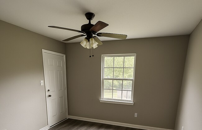
1843 Broken Arrow Dr
Little Rock-North Little Rock-Conway, AR
Arrow Head Manor
33N-052-00-071-00
ALL OF LTS 10 THRU 16 ALL OF LTS 18 & 22 LT 29 EXC BEG SW COR N40*W173.81 FOR POB TH N40*W47.77 N20*E488 S64*E121.46 S20*W337.4 S6*E97.12 S79*W145.60 TO POB & ALL OF LT 30 BK 4 & LTS 6 THRU 17 REPLATTED AS LTS 8A 9A 10A 11A 12A 13A BK 8
Apartment
Pulaski
X
Arkansas
05119C0341G
10
2025
10.99 AC
2025
North Little Rock
003208
Little Rock/N Little Rock
48,142 SF
DEMOGRAPHICS near 1843 Broken Arrow Dr
1 Mile
3 Mile
5 Mile
2024 Total Population
8,939
45,441
113,896
2029 Population
8,943
45,540
114,416
Pop Growth 2024-2029
+ 0.04%
+ 0.22%
+ 0.46%
Average Age
36
39
40
2024 Total Households
3,645
20,673
53,119
HH Growth 2024-2029
0.00%
+ 0.18%
+ 0.48%
Median Household Inc
$40,095
$47,450
$53,064
Avg Household Size
2.30
2.10
2.00
2024 Avg HH Vehicles
2.00
2.00
2.00
Median Home Value
$76,033
$152,831
$180,468
Median Year Built
1966
1970
1969
Nearby Places
Map Layers
Map Styles
 Street
 Aerial
- Restaurants
- Banks
- Shops
- Fitness
- Groceries
PUBLIC TRANSPORTATION
COMMUTER RAIL
Little Rock Union Station (Texas Eagle - Amtrak)
DRIVE
WALK
Distance
Little Rock Union Station (Texas Eagle - Amtrak)
11 min
5.1 mi
AIRPORT
Bill and Hillary Clinton Ntl/Adams Field
DRIVE
WALK
Distance
Bill and Hillary Clinton Ntl/Adams Field
16 min
9.3 mi
Freight Ports
Port of Shreveport
DRIVE
WALK
Distance
Port of Shreveport
258 min
238.2 mi
Nearby Properties
Address
Land Use
TOTAL SIZE
Lot Size
Zoning
Address
Land Use
TOTAL SIZE
Lot Size
Zoning
1.80 AC
Address
Land Use
TOTAL SIZE
Lot Size
Zoning
0.90 AC
Address
Land Use
TOTAL SIZE
Lot Size
Zoning
0.45 AC
Address
Land Use
TOTAL SIZE
Lot Size
Zoning
526,829 SF
33.78 AC
Address
Land Use
TOTAL SIZE
Lot Size
Zoning
305,882 SF
7.82 AC
Address
Land Use
TOTAL SIZE
Lot Size
Zoning
7,859 SF
175.11 AC
Address
Land Use
TOTAL SIZE
Lot Size
Zoning
65.57 AC
Address
Land Use
TOTAL SIZE
Lot Size
Zoning
41,925 SF
13 AC
Address
Land Use
TOTAL SIZE
Lot Size
Zoning
195,404 SF
25.19 AC
Address
Land Use
TOTAL SIZE
Lot Size
Zoning
199,466 SF
38.24 AC
Address
Land Use
TOTAL SIZE
Lot Size
Zoning
35,964 SF
10.59 AC
Address
Land Use
TOTAL SIZE
Lot Size
Zoning
456,896 SF
18.54 AC
Address
Land Use
TOTAL SIZE
Lot Size
Zoning
40,758 SF
6.43 AC
Address
Land Use
TOTAL SIZE
Lot Size
Zoning
94,824 SF
19.51 AC
Address
Land Use
TOTAL SIZE
Lot Size
Zoning
153,981 SF
10.95 AC
Address
Land Use
TOTAL SIZE
Lot Size
Zoning
303,355 SF
17.47 AC
Address
Land Use
TOTAL SIZE
Lot Size
Zoning
105,316 SF
5.53 AC
Address
Land Use
TOTAL SIZE
Lot Size
Zoning
141,362 SF
14.25 AC
Address
Land Use
TOTAL SIZE
Lot Size
Zoning
34,159 SF
12.34 AC
Address
Land Use
TOTAL SIZE
Lot Size
Zoning
51,361 SF
6.14 AC
Address
Land Use
TOTAL SIZE
Lot Size
Zoning
108,922 SF
13.70 AC
Address
Land Use
TOTAL SIZE
Lot Size
Zoning
174,878 SF
7.55 AC
Address
Land Use
TOTAL SIZE
Lot Size
Zoning
228,599 SF
7.14 AC
Address
Land Use
TOTAL SIZE
Lot Size
Zoning
135,844 SF
3.11 AC
Address
Land Use
TOTAL SIZE
Lot Size
Zoning
83,431 SF
10.99 AC
Address
Land Use
TOTAL SIZE
Lot Size
Zoning
21,168 SF
8.30 AC
Address
Land Use
TOTAL SIZE
Lot Size
Zoning
94,248 SF
23.30 AC
Address
Land Use
TOTAL SIZE
Lot Size
Zoning
32,408 SF
9.36 AC
Address
Land Use
TOTAL SIZE
Lot Size
Zoning
173,669 SF
10.50 AC
Address
Land Use
TOTAL SIZE
Lot Size
Zoning
167,408 SF
2.61 AC
The World's #1 Commercial Real Estate Marketplace
Connect with us
© 2026 CoStar Group
The information above has been obtained from sources believed reliable. While we do not doubt its accuracy we have not verified it and make no guarantee, warranty or representation about it. It is your responsibility to independently confirm its accuracy and completeness. Any projections, opinions, assumptions, or estimates used are for example only and do not represent the current or future performance of the property. The value of this transaction to you depends on tax and other factors which should be evaluated by your tax, financial, and legal advisors. You and your advisors should conduct a careful, independent investigation of the property to determine to your satisfaction the suitability of the property for your needs.