Property Record
18431 166Th St, Basehor, KS 66007

Property Detail
18431 166Th St
182-09-0-00-00-019.00-0
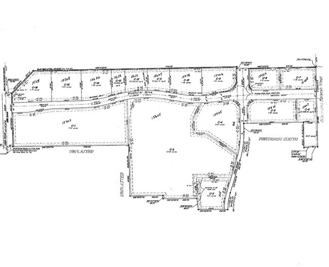
S09, T11, R22E, ACRES 5.04, TRACT 2; COM E1/4 COR S9; THENCE NW25 TO POB; THENCE SW700, NW334, NE700, SE TO POB
Agriculturalland
LEAVENWORTH
B and X Area of moderate flood hazard, usually the area between the limits of the 100-year and 500-year floods.
Kansas
2023
5.04 AC
2025
Leavenworth County
071202
Kansas City
3,707 SF
Kansas City, MO-KS
NEARBY LISTINGS FOR SALE OR LEASE
-
-
View all Basehor listings for sale on LoopNet.com
DEMOGRAPHICS near 18431 166Th St
1 mile
3 mile
5 mile
2025 Total Population
924
8,507
17,673
2030 Population
951
8,855
18,228
Pop Growth 2025-2030
+ 2.92%
+ 4.09%
+ 3.14%
Average Age
42
41
41
2025 Total Households
326
3,106
6,602
HH Growth 2025-2030
+ 3.07%
+ 4.25%
+ 3.21%
Median Household Inc
$98,610
$94,975
$96,841
Avg Household Size
2.80
2.70
2.70
2025 Avg HH Vehicles
3.00
2.00
2.00
Median Home Value
$386,597
$348,672
$334,128
Median Year Built
1995
1996
1997
Nearby Places
Map Layers
Map Styles
 Street
 Aerial
Layers
 Traffic
 Biking
Places
Listings with unknown addresses are not visible on the map
- Restaurants
- Banks
- Shops
- Fitness
- Groceries
PUBLIC TRANSPORTATION
AIRPORT
Kansas City International
Drive
Walk
Distance
Kansas City International
41 min
31.2 mi
Freight Ports
Tulsa Port Of Catoosa
Drive
Walk
Distance
Tulsa Port Of Catoosa
280 min
248.5 mi
Nearby Properties
Address
Land Use
TOTAL SIZE
Lot Size
Zoning
Address
Land Use
TOTAL SIZE
Lot Size
Zoning
110,528 SF
47.34 AC
Address
Land Use
TOTAL SIZE
Lot Size
Zoning
169,410 SF
37.81 AC
Address
Land Use
TOTAL SIZE
Lot Size
Zoning
77,925 SF
11.31 AC
Address
Land Use
TOTAL SIZE
Lot Size
Zoning
52,047 SF
12.18 AC
Address
Land Use
TOTAL SIZE
Lot Size
Zoning
21,511 SF
5.23 AC
Address
Land Use
TOTAL SIZE
Lot Size
Zoning
47,070 SF
15.34 AC
Address
Land Use
TOTAL SIZE
Lot Size
Zoning
39,215 SF
18.35 AC
Address
Land Use
TOTAL SIZE
Lot Size
Zoning
48,590 SF
4.72 AC
Address
Land Use
TOTAL SIZE
Lot Size
Zoning
2.75 AC
Address
Land Use
TOTAL SIZE
Lot Size
Zoning
19,753 SF
4.83 AC
Address
Land Use
TOTAL SIZE
Lot Size
Zoning
16,854 SF
2.60 AC
Address
Land Use
TOTAL SIZE
Lot Size
Zoning
14,834 SF
9.99 AC
Address
Land Use
TOTAL SIZE
Lot Size
Zoning
12,163 SF
3.31 AC
Address
Land Use
TOTAL SIZE
Lot Size
Zoning
12,160 SF
7.10 AC
Address
Land Use
TOTAL SIZE
Lot Size
Zoning
4,646 SF
74.99 AC
Address
Land Use
TOTAL SIZE
Lot Size
Zoning
9,100 SF
0.64 AC
Address
Land Use
TOTAL SIZE
Lot Size
Zoning
73.91 AC
Address
Land Use
TOTAL SIZE
Lot Size
Zoning
5,262 SF
1.94 AC
Address
Land Use
TOTAL SIZE
Lot Size
Zoning
13,867 SF
3 AC
Address
Land Use
TOTAL SIZE
Lot Size
Zoning
43,170 SF
6.25 AC
Address
Land Use
TOTAL SIZE
Lot Size
Zoning
21,000 SF
5.47 AC
Address
Land Use
TOTAL SIZE
Lot Size
Zoning
26,626 SF
4.66 AC
Address
Land Use
TOTAL SIZE
Lot Size
Zoning
Address
Land Use
TOTAL SIZE
Lot Size
Zoning
900 SF
12 AC
Address
Land Use
TOTAL SIZE
Lot Size
Zoning
5,600 SF
7.73 AC
Address
Land Use
TOTAL SIZE
Lot Size
Zoning
9,300 SF
9.73 AC
Address
Land Use
TOTAL SIZE
Lot Size
Zoning
759 SF
15.03 AC
Address
Land Use
TOTAL SIZE
Lot Size
Zoning
10,500 SF
1.12 AC
Address
Land Use
TOTAL SIZE
Lot Size
Zoning
6,020 SF
0.75 AC
Address
Land Use
TOTAL SIZE
Lot Size
Zoning
12,890 SF
78.80 AC
The World's #1 Commercial Real Estate Marketplace
Connect with us
© 2026 CoStar Group
The information above has been obtained from sources believed reliable. While we do not doubt its accuracy we have not verified it and make no guarantee, warranty or representation about it. It is your responsibility to independently confirm its accuracy and completeness. Any projections, opinions, assumptions, or estimates used are for example only and do not represent the current or future performance of the property. The value of this transaction to you depends on tax and other factors which should be evaluated by your tax, financial, and legal advisors. You and your advisors should conduct a careful, independent investigation of the property to determine to your satisfaction the suitability of the property for your needs.