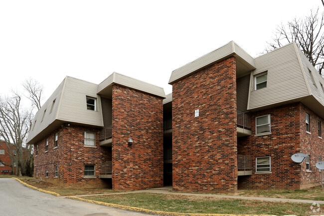
Property Record
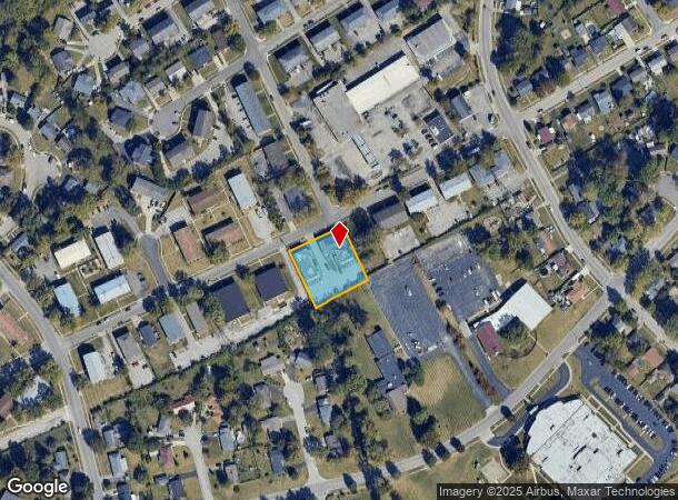
1844 Augusta Dr, Lexington, KY 40505
NEARBY LISTINGS FOR SALE OR LEASE
Property Detail
1844 Augusta Dr
Lexington-Fayette, KY
Dixie Plantation
14295750
C-682 DIXIE PLANTATION UNIT 2 SECT 1-C LOT 24 - 31; BOOK: 3647 PAGE: 642
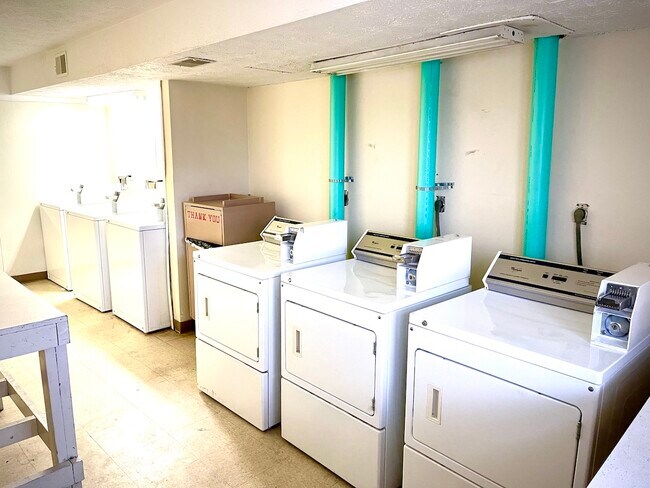
Apartment
Fayette
X
Kentucky
2100670137E
24-31
2025
0.63 AC
2025
Eastland Parkway
003202
Lexington/Fayette
12,996 SF
DEMOGRAPHICS near 1844 Augusta Dr
1 mile
3 mile
5 mile
2024 Total Population
9,372
61,526
157,639
2029 Population
9,381
61,668
157,930
Pop Growth 2024-2029
+ 0.10%
+ 0.23%
+ 0.18%
Average Age
41
39
37
2024 Total Households
4,204
27,107
67,235
HH Growth 2024-2029
+ 0.02%
+ 0.22%
+ 0.22%
Median Household Inc
$38,531
$53,025
$55,035
Avg Household Size
2.10
2.20
2.20
2024 Avg HH Vehicles
2.00
2.00
2.00
Median Home Value
$166,782
$188,155
$258,439
Median Year Built
1967
1969
1978
Nearby Places
Map Layers
Map Styles
 Street
 Aerial
Transit
 Traffic
 Biking
Places
Listings with unknown addresses are not visible on the map
- Restaurants
- Banks
- Shops
- Fitness
- Groceries
PUBLIC TRANSPORTATION
AIRPORT
Blue Grass
Drive
Walk
Distance
Blue Grass
24 min
13.4 mi
SALE & LEASE HISTORY
LISTING DATE
SALE/LEASE

Mar 28, 2022
For Sale
Nearby Properties
Address
Land Use
TOTAL SIZE
Lot Size
Zoning
Address
Land Use
TOTAL SIZE
Lot Size
Zoning
7,640 SF
9.04 AC
EAR-3
Address
Land Use
TOTAL SIZE
Lot Size
Zoning
209,517 SF
39.97 AC
R-1B
Address
Land Use
TOTAL SIZE
Lot Size
Zoning
19 AC
R-3
Address
Land Use
TOTAL SIZE
Lot Size
Zoning
163,536 SF
117.26 AC
I-1
Address
Land Use
TOTAL SIZE
Lot Size
Zoning
64,617 SF
41.63 AC
B-6P
Address
Land Use
TOTAL SIZE
Lot Size
Zoning
8,208 SF
21.16 AC
R-3
Address
Land Use
TOTAL SIZE
Lot Size
Zoning
57,974 SF
15.22 AC
B-6P
Address
Land Use
TOTAL SIZE
Lot Size
Zoning
24,174 SF
15.02 AC
R-3
Address
Land Use
TOTAL SIZE
Lot Size
Zoning
41.55 AC
ED
Address
Land Use
TOTAL SIZE
Lot Size
Zoning
42,642 SF
10.35 AC
B-6P
Address
Land Use
TOTAL SIZE
Lot Size
Zoning
9,434 SF
16.28 AC
R-3
Address
Land Use
TOTAL SIZE
Lot Size
Zoning
103,445 SF
18.39 AC
A-U
Address
Land Use
TOTAL SIZE
Lot Size
Zoning
267,060 SF
65 AC
R-3
Address
Land Use
TOTAL SIZE
Lot Size
Zoning
53,543 SF
9.78 AC
R-1C
Address
Land Use
TOTAL SIZE
Lot Size
Zoning
123,132 SF
6.81 AC
R-4
Address
Land Use
TOTAL SIZE
Lot Size
Zoning
147,967 SF
17.03 AC
CC
Address
Land Use
TOTAL SIZE
Lot Size
Zoning
39,672 SF
46.50 AC
R-1B
Address
Land Use
TOTAL SIZE
Lot Size
Zoning
20,267 SF
877.22 AC
A-R
Address
Land Use
TOTAL SIZE
Lot Size
Zoning
407,736 SF
29.54 AC
P-1
Address
Land Use
TOTAL SIZE
Lot Size
Zoning
12,048 SF
4.25 AC
B-2A
Address
Land Use
TOTAL SIZE
Lot Size
Zoning
25,032 SF
12.25 AC
B-6P
Address
Land Use
TOTAL SIZE
Lot Size
Zoning
Address
Land Use
TOTAL SIZE
Lot Size
Zoning
235,969 SF
27.81 AC
B-6P
Address
Land Use
TOTAL SIZE
Lot Size
Zoning
13.50 AC
R-3
Address
Land Use
TOTAL SIZE
Lot Size
Zoning
14.42 AC
P-1
Address
Land Use
TOTAL SIZE
Lot Size
Zoning
72,720 SF
15.12 AC
R-3
Address
Land Use
TOTAL SIZE
Lot Size
Zoning
183,471 SF
20.83 AC
I-1
Address
Land Use
TOTAL SIZE
Lot Size
Zoning
71,420 SF
14.82 AC
R-2
Address
Land Use
TOTAL SIZE
Lot Size
Zoning
72,302 SF
12 AC
R-3
Address
Land Use
TOTAL SIZE
Lot Size
Zoning
26,470 SF
24.36 AC
I-1
The World's #1 Commercial Real Estate Marketplace
Connect with us
© 2026 CoStar Group
The information above has been obtained from sources believed reliable. While we do not doubt its accuracy we have not verified it and make no guarantee, warranty or representation about it. It is your responsibility to independently confirm its accuracy and completeness. Any projections, opinions, assumptions, or estimates used are for example only and do not represent the current or future performance of the property. The value of this transaction to you depends on tax and other factors which should be evaluated by your tax, financial, and legal advisors. You and your advisors should conduct a careful, independent investigation of the property to determine to your satisfaction the suitability of the property for your needs.