Property Record
1844 Baldwin St, Jenison, MI 49428
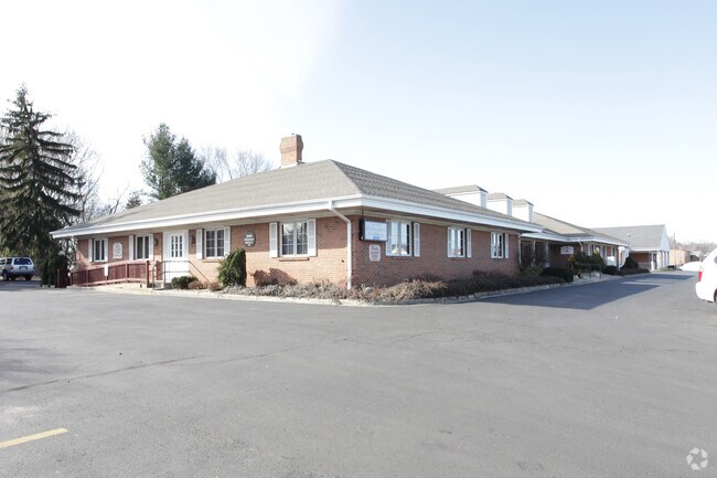
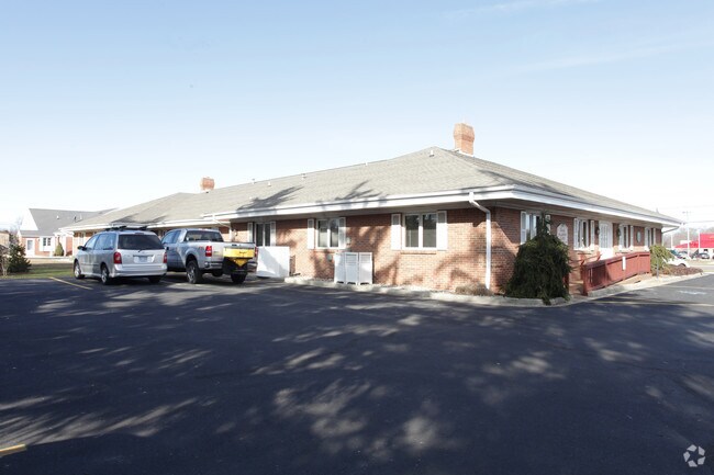

Property Detail
1844 Baldwin St
70-14-15-422-005
UNIT 4 PINE GROVE PROFESSIONAL BLDG OFFICE CONDOMINIUM, MASTER DEED RECORDED IN OTTAWA COUNTY REGISTER OF DEEDS LIBER 1038
Officebuilding
Ottawa
OS
Michigan
B and X Area of moderate flood hazard, usually the area between the limits of the 100-year and 500-year floods.
0.89 AC
2025
E Ottawa Cnty/Hudsonville
2025
West Michigan
021603
Grand Rapids-Wyoming-Kentwood, MI
1,472 SF
NEARBY LISTINGS FOR SALE OR LEASE
-
-
View all Jenison listings for lease on LoopNet.com
DEMOGRAPHICS near 1844 Baldwin St
1 mile
3 mile
5 mile
2025 Total Population
9,529
48,845
100,812
2030 Population
9,705
50,148
103,917
Pop Growth 2025-2030
+ 1.85%
+ 2.67%
+ 3.08%
Average Age
40
39
38
2025 Total Households
3,454
17,563
36,199
HH Growth 2025-2030
+ 1.97%
+ 2.75%
+ 3.20%
Median Household Inc
$93,369
$93,966
$91,842
Avg Household Size
2.70
2.70
2.70
2025 Avg HH Vehicles
2.00
2.00
2.00
Median Home Value
$272,143
$316,615
$328,095
Median Year Built
1971
1982
1986
Nearby Places
Map Layers
Map Styles
 Street
 Aerial
Transit
 Traffic
 Biking
Places
Listings with unknown addresses are not visible on the map
- Restaurants
- Banks
- Shops
- Fitness
- Groceries
PUBLIC TRANSPORTATION
COMMUTER RAIL
Grand Rapids Vernon J. Ehlers Station (Pere Marquette - Amtrak)
Drive
Walk
Distance
Grand Rapids Vernon J. Ehlers Station (Pere Marquette - Amtrak)
14 min
9.4 mi
AIRPORT
Gerald R Ford International
Drive
Walk
Distance
Gerald R Ford International
33 min
18.1 mi
Freight Ports
Port Milwaukee
Drive
Walk
Distance
Port Milwaukee
299 min
253.5 mi
SALE & LEASE HISTORY
LISTING DATE
SALE/LEASE

Dec 01, 2016
For Lease
Nearby Properties
Address
Land Use
TOTAL SIZE
Lot Size
Zoning
Address
Land Use
TOTAL SIZE
Lot Size
Zoning
268,440 SF
28.11 AC
HDR
Address
Land Use
TOTAL SIZE
Lot Size
Zoning
20.61 AC
HDR
Address
Land Use
TOTAL SIZE
Lot Size
Zoning
269,021 SF
22.89 AC
HDR
Address
Land Use
TOTAL SIZE
Lot Size
Zoning
173,288 SF
4.17 AC
PUD
Address
Land Use
TOTAL SIZE
Lot Size
Zoning
114,312 SF
22.23 AC
R-4
Address
Land Use
TOTAL SIZE
Lot Size
Zoning
222,785 SF
26.69 AC
CS
Address
Land Use
TOTAL SIZE
Lot Size
Zoning
124,950 SF
18.30 AC
MHR
Address
Land Use
TOTAL SIZE
Lot Size
Zoning
66,766 SF
R-1-A
Address
Land Use
TOTAL SIZE
Lot Size
Zoning
139,774 SF
10.67 AC
HDR-B
Address
Land Use
TOTAL SIZE
Lot Size
Zoning
82,554 SF
5.56 AC
HDR
Address
Land Use
TOTAL SIZE
Lot Size
Zoning
164,700 SF
19.18 AC
C-5
Address
Land Use
TOTAL SIZE
Lot Size
Zoning
6.77 AC
R3-B
Address
Land Use
TOTAL SIZE
Lot Size
Zoning
71,102 SF
8.65 AC
MHR
Address
Land Use
TOTAL SIZE
Lot Size
Zoning
45,636 SF
14.11 AC
C-5
Address
Land Use
TOTAL SIZE
Lot Size
Zoning
106,193 SF
10.68 AC
CS
Address
Land Use
TOTAL SIZE
Lot Size
Zoning
8,448 SF
2.68 AC
R-4
Address
Land Use
TOTAL SIZE
Lot Size
Zoning
59,018 SF
10.60 AC
HDR
Address
Land Use
TOTAL SIZE
Lot Size
Zoning
66,980 SF
LDR
Address
Land Use
TOTAL SIZE
Lot Size
Zoning
44,400 SF
6.69 AC
HS
Address
Land Use
TOTAL SIZE
Lot Size
Zoning
16,816 SF
3.33 AC
NS
Address
Land Use
TOTAL SIZE
Lot Size
Zoning
90,900 SF
8.53 AC
CS
Address
Land Use
TOTAL SIZE
Lot Size
Zoning
94,894 SF
7.35 AC
I
Address
Land Use
TOTAL SIZE
Lot Size
Zoning
5,054 SF
3.86 AC
LDR
Address
Land Use
TOTAL SIZE
Lot Size
Zoning
39,306 SF
3.65 AC
I
Address
Land Use
TOTAL SIZE
Lot Size
Zoning
174,484 SF
10.50 AC
I-2
Address
Land Use
TOTAL SIZE
Lot Size
Zoning
47,632 SF
4 AC
CS
Address
Land Use
TOTAL SIZE
Lot Size
Zoning
Address
Land Use
TOTAL SIZE
Lot Size
Zoning
33,530 SF
3.84 AC
HDR
Address
Land Use
TOTAL SIZE
Lot Size
Zoning
10,000 SF
2.02 AC
OS
Address
Land Use
TOTAL SIZE
Lot Size
Zoning
38,588 SF
3.14 AC
CS
The World's #1 Commercial Real Estate Marketplace
Connect with us
© 2026 CoStar Group
The information above has been obtained from sources believed reliable. While we do not doubt its accuracy we have not verified it and make no guarantee, warranty or representation about it. It is your responsibility to independently confirm its accuracy and completeness. Any projections, opinions, assumptions, or estimates used are for example only and do not represent the current or future performance of the property. The value of this transaction to you depends on tax and other factors which should be evaluated by your tax, financial, and legal advisors. You and your advisors should conduct a careful, independent investigation of the property to determine to your satisfaction the suitability of the property for your needs.