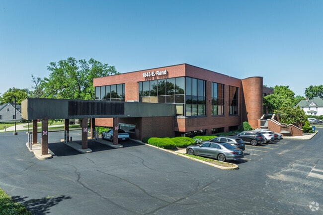
Property Record
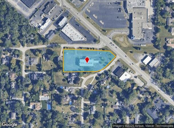
1845 E Rand Rd 243 Rd, Prospect Heights, IL 60070
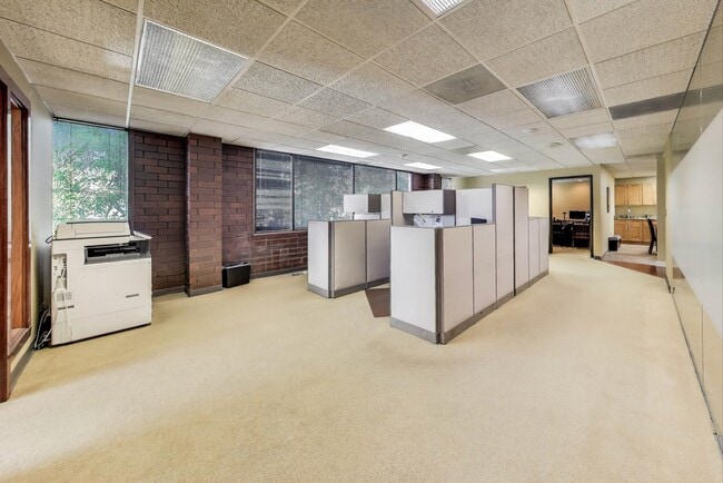
Current Lease Availabilities
NEARBY LISTINGS FOR SALE OR LEASE
Property Detail
1845 E Rand Rd 243 Rd
03-21-302-028-1093
Rand/Olive Office & Finl Ctr
Commercialcondominium
Cook
X
Illinois
17031C0202J
1
2023
2.22 AC
2024
Schaumburg Area
802605
Chicago
154 SF
Chicago-Naperville-Elgin, IL-IN-WI
DEMOGRAPHICS near 1845 E Rand Rd 243 Rd
1 Mile
3 Mile
5 Mile
2024 Total Population
11,496
125,845
329,965
2029 Population
11,118
122,115
320,431
Pop Growth 2024-2029
(3.29%)
(2.96%)
(2.89%)
Average Age
44
43
42
2024 Total Households
4,502
49,413
128,933
HH Growth 2024-2029
(3.75%)
(3.30%)
(3.21%)
Median Household Inc
$109,251
$104,102
$89,824
Avg Household Size
2.50
2.50
2.50
2024 Avg HH Vehicles
2.00
2.00
2.00
Median Home Value
$396,594
$355,265
$332,809
Median Year Built
1968
1970
1973
Nearby Places
- Restaurants
- Banks
- Shops
- Fitness
- Groceries
PUBLIC TRANSPORTATION
COMMUTER RAIL
Arlington Heights Station (Union Pacific Northwest Line - Northeast Illinois Regional Commuter Railroad (Metra))
DRIVE
WALK
Distance
Arlington Heights Station (Union Pacific Northwest Line - Northeast Illinois Regional Commuter Railroad (Metra))
7 min
2.3 mi
Arlington Park Station (Union Pacific Northwest Line - Northeast Illinois Regional Commuter Railroad (Metra))
DRIVE
WALK
Distance
Arlington Park Station (Union Pacific Northwest Line - Northeast Illinois Regional Commuter Railroad (Metra))
8 min
3.3 mi
AIRPORT
Chicago O'Hare International
DRIVE
WALK
Distance
Chicago O'Hare International
21 min
11.9 mi
Chicago Midway International
DRIVE
WALK
Distance
Chicago Midway International
50 min
27.5 mi
Freight Ports
Port Milwaukee
DRIVE
WALK
Distance
Port Milwaukee
87 min
71.2 mi
Nearby Properties
Address
Land Use
TOTAL SIZE
Lot Size
Zoning
Address
Land Use
TOTAL SIZE
Lot Size
Zoning
22.72 AC
Address
Land Use
TOTAL SIZE
Lot Size
Zoning
Address
Land Use
TOTAL SIZE
Lot Size
Zoning
642,049 SF
33.14 AC
Address
Land Use
TOTAL SIZE
Lot Size
Zoning
366,052 SF
32.18 AC
Address
Land Use
TOTAL SIZE
Lot Size
Zoning
234,337 SF
23.59 AC
Address
Land Use
TOTAL SIZE
Lot Size
Zoning
Address
Land Use
TOTAL SIZE
Lot Size
Zoning
18.34 AC
Address
Land Use
TOTAL SIZE
Lot Size
Zoning
262,533 SF
32.21 AC
Address
Land Use
TOTAL SIZE
Lot Size
Zoning
561,594 SF
29.88 AC
Address
Land Use
TOTAL SIZE
Lot Size
Zoning
690,195 SF
39.48 AC
Address
Land Use
TOTAL SIZE
Lot Size
Zoning
Address
Land Use
TOTAL SIZE
Lot Size
Zoning
195,269 SF
11.07 AC
Address
Land Use
TOTAL SIZE
Lot Size
Zoning
295,685 SF
27.21 AC
Address
Land Use
TOTAL SIZE
Lot Size
Zoning
Address
Land Use
TOTAL SIZE
Lot Size
Zoning
161,035 SF
13.57 AC
Address
Land Use
TOTAL SIZE
Lot Size
Zoning
286,720 SF
9.77 AC
Address
Land Use
TOTAL SIZE
Lot Size
Zoning
138,926 SF
2.81 AC
Address
Land Use
TOTAL SIZE
Lot Size
Zoning
Address
Land Use
TOTAL SIZE
Lot Size
Zoning
176,325 SF
18.20 AC
Address
Land Use
TOTAL SIZE
Lot Size
Zoning
145,274 SF
10.23 AC
Address
Land Use
TOTAL SIZE
Lot Size
Zoning
21.16 AC
Address
Land Use
TOTAL SIZE
Lot Size
Zoning
152,773 SF
1.30 AC
Address
Land Use
TOTAL SIZE
Lot Size
Zoning
Address
Land Use
TOTAL SIZE
Lot Size
Zoning
51,028 SF
4.20 AC
Address
Land Use
TOTAL SIZE
Lot Size
Zoning
63,969 SF
3.16 AC
Address
Land Use
TOTAL SIZE
Lot Size
Zoning
Address
Land Use
TOTAL SIZE
Lot Size
Zoning
197,350 SF
11.83 AC
Address
Land Use
TOTAL SIZE
Lot Size
Zoning
256,610 SF
12.53 AC
Address
Land Use
TOTAL SIZE
Lot Size
Zoning
12.53 AC
Address
Land Use
TOTAL SIZE
Lot Size
Zoning
16.74 AC
The World's #1 Commercial Real Estate Marketplace
Connect with us
© 2025 CoStar Group
The information above has been obtained from sources believed reliable. While we do not doubt its accuracy we have not verified it and make no guarantee, warranty or representation about it. It is your responsibility to independently confirm its accuracy and completeness. Any projections, opinions, assumptions, or estimates used are for example only and do not represent the current or future performance of the property. The value of this transaction to you depends on tax and other factors which should be evaluated by your tax, financial, and legal advisors. You and your advisors should conduct a careful, independent investigation of the property to determine to your satisfaction the suitability of the property for your needs.