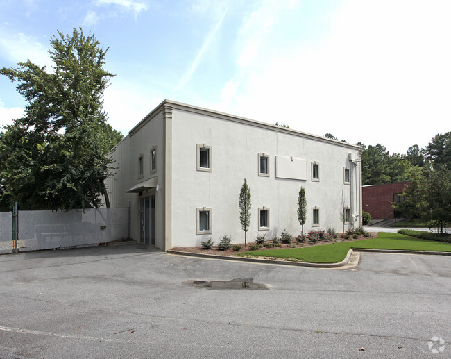
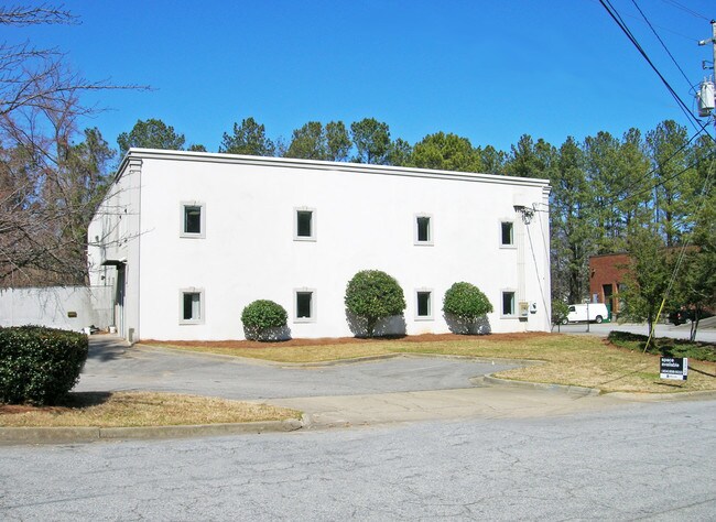
Property Record
1845 Macarthur Blvd Nw, Atlanta, GA 30318


NEARBY LISTINGS FOR SALE OR LEASE
Property Detail
1845 Macarthur Blvd Nw
Atlanta-Sandy Springs-Roswell, GA
C L Burks Inc
17-0230-0006-082-8
LAND SIZE CORRECTION FROM 15500 SQFT TO 2.8096 ACRES
Warehouse
Fulton
X
Georgia
13121C0229F
230
2024
2.81 AC
2025
Chattahoochee
008802
Atlanta
8,816 SF
DEMOGRAPHICS near 1845 Macarthur Blvd Nw
1 Mile
3 Mile
5 Mile
2024 Total Population
8,843
71,689
293,232
2029 Population
9,453
74,197
305,247
Pop Growth 2024-2029
+ 6.90%
+ 3.50%
+ 4.10%
Average Age
34
36
37
2024 Total Households
3,930
32,303
140,655
HH Growth 2024-2029
+ 7.28%
+ 3.67%
+ 4.32%
Median Household Inc
$112,982
$94,091
$87,291
Avg Household Size
2.20
2.10
1.90
2024 Avg HH Vehicles
2.00
2.00
1.00
Median Home Value
$418,049
$460,763
$453,454
Median Year Built
2005
1995
1996
Nearby Places
Map Layers
Map Styles
 Street
 Aerial
- Restaurants
- Banks
- Shops
- Fitness
- Groceries
PUBLIC TRANSPORTATION
COMMUTER RAIL
DRIVE
WALK
Distance
11 min
4.2 mi
AIRPORT
Hartsfield - Jackson Atlanta International
DRIVE
WALK
Distance
Hartsfield - Jackson Atlanta International
29 min
16.1 mi
SALE & LEASE HISTORY
LISTING DATE
SALE/LEASE

Sep 26, 2016
For Lease
Nearby Properties
Address
Land Use
TOTAL SIZE
Lot Size
Zoning
Address
Land Use
TOTAL SIZE
Lot Size
Zoning
638,721 SF
3.31 AC
I1
Address
Land Use
TOTAL SIZE
Lot Size
Zoning
961,817 SF
25.44 AC
I2
Address
Land Use
TOTAL SIZE
Lot Size
Zoning
485,185 SF
3.76 AC
I2
Address
Land Use
TOTAL SIZE
Lot Size
Zoning
630,471 SF
0.70 AC
I2
Address
Land Use
TOTAL SIZE
Lot Size
Zoning
467,671 SF
4.82 AC
C1
Address
Land Use
TOTAL SIZE
Lot Size
Zoning
296,698 SF
8.99 AC
RG2
Address
Land Use
TOTAL SIZE
Lot Size
Zoning
770,093 SF
11.08 AC
RG3
Address
Land Use
TOTAL SIZE
Lot Size
Zoning
418,096 SF
7.73 AC
I2
Address
Land Use
TOTAL SIZE
Lot Size
Zoning
494,100 SF
6.10 AC
I2
Address
Land Use
TOTAL SIZE
Lot Size
Zoning
520,886 SF
9.96 AC
I2
Address
Land Use
TOTAL SIZE
Lot Size
Zoning
405,957 SF
13.73 AC
RG3
Address
Land Use
TOTAL SIZE
Lot Size
Zoning
354,766 SF
11.32 AC
RG3
Address
Land Use
TOTAL SIZE
Lot Size
Zoning
549,094 SF
6.26 AC
I2
Address
Land Use
TOTAL SIZE
Lot Size
Zoning
695,481 SF
11.66 AC
RG3
Address
Land Use
TOTAL SIZE
Lot Size
Zoning
1,770,090 SF
23.90 AC
RG2
Address
Land Use
TOTAL SIZE
Lot Size
Zoning
511,640 SF
5.56 AC
OIC
Address
Land Use
TOTAL SIZE
Lot Size
Zoning
354,710 SF
25.27 AC
R5
Address
Land Use
TOTAL SIZE
Lot Size
Zoning
115 AC
I2
Address
Land Use
TOTAL SIZE
Lot Size
Zoning
580,189 SF
5.49 AC
OI
Address
Land Use
TOTAL SIZE
Lot Size
Zoning
469,880 SF
8.90 AC
OI
Address
Land Use
TOTAL SIZE
Lot Size
Zoning
329,385 SF
15.29 AC
RHR
Address
Land Use
TOTAL SIZE
Lot Size
Zoning
9.22 AC
R4A
Address
Land Use
TOTAL SIZE
Lot Size
Zoning
439,167 SF
41.13 AC
RM-12
Address
Land Use
TOTAL SIZE
Lot Size
Zoning
445,848 SF
2.54 AC
OI
Address
Land Use
TOTAL SIZE
Lot Size
Zoning
281,632 SF
27.12 AC
RM-12
Address
Land Use
TOTAL SIZE
Lot Size
Zoning
982,494 SF
11.98 AC
C1
Address
Land Use
TOTAL SIZE
Lot Size
Zoning
360,268 SF
4.30 AC
I2
Address
Land Use
TOTAL SIZE
Lot Size
Zoning
456,000 SF
5.42 AC
I2
Address
Land Use
TOTAL SIZE
Lot Size
Zoning
208,049 SF
5.86 AC
I2
Address
Land Use
TOTAL SIZE
Lot Size
Zoning
440,000 SF
3.48 AC
I2
The World's #1 Commercial Real Estate Marketplace
Connect with us
© 2026 CoStar Group
The information above has been obtained from sources believed reliable. While we do not doubt its accuracy we have not verified it and make no guarantee, warranty or representation about it. It is your responsibility to independently confirm its accuracy and completeness. Any projections, opinions, assumptions, or estimates used are for example only and do not represent the current or future performance of the property. The value of this transaction to you depends on tax and other factors which should be evaluated by your tax, financial, and legal advisors. You and your advisors should conduct a careful, independent investigation of the property to determine to your satisfaction the suitability of the property for your needs.