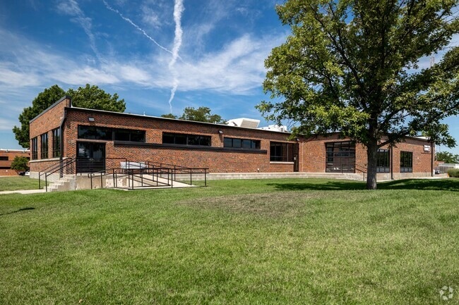
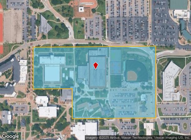
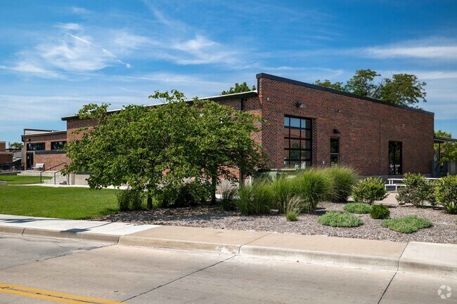
Property Record
1845 N Fairmount Ave, Wichita, KS 67260
NEARBY LISTINGS FOR SALE OR LEASE
Property Detail
1845 N Fairmount Ave
121-11-0-21-01-001.00F
BEG 1440 FT E & 1330 FT N SW COR NW1/4 N 714.4 FT E TO E LI S 714.4 FT W TO BEG EXC W 387.8 FT S 300 FTSEC 11-27-1E EXEMPT 6422-0
University
Sedgwick
X
Kansas
20173C0356G
17.27 AC
2024
Northeast
2025
Wichita
000900
Wichita, KS
148,617 SF
DEMOGRAPHICS near 1845 N Fairmount Ave
1 Mile
3 Mile
5 Mile
2024 Total Population
12,136
78,881
199,063
2029 Population
12,598
81,287
204,891
Pop Growth 2024-2029
+ 3.81%
+ 3.05%
+ 2.93%
Average Age
34
38
38
2024 Total Households
4,134
31,960
82,695
HH Growth 2024-2029
+ 4.18%
+ 3.13%
+ 3.10%
Median Household Inc
$41,678
$53,723
$54,771
Avg Household Size
2.30
2.30
2.30
2024 Avg HH Vehicles
1.00
2.00
2.00
Median Home Value
$94,181
$182,614
$174,107
Median Year Built
1959
1963
1963
Nearby Places
Map Layers
Map Styles
 Street
 Aerial
- Restaurants
- Banks
- Shops
- Fitness
- Groceries
PUBLIC TRANSPORTATION
AIRPORT
Wichita Dwight D Eisenhower Ntl
DRIVE
WALK
Distance
Wichita Dwight D Eisenhower Ntl
21 min
11.9 mi
Freight Ports
Tulsa Port Of Catoosa
DRIVE
WALK
Distance
Tulsa Port Of Catoosa
212 min
196.6 mi
Nearby Properties
Address
Land Use
TOTAL SIZE
Lot Size
Zoning
Address
Land Use
TOTAL SIZE
Lot Size
Zoning
499,239 SF
18.70 AC
GO
Address
Land Use
TOTAL SIZE
Lot Size
Zoning
481,160 SF
63.37 AC
SF-5
Address
Land Use
TOTAL SIZE
Lot Size
Zoning
346,728 SF
15.91 AC
SF-5
Address
Land Use
TOTAL SIZE
Lot Size
Zoning
576,707 SF
53.70 AC
B,LC
Address
Land Use
TOTAL SIZE
Lot Size
Zoning
179,764 SF
42.17 AC
SF-5,LI
Address
Land Use
TOTAL SIZE
Lot Size
Zoning
271,541 SF
39.20 AC
GO
Address
Land Use
TOTAL SIZE
Lot Size
Zoning
340,322 SF
32.82 AC
SF-5,B
Address
Land Use
TOTAL SIZE
Lot Size
Zoning
104,331 SF
SF-5
Address
Land Use
TOTAL SIZE
Lot Size
Zoning
305,447 SF
46.77 AC
GI
Address
Land Use
TOTAL SIZE
Lot Size
Zoning
103,261 SF
5.49 AC
B
Address
Land Use
TOTAL SIZE
Lot Size
Zoning
186,902 SF
5.24 AC
SF-5
Address
Land Use
TOTAL SIZE
Lot Size
Zoning
945,203 SF
9.53 AC
GO
Address
Land Use
TOTAL SIZE
Lot Size
Zoning
169,134 SF
18.97 AC
SF-5
Address
Land Use
TOTAL SIZE
Lot Size
Zoning
199,468 SF
24.45 AC
SF-5
Address
Land Use
TOTAL SIZE
Lot Size
Zoning
73,314 SF
3.18 AC
SF-5
Address
Land Use
TOTAL SIZE
Lot Size
Zoning
69,125 SF
16.79 AC
MF-29,MF-1
Address
Land Use
TOTAL SIZE
Lot Size
Zoning
74,242 SF
23.99 AC
GC
Address
Land Use
TOTAL SIZE
Lot Size
Zoning
92,973 SF
5.52 AC
PUD
Address
Land Use
TOTAL SIZE
Lot Size
Zoning
67,067 SF
8.36 AC
SF-5
Address
Land Use
TOTAL SIZE
Lot Size
Zoning
111,805 SF
20.09 AC
SF-5
Address
Land Use
TOTAL SIZE
Lot Size
Zoning
84,452 SF
0.46 AC
B
Address
Land Use
TOTAL SIZE
Lot Size
Zoning
41,526 SF
17.52 AC
LC
Address
Land Use
TOTAL SIZE
Lot Size
Zoning
65,973 SF
5.39 AC
TF-3
Address
Land Use
TOTAL SIZE
Lot Size
Zoning
66,601 SF
3.85 AC
SF-5
Address
Land Use
TOTAL SIZE
Lot Size
Zoning
81,870 SF
3.70 AC
B,GC
Address
Land Use
TOTAL SIZE
Lot Size
Zoning
85,412 SF
1.21 AC
TF-3
Address
Land Use
TOTAL SIZE
Lot Size
Zoning
60,232 SF
0.72 AC
SF-5
Address
Land Use
TOTAL SIZE
Lot Size
Zoning
72,001 SF
21.99 AC
LI
Address
Land Use
TOTAL SIZE
Lot Size
Zoning
116,114 SF
53.39 AC
SF-5
The World's #1 Commercial Real Estate Marketplace
Connect with us
© 2026 CoStar Group
The information above has been obtained from sources believed reliable. While we do not doubt its accuracy we have not verified it and make no guarantee, warranty or representation about it. It is your responsibility to independently confirm its accuracy and completeness. Any projections, opinions, assumptions, or estimates used are for example only and do not represent the current or future performance of the property. The value of this transaction to you depends on tax and other factors which should be evaluated by your tax, financial, and legal advisors. You and your advisors should conduct a careful, independent investigation of the property to determine to your satisfaction the suitability of the property for your needs.