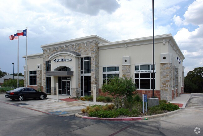
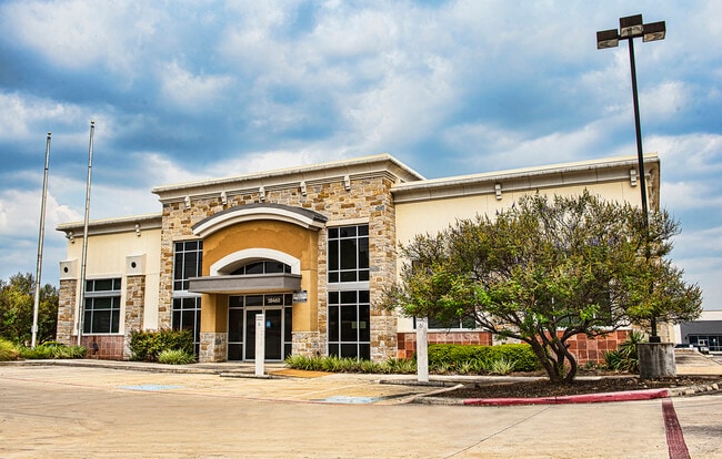
Property Record
18460 Blanco Rd, San Antonio, TX 78258

Save to a Folder
{{folder.Name}}
{{folder.ListingIds.length}} Properties
{{folder.ListingIds.length}} Property
Create a New Folder
Property Detail
18460 Blanco Rd
San Antonio-New Braunfels, TX
NCB 16331 BLK 7 LOT 64 0.918 AC (LEASE HOLD ACCT) BLANCO MARKET SUBD 2010 LEGAL CHANGE PER AMENDING PLAT 9608/77-86
16331-007-0601
BEXAR
Financialbuilding
Texas
B and X Area of moderate flood hazard, usually the area between the limits of the 100-year and 500-year floods.
64
2025
0.92 AC
2025
Far North Central
191816
San Antonio
4,840 SF
NEARBY LISTINGS FOR SALE OR LEASE
DEMOGRAPHICS near 18460 Blanco Rd
1 mile
3 mile
5 mile
2025 Total Population
9,094
73,322
198,257
2030 Population
9,498
76,586
208,090
Pop Growth 2025-2030
+ 4.44%
+ 4.45%
+ 4.96%
Average Age
42
40
40
2025 Total Households
3,777
28,900
80,835
HH Growth 2025-2030
+ 4.63%
+ 4.65%
+ 5.13%
Median Household Inc
$115,040
$111,032
$96,028
Avg Household Size
2.30
2.50
2.40
2025 Avg HH Vehicles
2.00
2.00
2.00
Median Home Value
$553,763
$458,699
$422,431
Median Year Built
1996
1997
1995
Nearby Places
Map Layers
Map Styles
 Street
 Aerial
Layers
 Traffic
 Biking
Places
Listings with unknown addresses are not visible on the map
- Restaurants
- Banks
- Shops
- Fitness
- Groceries
PUBLIC TRANSPORTATION
AIRPORT
San Antonio International
Drive
Walk
Distance
San Antonio International
14 min
9.4 mi
Freight Ports
Calhoun Port
Drive
Walk
Distance
Calhoun Port
189 min
158.2 mi
SALE & LEASE HISTORY
LISTING DATE
SALE/LEASE

Sep 23, 2021
For Lease
Jul 17, 2017
For Sale
Dec 19, 2017
For Lease
Apr 06, 2017
For Sale
Nearby Properties
Address
Land Use
TOTAL SIZE
Lot Size
Zoning
Address
Land Use
TOTAL SIZE
Lot Size
Zoning
621,591 SF
15.25 AC
Address
Land Use
TOTAL SIZE
Lot Size
Zoning
427,456 SF
37.12 AC
Address
Land Use
TOTAL SIZE
Lot Size
Zoning
631,284 SF
14.61 AC
Address
Land Use
TOTAL SIZE
Lot Size
Zoning
387,893 SF
11.97 AC
Address
Land Use
TOTAL SIZE
Lot Size
Zoning
311,728 SF
7.47 AC
Address
Land Use
TOTAL SIZE
Lot Size
Zoning
480,363 SF
28.52 AC
Address
Land Use
TOTAL SIZE
Lot Size
Zoning
292,126 SF
12.86 AC
Address
Land Use
TOTAL SIZE
Lot Size
Zoning
315,719 SF
13.91 AC
Address
Land Use
TOTAL SIZE
Lot Size
Zoning
308,375 SF
15.77 AC
Address
Land Use
TOTAL SIZE
Lot Size
Zoning
303,085 SF
12.42 AC
Address
Land Use
TOTAL SIZE
Lot Size
Zoning
347,053 SF
12.94 AC
Address
Land Use
TOTAL SIZE
Lot Size
Zoning
177,316 SF
19.83 AC
Address
Land Use
TOTAL SIZE
Lot Size
Zoning
209,715 SF
22.91 AC
Address
Land Use
TOTAL SIZE
Lot Size
Zoning
327,760 SF
18.75 AC
Address
Land Use
TOTAL SIZE
Lot Size
Zoning
284,202 SF
13.59 AC
Address
Land Use
TOTAL SIZE
Lot Size
Zoning
138,292 SF
17.91 AC
Address
Land Use
TOTAL SIZE
Lot Size
Zoning
317,041 SF
26.69 AC
Address
Land Use
TOTAL SIZE
Lot Size
Zoning
289,271 SF
16.87 AC
Address
Land Use
TOTAL SIZE
Lot Size
Zoning
69,860 SF
20.10 AC
Address
Land Use
TOTAL SIZE
Lot Size
Zoning
234,914 SF
16.29 AC
Address
Land Use
TOTAL SIZE
Lot Size
Zoning
154,937 SF
22 AC
Address
Land Use
TOTAL SIZE
Lot Size
Zoning
347,053 SF
12.94 AC
Address
Land Use
TOTAL SIZE
Lot Size
Zoning
269,525 SF
17.75 AC
Address
Land Use
TOTAL SIZE
Lot Size
Zoning
249,562 SF
9.65 AC
Address
Land Use
TOTAL SIZE
Lot Size
Zoning
281,805 SF
14.52 AC
Address
Land Use
TOTAL SIZE
Lot Size
Zoning
99,301 SF
13.49 AC
Address
Land Use
TOTAL SIZE
Lot Size
Zoning
273,257 SF
17.62 AC
Address
Land Use
TOTAL SIZE
Lot Size
Zoning
256,048 SF
15.45 AC
Address
Land Use
TOTAL SIZE
Lot Size
Zoning
143,164 SF
30.79 AC
Address
Land Use
TOTAL SIZE
Lot Size
Zoning
190,879 SF
14.48 AC
The World's #1 Commercial Real Estate Marketplace
Connect with us
© 2026 CoStar Group
The information above has been obtained from sources believed reliable. While we do not doubt its accuracy we have not verified it and make no guarantee, warranty or representation about it. It is your responsibility to independently confirm its accuracy and completeness. Any projections, opinions, assumptions, or estimates used are for example only and do not represent the current or future performance of the property. The value of this transaction to you depends on tax and other factors which should be evaluated by your tax, financial, and legal advisors. You and your advisors should conduct a careful, independent investigation of the property to determine to your satisfaction the suitability of the property for your needs.