Property Record
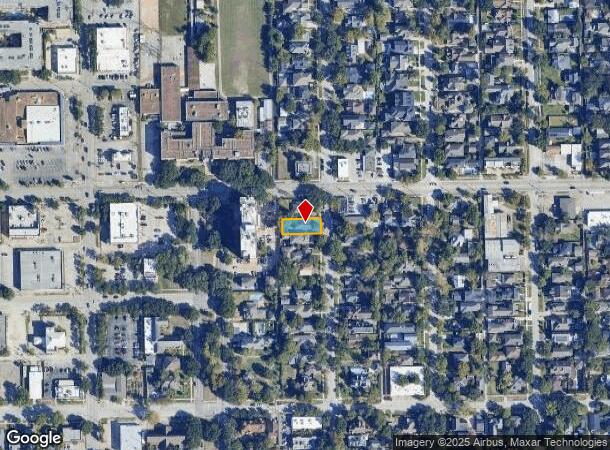
1847 Harvard St, Houston, TX 77008
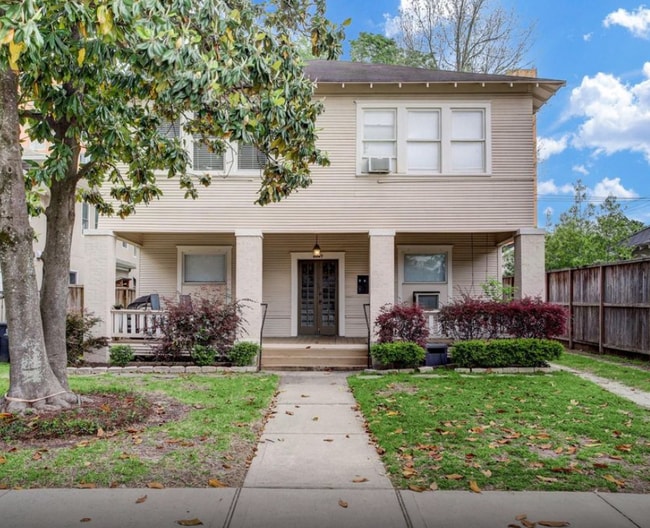
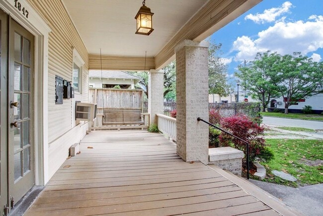
This Property Is For Sale
NEARBY LISTINGS FOR SALE OR LEASE
Property Detail
1847 Harvard St
Houston-The Woodlands-Sugar Land, TX
Houston Heights
0201000000002
LT 2 BLK 104 HOUSTON HEIGHTS
Apartment
Harris
X
Texas
48201C0670M
2
2024
0.15 AC
2025
Greater Heights
511302
Houston
2,996 SF
DEMOGRAPHICS near 1847 Harvard St
1 Mile
3 Mile
5 Mile
2024 Total Population
23,682
181,844
461,836
2029 Population
25,789
197,372
500,600
Pop Growth 2024-2029
+ 8.90%
+ 8.54%
+ 8.39%
Average Age
40
38
38
2024 Total Households
11,202
81,747
200,435
HH Growth 2024-2029
+ 8.94%
+ 8.82%
+ 8.92%
Median Household Inc
$148,002
$106,785
$87,097
Avg Household Size
2.10
2.20
2.20
2024 Avg HH Vehicles
2.00
2.00
2.00
Median Home Value
$713,208
$498,304
$454,317
Median Year Built
1987
1998
1992
Nearby Places
Map Layers
Map Styles
 Street
 Aerial
- Restaurants
- Banks
- Shops
- Fitness
- Groceries
PUBLIC TRANSPORTATION
COMMUTER RAIL
Houston (Sunset Limited - Amtrak)
DRIVE
WALK
Distance
Houston (Sunset Limited - Amtrak)
7 min
3.8 mi
AIRPORT
William P Hobby
DRIVE
WALK
Distance
William P Hobby
28 min
16.7 mi
George Bush Intcntl/Houston
DRIVE
WALK
Distance
George Bush Intcntl/Houston
24 min
18.9 mi
Freight Ports
Port of Houston
DRIVE
WALK
Distance
Port of Houston
22 min
14.2 mi
Nearby Properties
Address
Land Use
TOTAL SIZE
Lot Size
Zoning
Address
Land Use
TOTAL SIZE
Lot Size
Zoning
453,456 SF
3.11 AC
Address
Land Use
TOTAL SIZE
Lot Size
Zoning
432,689 SF
2.84 AC
Address
Land Use
TOTAL SIZE
Lot Size
Zoning
649,000 SF
7.35 AC
Address
Land Use
TOTAL SIZE
Lot Size
Zoning
519,374 SF
6.18 AC
Address
Land Use
TOTAL SIZE
Lot Size
Zoning
788,433 SF
5.09 AC
Address
Land Use
TOTAL SIZE
Lot Size
Zoning
416,975 SF
2.52 AC
Address
Land Use
TOTAL SIZE
Lot Size
Zoning
675,412 SF
10.09 AC
Address
Land Use
TOTAL SIZE
Lot Size
Zoning
641,392 SF
10 AC
Address
Land Use
TOTAL SIZE
Lot Size
Zoning
591,997 SF
4.83 AC
Address
Land Use
TOTAL SIZE
Lot Size
Zoning
563,626 SF
4.71 AC
Address
Land Use
TOTAL SIZE
Lot Size
Zoning
308,055 SF
2.22 AC
Address
Land Use
TOTAL SIZE
Lot Size
Zoning
474,326 SF
43.16 AC
Address
Land Use
TOTAL SIZE
Lot Size
Zoning
314,489 SF
1.84 AC
Address
Land Use
TOTAL SIZE
Lot Size
Zoning
429,771 SF
3.49 AC
Address
Land Use
TOTAL SIZE
Lot Size
Zoning
315,439 SF
3.54 AC
Address
Land Use
TOTAL SIZE
Lot Size
Zoning
641,684 SF
3.30 AC
Address
Land Use
TOTAL SIZE
Lot Size
Zoning
432,691 SF
3.26 AC
Address
Land Use
TOTAL SIZE
Lot Size
Zoning
443,982 SF
3.79 AC
Address
Land Use
TOTAL SIZE
Lot Size
Zoning
324,709 SF
4 AC
Address
Land Use
TOTAL SIZE
Lot Size
Zoning
261,312 SF
1.81 AC
Address
Land Use
TOTAL SIZE
Lot Size
Zoning
457,647 SF
2.30 AC
Address
Land Use
TOTAL SIZE
Lot Size
Zoning
468,706 SF
3.80 AC
Address
Land Use
TOTAL SIZE
Lot Size
Zoning
538,026 SF
7.03 AC
Address
Land Use
TOTAL SIZE
Lot Size
Zoning
593,265 SF
3.73 AC
Address
Land Use
TOTAL SIZE
Lot Size
Zoning
683,861 SF
15.03 AC
Address
Land Use
TOTAL SIZE
Lot Size
Zoning
445,191 SF
3.58 AC
Address
Land Use
TOTAL SIZE
Lot Size
Zoning
477,064 SF
4.60 AC
Address
Land Use
TOTAL SIZE
Lot Size
Zoning
684,371 SF
3.97 AC
Address
Land Use
TOTAL SIZE
Lot Size
Zoning
255,545 SF
2.91 AC
Address
Land Use
TOTAL SIZE
Lot Size
Zoning
264,101 SF
3.58 AC
The World's #1 Commercial Real Estate Marketplace
Connect with us
© 2025 CoStar Group
The information above has been obtained from sources believed reliable. While we do not doubt its accuracy we have not verified it and make no guarantee, warranty or representation about it. It is your responsibility to independently confirm its accuracy and completeness. Any projections, opinions, assumptions, or estimates used are for example only and do not represent the current or future performance of the property. The value of this transaction to you depends on tax and other factors which should be evaluated by your tax, financial, and legal advisors. You and your advisors should conduct a careful, independent investigation of the property to determine to your satisfaction the suitability of the property for your needs.