Property Record
1849 Data Dr, Hoover, AL 35244
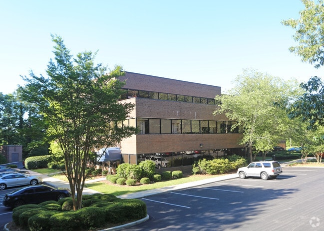

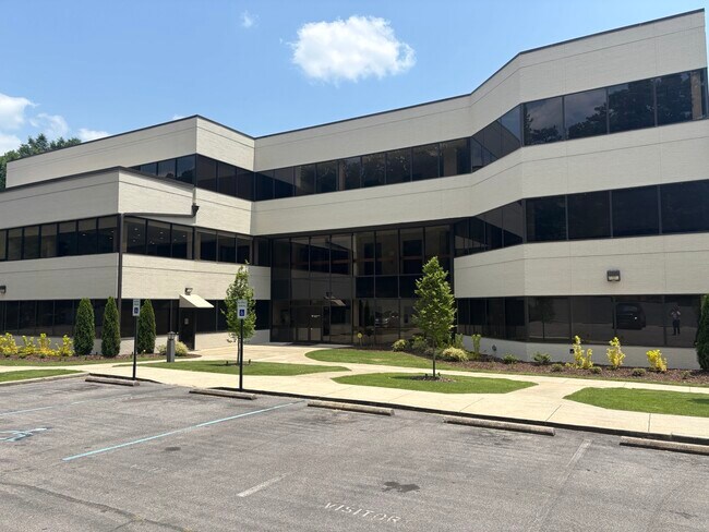
Property Detail
1849 Data Dr
40-00-18-3-000-004.000
LOT 1 TELCO 143/50
Officebuilding
Jefferson
PO
Alabama
B and X Area of moderate flood hazard, usually the area between the limits of the 100-year and 500-year floods.
1
2024
3 AC
2025
Hoover
030352
Birmingham
19,977 SF
Birmingham, AL
NEARBY LISTINGS FOR SALE OR LEASE
DEMOGRAPHICS near 1849 Data Dr
1 mile
3 mile
5 mile
2025 Total Population
9,279
50,663
112,088
2030 Population
8,807
49,749
110,589
Pop Growth 2025-2030
(5.09%)
(1.80%)
(1.34%)
Average Age
34
40
40
2025 Total Households
4,463
21,818
45,583
HH Growth 2025-2030
(5.11%)
(2.00%)
(1.54%)
Median Household Inc
$56,824
$83,776
$96,459
Avg Household Size
2.00
2.20
2.40
2025 Avg HH Vehicles
2.00
2.00
2.00
Median Home Value
$261,938
$363,346
$394,592
Median Year Built
1988
1985
1985
Nearby Places
Map Layers
Map Styles
 Street
 Aerial
Layers
 Traffic
 Biking
Places
Listings with unknown addresses are not visible on the map
- Restaurants
- Banks
- Shops
- Fitness
- Groceries
PUBLIC TRANSPORTATION
AIRPORT
Birmingham-Shuttlesworth International
Drive
Walk
Distance
Birmingham-Shuttlesworth International
28 min
17.5 mi
SALE & LEASE HISTORY
LISTING DATE
SALE/LEASE

Jun 17, 2024
For Lease
Feb 19, 2018
For Lease
Aug 22, 2017
For Sale
Nearby Properties
Address
Land Use
TOTAL SIZE
Lot Size
Zoning
Address
Land Use
TOTAL SIZE
Lot Size
Zoning
515,818 SF
38 AC
CP
Address
Land Use
TOTAL SIZE
Lot Size
Zoning
501,099 SF
33 AC
PO
Address
Land Use
TOTAL SIZE
Lot Size
Zoning
1,008,008 SF
74 AC
R4
Address
Land Use
TOTAL SIZE
Lot Size
Zoning
442,000 SF
36.22 AC
Address
Land Use
TOTAL SIZE
Lot Size
Zoning
333,513 SF
41 AC
C2
Address
Land Use
TOTAL SIZE
Lot Size
Zoning
745,655 SF
16 AC
C-1
Address
Land Use
TOTAL SIZE
Lot Size
Zoning
267,122 SF
26 AC
PC
Address
Land Use
TOTAL SIZE
Lot Size
Zoning
80,269 SF
2.50 AC
C-1
Address
Land Use
TOTAL SIZE
Lot Size
Zoning
12,200 SF
28.77 AC
Address
Land Use
TOTAL SIZE
Lot Size
Zoning
582,638 SF
43.76 AC
PUDP
Address
Land Use
TOTAL SIZE
Lot Size
Zoning
69,151 SF
5 AC
PC
Address
Land Use
TOTAL SIZE
Lot Size
Zoning
16,385 SF
4.95 AC
Address
Land Use
TOTAL SIZE
Lot Size
Zoning
Address
Land Use
TOTAL SIZE
Lot Size
Zoning
186,953 SF
20 AC
PR2
Address
Land Use
TOTAL SIZE
Lot Size
Zoning
210,033 SF
7.85 AC
Address
Land Use
TOTAL SIZE
Lot Size
Zoning
294,855 SF
30 AC
R4
Address
Land Use
TOTAL SIZE
Lot Size
Zoning
237,921 SF
6 AC
PUDP
Address
Land Use
TOTAL SIZE
Lot Size
Zoning
241,232 SF
15 AC
PR2
Address
Land Use
TOTAL SIZE
Lot Size
Zoning
446,170 SF
19 AC
PR2
Address
Land Use
TOTAL SIZE
Lot Size
Zoning
284,436 SF
40.98 AC
PUDP
Address
Land Use
TOTAL SIZE
Lot Size
Zoning
165,474 SF
90 AC
PR2
Address
Land Use
TOTAL SIZE
Lot Size
Zoning
365,402 SF
25 AC
R4
Address
Land Use
TOTAL SIZE
Lot Size
Zoning
2,199 SF
23 AC
Address
Land Use
TOTAL SIZE
Lot Size
Zoning
238,304 SF
19 AC
PR-2
Address
Land Use
TOTAL SIZE
Lot Size
Zoning
160,443 SF
23 AC
C-2
Address
Land Use
TOTAL SIZE
Lot Size
Zoning
41,980 SF
26.70 AC
PC
Address
Land Use
TOTAL SIZE
Lot Size
Zoning
94,094 SF
14.40 AC
PO-P
Address
Land Use
TOTAL SIZE
Lot Size
Zoning
102,342 SF
11 AC
Address
Land Use
TOTAL SIZE
Lot Size
Zoning
200,679 SF
20 AC
PR2
Address
Land Use
TOTAL SIZE
Lot Size
Zoning
191,623 SF
20 AC
R4
The World's #1 Commercial Real Estate Marketplace
Connect with us
© 2026 CoStar Group
The information above has been obtained from sources believed reliable. While we do not doubt its accuracy we have not verified it and make no guarantee, warranty or representation about it. It is your responsibility to independently confirm its accuracy and completeness. Any projections, opinions, assumptions, or estimates used are for example only and do not represent the current or future performance of the property. The value of this transaction to you depends on tax and other factors which should be evaluated by your tax, financial, and legal advisors. You and your advisors should conduct a careful, independent investigation of the property to determine to your satisfaction the suitability of the property for your needs.