Property Record
1849 S Power Rd, Mesa, AZ 85206
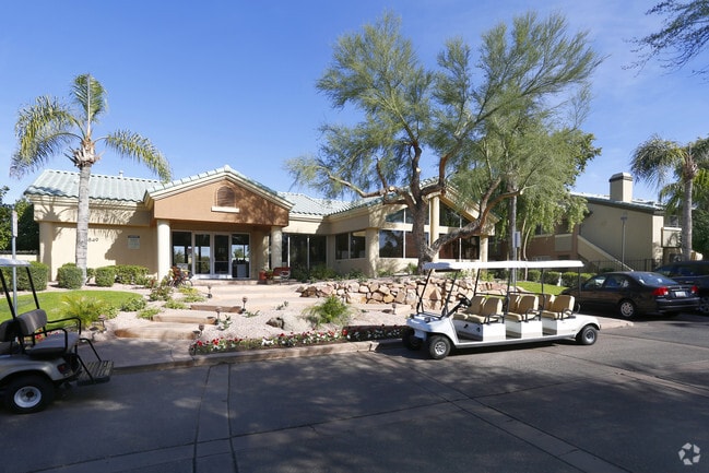


Property Detail
1849 S Power Rd
218-56-450A
TH PT SE4 SE4 SEC 36 LY W/IN DKT 88-324725 EX P/F 95-460526
Apartment
Maricopa
M-M
Arizona
C and X Area of minimal flood hazard, usually depicted on FIRMs as above the 500-year flood level.
9.69 AC
2025
Superstition Springs
2025
Phoenix
422633
Phoenix-Mesa-Chandler, AZ
156,644 SF
NEARBY LISTINGS FOR SALE OR LEASE
DEMOGRAPHICS near 1849 S Power Rd
1 mile
3 mile
5 mile
2025 Total Population
9,189
113,964
305,648
2030 Population
9,498
119,093
318,669
Pop Growth 2025-2030
+ 3.36%
+ 4.50%
+ 4.26%
Average Age
39
44
42
2025 Total Households
3,479
45,883
117,881
HH Growth 2025-2030
+ 3.56%
+ 4.84%
+ 4.52%
Median Household Inc
$89,601
$80,591
$85,587
Avg Household Size
2.60
2.40
2.50
2025 Avg HH Vehicles
2.00
2.00
2.00
Median Home Value
$468,527
$401,914
$418,358
Median Year Built
1994
1994
1994
Nearby Places
Map Layers
Map Styles
 Street
 Aerial
Layers
 Traffic
 Biking
Places
Listings with unknown addresses are not visible on the map
- Restaurants
- Banks
- Shops
- Fitness
- Groceries
PUBLIC TRANSPORTATION
AIRPORT
Phoenix-Mesa Gateway
Drive
Walk
Distance
Phoenix-Mesa Gateway
12 min
6.4 mi
Phoenix Sky Harbor International
Drive
Walk
Distance
Phoenix Sky Harbor International
31 min
22.6 mi
Freight Ports
Port of San Diego
Drive
Walk
Distance
Port of San Diego
417 min
378.9 mi
Nearby Properties
Address
Land Use
TOTAL SIZE
Lot Size
Zoning
Address
Land Use
TOTAL SIZE
Lot Size
Zoning
184.86 AC
Address
Land Use
TOTAL SIZE
Lot Size
Zoning
1,522,034 SF
32.67 AC
C-N
Address
Land Use
TOTAL SIZE
Lot Size
Zoning
981,158 SF
43.42 AC
C-G
Address
Land Use
TOTAL SIZE
Lot Size
Zoning
93.03 AC
Address
Land Use
TOTAL SIZE
Lot Size
Zoning
1,195,173 SF
71.41 AC
Address
Land Use
TOTAL SIZE
Lot Size
Zoning
403,171 SF
34.53 AC
PF
Address
Land Use
TOTAL SIZE
Lot Size
Zoning
4.60 AC
C-C
Address
Land Use
TOTAL SIZE
Lot Size
Zoning
441,928 SF
17.31 AC
RM3
Address
Land Use
TOTAL SIZE
Lot Size
Zoning
390,917 SF
15.82 AC
RM4
Address
Land Use
TOTAL SIZE
Lot Size
Zoning
461,845 SF
21.62 AC
LI
Address
Land Use
TOTAL SIZE
Lot Size
Zoning
18.75 AC
PF
Address
Land Use
TOTAL SIZE
Lot Size
Zoning
711,933 SF
45.84 AC
Address
Land Use
TOTAL SIZE
Lot Size
Zoning
3.03 AC
C-C
Address
Land Use
TOTAL SIZE
Lot Size
Zoning
142,871 SF
40.83 AC
PF
Address
Land Use
TOTAL SIZE
Lot Size
Zoning
10.63 AC
Address
Land Use
TOTAL SIZE
Lot Size
Zoning
129,201 SF
24.65 AC
LI
Address
Land Use
TOTAL SIZE
Lot Size
Zoning
160,296 SF
33.63 AC
PF
Address
Land Use
TOTAL SIZE
Lot Size
Zoning
456,889 SF
25.99 AC
Address
Land Use
TOTAL SIZE
Lot Size
Zoning
269,763 SF
17.49 AC
M-H
Address
Land Use
TOTAL SIZE
Lot Size
Zoning
344,619 SF
13.85 AC
M-H
Address
Land Use
TOTAL SIZE
Lot Size
Zoning
425,158 SF
23.71 AC
M-H
Address
Land Use
TOTAL SIZE
Lot Size
Zoning
98,852 SF
1.23 AC
C-G
Address
Land Use
TOTAL SIZE
Lot Size
Zoning
224,633 SF
13.55 AC
M-M
Address
Land Use
TOTAL SIZE
Lot Size
Zoning
223,174 SF
11.32 AC
M-M
Address
Land Use
TOTAL SIZE
Lot Size
Zoning
307,545 SF
17.61 AC
M-H
Address
Land Use
TOTAL SIZE
Lot Size
Zoning
1.68 AC
Address
Land Use
TOTAL SIZE
Lot Size
Zoning
1.68 AC
Address
Land Use
TOTAL SIZE
Lot Size
Zoning
219,041 SF
5.71 AC
I-1
Address
Land Use
TOTAL SIZE
Lot Size
Zoning
7.82 AC
The World's #1 Commercial Real Estate Marketplace
Connect with us
© 2026 CoStar Group
The information above has been obtained from sources believed reliable. While we do not doubt its accuracy we have not verified it and make no guarantee, warranty or representation about it. It is your responsibility to independently confirm its accuracy and completeness. Any projections, opinions, assumptions, or estimates used are for example only and do not represent the current or future performance of the property. The value of this transaction to you depends on tax and other factors which should be evaluated by your tax, financial, and legal advisors. You and your advisors should conduct a careful, independent investigation of the property to determine to your satisfaction the suitability of the property for your needs.