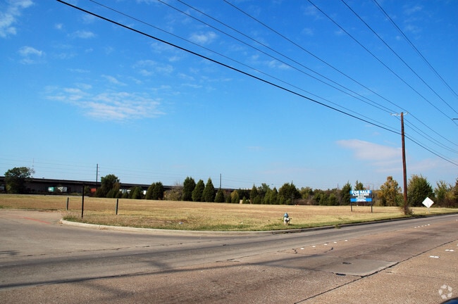
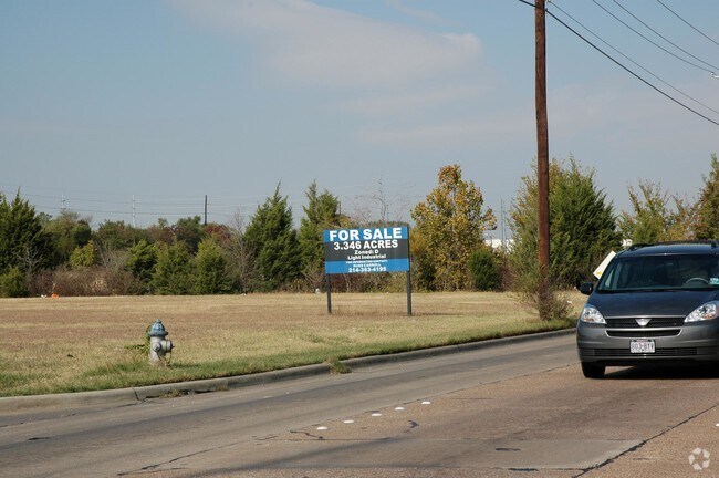
Property Record
1849 S Shiloh Rd, Garland, TX 75042

NEARBY LISTINGS FOR SALE OR LEASE
-
-
-
-
No Photo
-
-
-
-
View all Garland listings for sale on LoopNet.com
Property Detail
1849 S Shiloh Rd
Dallas-Fort Worth-Arlington, TX
R D Jones
65071577510010200
R D JONES ABST 715 PG 775 TR 1.2 ACS 3.346 INT200503598035 DD10282005 CO-DC 0715775100102 3CG07157751
Commercialacreage
Dallas
AE
Texas
48113C0220L
3.35 AC
2024
Garland
2025
Dallas/Ft Worth
018501
DEMOGRAPHICS near 1849 S Shiloh Rd
1 Mile
3 Mile
5 Mile
2024 Total Population
6,053
130,232
377,402
2029 Population
5,940
128,454
372,860
Pop Growth 2024-2029
(1.87%)
(1.37%)
(1.20%)
Average Age
37
36
37
2024 Total Households
1,996
42,825
133,963
HH Growth 2024-2029
(2.15%)
(1.59%)
(1.33%)
Median Household Inc
$68,685
$55,071
$59,615
Avg Household Size
3.00
2.90
2.70
2024 Avg HH Vehicles
2.00
2.00
2.00
Median Home Value
$182,655
$212,367
$247,829
Median Year Built
1957
1970
1976
Nearby Places
- Restaurants
- Banks
- Shops
- Fitness
- Groceries
PUBLIC TRANSPORTATION
AIRPORT
Dallas Love Field
DRIVE
WALK
Distance
Dallas Love Field
29 min
19.0 mi
Dallas-Fort Worth International
DRIVE
WALK
Distance
Dallas-Fort Worth International
36 min
27.9 mi
Nearby Properties
Address
Land Use
TOTAL SIZE
Lot Size
Zoning
Address
Land Use
TOTAL SIZE
Lot Size
Zoning
351,901 SF
11.84 AC
Z239
Address
Land Use
TOTAL SIZE
Lot Size
Zoning
181,854 SF
14.51 AC
Z239
Address
Land Use
TOTAL SIZE
Lot Size
Zoning
310,119 SF
9.65 AC
Z150
Address
Land Use
TOTAL SIZE
Lot Size
Zoning
491,903 SF
22.48 AC
Z164
Address
Land Use
TOTAL SIZE
Lot Size
Zoning
517,500 SF
29.97 AC
Z116
Address
Land Use
TOTAL SIZE
Lot Size
Zoning
922,851 SF
52.30 AC
Z144
Address
Land Use
TOTAL SIZE
Lot Size
Zoning
107,686 SF
30.09 AC
Z386
Address
Land Use
TOTAL SIZE
Lot Size
Zoning
480,000 SF
25.27 AC
Z239
Address
Land Use
TOTAL SIZE
Lot Size
Zoning
472,244 SF
25.25 AC
Z144
Address
Land Use
TOTAL SIZE
Lot Size
Zoning
292,827 SF
13.81 AC
Z163
Address
Land Use
TOTAL SIZE
Lot Size
Zoning
531,950 SF
24.62 AC
Z239
Address
Land Use
TOTAL SIZE
Lot Size
Zoning
922,851 SF
52.28 AC
Z144
Address
Land Use
TOTAL SIZE
Lot Size
Zoning
121,440 SF
17.02 AC
Z298
Address
Land Use
TOTAL SIZE
Lot Size
Zoning
333,298 SF
10.91 AC
Z149
Address
Land Use
TOTAL SIZE
Lot Size
Zoning
265,986 SF
13.75 AC
Z163
Address
Land Use
TOTAL SIZE
Lot Size
Zoning
468,220 SF
20.60 AC
Z144
Address
Land Use
TOTAL SIZE
Lot Size
Zoning
270,114 SF
8.50 AC
Z150
Address
Land Use
TOTAL SIZE
Lot Size
Zoning
278,856 SF
9.57 AC
Z150
Address
Land Use
TOTAL SIZE
Lot Size
Zoning
187,440 SF
1.68 AC
Z25
Address
Land Use
TOTAL SIZE
Lot Size
Zoning
220,989 SF
12.94 AC
Z163
Address
Land Use
TOTAL SIZE
Lot Size
Zoning
435,179 SF
20.20 AC
Z144
Address
Land Use
TOTAL SIZE
Lot Size
Zoning
297,704 SF
13.74 AC
Z163
Address
Land Use
TOTAL SIZE
Lot Size
Zoning
256,584 SF
9.37 AC
Z164
Address
Land Use
TOTAL SIZE
Lot Size
Zoning
420,200 SF
34.75 AC
Z144
Address
Land Use
TOTAL SIZE
Lot Size
Zoning
382,000 SF
20.11 AC
Address
Land Use
TOTAL SIZE
Lot Size
Zoning
269,516 SF
13 AC
Z163
Address
Land Use
TOTAL SIZE
Lot Size
Zoning
392,736 SF
19.58 AC
Z144
Address
Land Use
TOTAL SIZE
Lot Size
Zoning
327,600 SF
17.70 AC
Z144
Address
Land Use
TOTAL SIZE
Lot Size
Zoning
240,756 SF
12.50 AC
Z160
Address
Land Use
TOTAL SIZE
Lot Size
Zoning
870,902 SF
53.53 AC
Z144
The World's #1 Commercial Real Estate Marketplace
Connect with us
© 2025 CoStar Group
The information above has been obtained from sources believed reliable. While we do not doubt its accuracy we have not verified it and make no guarantee, warranty or representation about it. It is your responsibility to independently confirm its accuracy and completeness. Any projections, opinions, assumptions, or estimates used are for example only and do not represent the current or future performance of the property. The value of this transaction to you depends on tax and other factors which should be evaluated by your tax, financial, and legal advisors. You and your advisors should conduct a careful, independent investigation of the property to determine to your satisfaction the suitability of the property for your needs.