Property Record
185 Anchors Way, Saint Joseph, MI 49085

NEARBY LISTINGS FOR SALE OR LEASE
Property Detail
185 Anchors Way
11-76-0105-0014-00-0
SPLIT/COMBINED ON 05/19/2020 FROM 76-0024-0025-01-7; UNIT 17 185 ANCHORS WAY CONDOMINIUM LIBER 305 PAGE 1
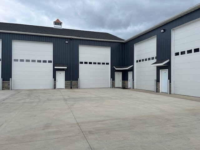
Warehouse
Berrien
AE
Michigan
26021C0101D
1.44 AC
2024
Michigan Southwest Area
2025
Other Market Areas
000802
Niles-Benton Harbor, MI
1,352 SF
DEMOGRAPHICS near 185 Anchors Way
1 Mile
3 Mile
5 Mile
2024 Total Population
6,253
29,724
44,417
2029 Population
6,242
29,350
43,660
Pop Growth 2024-2029
(0.18%)
(1.26%)
(1.70%)
Average Age
41
40
40
2024 Total Households
2,872
12,646
18,629
HH Growth 2024-2029
(0.77%)
(1.85%)
(2.13%)
Median Household Inc
$51,952
$40,733
$48,281
Avg Household Size
2.10
2.30
2.30
2024 Avg HH Vehicles
1.00
1.00
2.00
Median Home Value
$244,012
$172,650
$194,186
Median Year Built
1952
1958
1963
Nearby Places
Map Layers
Map Styles
 Street
 Aerial
- Restaurants
- Banks
- Shops
- Fitness
- Groceries
PUBLIC TRANSPORTATION
COMMUTER RAIL
St. Joseph-Benton Harbor Amtrak Station (Pere Marquette - Amtrak)
DRIVE
WALK
Distance
St. Joseph-Benton Harbor Amtrak Station (Pere Marquette - Amtrak)
4 min
19 min
1.0 mi
AIRPORT
South Bend International
DRIVE
WALK
Distance
South Bend International
53 min
38.2 mi
Freight Ports
Port Milwaukee
DRIVE
WALK
Distance
Port Milwaukee
222 min
182.0 mi
SALE & LEASE HISTORY
LISTING DATE
SALE/LEASE

Nov 07, 2024
For Sale
Nearby Properties
Address
Land Use
TOTAL SIZE
Lot Size
Zoning
Address
Land Use
TOTAL SIZE
Lot Size
Zoning
313,588 SF
11.48 AC
DISTRICT A
Address
Land Use
TOTAL SIZE
Lot Size
Zoning
216,232 SF
Address
Land Use
TOTAL SIZE
Lot Size
Zoning
Address
Land Use
TOTAL SIZE
Lot Size
Zoning
125,408 SF
4.66 AC
R-3
Address
Land Use
TOTAL SIZE
Lot Size
Zoning
89,062 SF
1.60 AC
W
Address
Land Use
TOTAL SIZE
Lot Size
Zoning
99,468 SF
10.07 AC
DISTRICT G
Address
Land Use
TOTAL SIZE
Lot Size
Zoning
87,978 SF
4.36 AC
R2 MDR
Address
Land Use
TOTAL SIZE
Lot Size
Zoning
73,680 SF
CO-A
Address
Land Use
TOTAL SIZE
Lot Size
Zoning
202,713 SF
14.23 AC
CO-A
Address
Land Use
TOTAL SIZE
Lot Size
Zoning
296,788 SF
34 AC
D1 COMM
Address
Land Use
TOTAL SIZE
Lot Size
Zoning
30,889 SF
2.83 AC
CO-A
Address
Land Use
TOTAL SIZE
Lot Size
Zoning
258,549 SF
17.20 AC
C MULTI
Address
Land Use
TOTAL SIZE
Lot Size
Zoning
53,504 SF
Address
Land Use
TOTAL SIZE
Lot Size
Zoning
69,750 SF
0.47 AC
D
Address
Land Use
TOTAL SIZE
Lot Size
Zoning
112,503 SF
4.30 AC
C MULTI FA
Address
Land Use
TOTAL SIZE
Lot Size
Zoning
86,000 SF
22.38 AC
D1 COMM
Address
Land Use
TOTAL SIZE
Lot Size
Zoning
28,312 SF
4.30 AC
C
Address
Land Use
TOTAL SIZE
Lot Size
Zoning
93,032 SF
0.51 AC
D
Address
Land Use
TOTAL SIZE
Lot Size
Zoning
75,050 SF
5.33 AC
NONE
Address
Land Use
TOTAL SIZE
Lot Size
Zoning
126,127 SF
11.84 AC
D1 COMM
Address
Land Use
TOTAL SIZE
Lot Size
Zoning
82,567 SF
1.74 AC
D
Address
Land Use
TOTAL SIZE
Lot Size
Zoning
90,000 SF
7.62 AC
W
Address
Land Use
TOTAL SIZE
Lot Size
Zoning
519,203 SF
25.57 AC
C
Address
Land Use
TOTAL SIZE
Lot Size
Zoning
65,584 SF
6.52 AC
CO-A
Address
Land Use
TOTAL SIZE
Lot Size
Zoning
84,732 SF
4.19 AC
C MULTI FA
Address
Land Use
TOTAL SIZE
Lot Size
Zoning
40,063 SF
9.78 AC
DISTRICT G
Address
Land Use
TOTAL SIZE
Lot Size
Zoning
25,080 SF
I-1
Address
Land Use
TOTAL SIZE
Lot Size
Zoning
70,617 SF
12 AC
E RESTRICT
Address
Land Use
TOTAL SIZE
Lot Size
Zoning
103,591 SF
8.77 AC
D1 COMM
Address
Land Use
TOTAL SIZE
Lot Size
Zoning
69,484 SF
8.08 AC
C MULTI
The World's #1 Commercial Real Estate Marketplace
Connect with us
© 2025 CoStar Group
The information above has been obtained from sources believed reliable. While we do not doubt its accuracy we have not verified it and make no guarantee, warranty or representation about it. It is your responsibility to independently confirm its accuracy and completeness. Any projections, opinions, assumptions, or estimates used are for example only and do not represent the current or future performance of the property. The value of this transaction to you depends on tax and other factors which should be evaluated by your tax, financial, and legal advisors. You and your advisors should conduct a careful, independent investigation of the property to determine to your satisfaction the suitability of the property for your needs.