Property Record
185 E Paulding Dr, Dallas, GA 30157
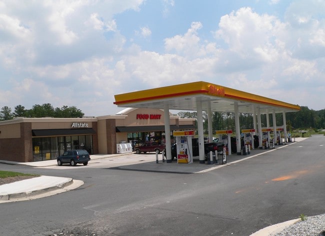

Property Detail
185 E Paulding Dr
106.1.2.049.0000
REAL PROPERTY
Storebuilding
Paulding
B2
Georgia
B and X Area of moderate flood hazard, usually the area between the limits of the 100-year and 500-year floods.
1250
2025
1.22 AC
2025
Paulding Cnty/Dallas
120203
Atlanta
7,600 SF
Atlanta-Sandy Springs-Roswell, GA
NEARBY LISTINGS FOR SALE OR LEASE
DEMOGRAPHICS near 185 E Paulding Dr
1 mile
3 mile
5 mile
2025 Total Population
4,049
34,221
98,714
2030 Population
4,463
37,764
107,551
Pop Growth 2025-2030
+ 10.22%
+ 10.35%
+ 8.95%
Average Age
38
38
38
2025 Total Households
1,347
11,312
33,144
HH Growth 2025-2030
+ 10.17%
+ 10.43%
+ 9.08%
Median Household Inc
$106,721
$116,845
$112,521
Avg Household Size
3.00
3.00
2.90
2025 Avg HH Vehicles
2.00
2.00
2.00
Median Home Value
$322,222
$350,739
$376,400
Median Year Built
2001
2003
2001
Nearby Places
Map Layers
Map Styles
 Street
 Aerial
Transit
 Traffic
 Biking
Places
Listings with unknown addresses are not visible on the map
- Restaurants
- Banks
- Shops
- Fitness
- Groceries
PUBLIC TRANSPORTATION
AIRPORT
Hartsfield - Jackson Atlanta International
Drive
Walk
Distance
Hartsfield - Jackson Atlanta International
63 min
41.5 mi
SALE & LEASE HISTORY
LISTING DATE
SALE/LEASE

Aug 31, 2018
For Lease
Nearby Properties
Address
Land Use
TOTAL SIZE
Lot Size
Zoning
Address
Land Use
TOTAL SIZE
Lot Size
Zoning
46.05 AC
Address
Land Use
TOTAL SIZE
Lot Size
Zoning
126,638 SF
20.26 AC
R4
Address
Land Use
TOTAL SIZE
Lot Size
Zoning
37.28 AC
Address
Land Use
TOTAL SIZE
Lot Size
Zoning
41.85 AC
Address
Land Use
TOTAL SIZE
Lot Size
Zoning
19.14 AC
Address
Land Use
TOTAL SIZE
Lot Size
Zoning
Address
Land Use
TOTAL SIZE
Lot Size
Zoning
18.44 AC
Address
Land Use
TOTAL SIZE
Lot Size
Zoning
151,906 SF
21.07 AC
B2
Address
Land Use
TOTAL SIZE
Lot Size
Zoning
Address
Land Use
TOTAL SIZE
Lot Size
Zoning
80,738 SF
10.30 AC
B2
Address
Land Use
TOTAL SIZE
Lot Size
Zoning
74,036 SF
23.20 AC
B2
Address
Land Use
TOTAL SIZE
Lot Size
Zoning
128.92 AC
Address
Land Use
TOTAL SIZE
Lot Size
Zoning
7.37 AC
Address
Land Use
TOTAL SIZE
Lot Size
Zoning
151.43 AC
Address
Land Use
TOTAL SIZE
Lot Size
Zoning
4,838 SF
3.42 AC
Address
Land Use
TOTAL SIZE
Lot Size
Zoning
80,476 SF
23.36 AC
B2
Address
Land Use
TOTAL SIZE
Lot Size
Zoning
22,974 SF
3.61 AC
B1
Address
Land Use
TOTAL SIZE
Lot Size
Zoning
Address
Land Use
TOTAL SIZE
Lot Size
Zoning
22,270 SF
2.18 AC
B2
Address
Land Use
TOTAL SIZE
Lot Size
Zoning
20,324 SF
1.82 AC
B2
Address
Land Use
TOTAL SIZE
Lot Size
Zoning
43,095 SF
2.18 AC
B2
Address
Land Use
TOTAL SIZE
Lot Size
Zoning
766.99 AC
Address
Land Use
TOTAL SIZE
Lot Size
Zoning
6.58 AC
Address
Land Use
TOTAL SIZE
Lot Size
Zoning
12.51 AC
Address
Land Use
TOTAL SIZE
Lot Size
Zoning
12,958 SF
19.27 AC
B2
Address
Land Use
TOTAL SIZE
Lot Size
Zoning
14,494 SF
1.57 AC
B2
Address
Land Use
TOTAL SIZE
Lot Size
Zoning
36,635 SF
28.28 AC
B2
Address
Land Use
TOTAL SIZE
Lot Size
Zoning
62,232 SF
2.02 AC
B2
Address
Land Use
TOTAL SIZE
Lot Size
Zoning
5.30 AC
Address
Land Use
TOTAL SIZE
Lot Size
Zoning
140,120 SF
9.15 AC
I1
The World's #1 Commercial Real Estate Marketplace
Connect with us
© 2026 CoStar Group
The information above has been obtained from sources believed reliable. While we do not doubt its accuracy we have not verified it and make no guarantee, warranty or representation about it. It is your responsibility to independently confirm its accuracy and completeness. Any projections, opinions, assumptions, or estimates used are for example only and do not represent the current or future performance of the property. The value of this transaction to you depends on tax and other factors which should be evaluated by your tax, financial, and legal advisors. You and your advisors should conduct a careful, independent investigation of the property to determine to your satisfaction the suitability of the property for your needs.