Property Record
185 Reflection Pointe Cir, Asheville, NC 28806
NEARBY LISTINGS FOR SALE OR LEASE
-
-
View all Asheville listings for sale on LoopNet.com
Property Detail
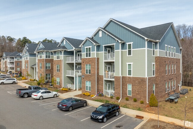
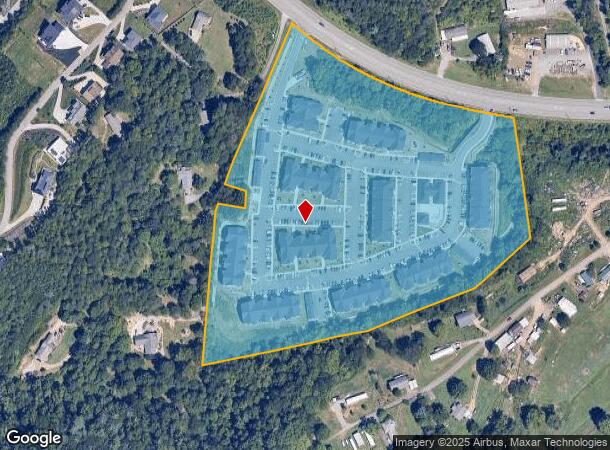
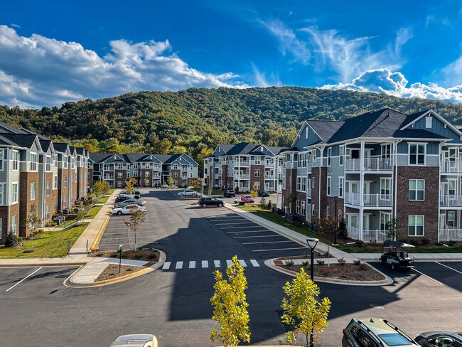
185 Reflection Pointe Cir
Asheville, NC
Louise B Buckner
9619-67-7431-00000
LOT: 1 - 3 PLAT: 0060-0165
Apartment
Buncombe
AE
North Carolina
3700961900J
1-3
2024
16.84 AC
2025
West Asheville
002608
Asheville
100,240 SF
DEMOGRAPHICS near 185 Reflection Pointe Cir
1 Mile
3 Mile
5 Mile
2024 Total Population
3,915
25,144
76,859
2029 Population
4,053
25,877
79,003
Pop Growth 2024-2029
+ 3.52%
+ 2.92%
+ 2.79%
Average Age
40
40
40
2024 Total Households
1,700
10,374
31,687
HH Growth 2024-2029
+ 3.41%
+ 2.63%
+ 2.52%
Median Household Inc
$62,160
$60,008
$69,452
Avg Household Size
2.30
2.30
2.30
2024 Avg HH Vehicles
2.00
2.00
2.00
Median Home Value
$348,139
$344,896
$401,240
Median Year Built
1998
1988
1984
Nearby Places
Map Layers
Map Styles
 Street
 Aerial
- Restaurants
- Banks
- Shops
- Fitness
- Groceries
PUBLIC TRANSPORTATION
AIRPORT
Asheville Regional
DRIVE
WALK
Distance
Asheville Regional
26 min
16.9 mi
Freight Ports
North Charleston Terminal
DRIVE
WALK
Distance
North Charleston Terminal
297 min
260.6 mi
Nearby Properties
Address
Land Use
TOTAL SIZE
Lot Size
Zoning
Address
Land Use
TOTAL SIZE
Lot Size
Zoning
285,416 SF
98.33 AC
PS
Address
Land Use
TOTAL SIZE
Lot Size
Zoning
311,958 SF
33.93 AC
OU
Address
Land Use
TOTAL SIZE
Lot Size
Zoning
106,436 SF
22.02 AC
PS
Address
Land Use
TOTAL SIZE
Lot Size
Zoning
97,263 SF
17.50 AC
INST
Address
Land Use
TOTAL SIZE
Lot Size
Zoning
72,413 SF
18.25 AC
RM16
Address
Land Use
TOTAL SIZE
Lot Size
Zoning
55,153 SF
13.39 AC
RM16
Address
Land Use
TOTAL SIZE
Lot Size
Zoning
145,519 SF
10.75 AC
R-2
Address
Land Use
TOTAL SIZE
Lot Size
Zoning
87,857 SF
90.07 AC
INST
Address
Land Use
TOTAL SIZE
Lot Size
Zoning
96,028 SF
38.50 AC
PS
Address
Land Use
TOTAL SIZE
Lot Size
Zoning
34,297 SF
5.31 AC
INST
Address
Land Use
TOTAL SIZE
Lot Size
Zoning
16,129 SF
61.10 AC
PS
Address
Land Use
TOTAL SIZE
Lot Size
Zoning
82,502 SF
8.77 AC
CS
Address
Land Use
TOTAL SIZE
Lot Size
Zoning
78,528 SF
10.38 AC
CS
Address
Land Use
TOTAL SIZE
Lot Size
Zoning
16,036 SF
3.89 AC
RM16
Address
Land Use
TOTAL SIZE
Lot Size
Zoning
136,510 SF
19.07 AC
CI
Address
Land Use
TOTAL SIZE
Lot Size
Zoning
26,752 SF
4.15 AC
R-2
Address
Land Use
TOTAL SIZE
Lot Size
Zoning
18,418 SF
28.50 AC
R-21
Address
Land Use
TOTAL SIZE
Lot Size
Zoning
80,538 SF
19.73 AC
CI
Address
Land Use
TOTAL SIZE
Lot Size
Zoning
11,198 SF
3.33 AC
PS
Address
Land Use
TOTAL SIZE
Lot Size
Zoning
16,389 SF
4.18 AC
PS
Address
Land Use
TOTAL SIZE
Lot Size
Zoning
33,428 SF
3.42 AC
HB
Address
Land Use
TOTAL SIZE
Lot Size
Zoning
131,534 SF
5.40 AC
CI
Address
Land Use
TOTAL SIZE
Lot Size
Zoning
56,654 SF
4.62 AC
CS
Address
Land Use
TOTAL SIZE
Lot Size
Zoning
8,978 SF
4.80 AC
PS
Address
Land Use
TOTAL SIZE
Lot Size
Zoning
82,412 SF
20.69 AC
RES EXP
Address
Land Use
TOTAL SIZE
Lot Size
Zoning
26,973 SF
6.91 AC
OU
Address
Land Use
TOTAL SIZE
Lot Size
Zoning
64,546 SF
5.99 AC
CI
Address
Land Use
TOTAL SIZE
Lot Size
Zoning
14,406 SF
2.80 AC
CS
Address
Land Use
TOTAL SIZE
Lot Size
Zoning
15,862 SF
24.26 AC
R-2
The World's #1 Commercial Real Estate Marketplace
Connect with us
© 2025 CoStar Group
The information above has been obtained from sources believed reliable. While we do not doubt its accuracy we have not verified it and make no guarantee, warranty or representation about it. It is your responsibility to independently confirm its accuracy and completeness. Any projections, opinions, assumptions, or estimates used are for example only and do not represent the current or future performance of the property. The value of this transaction to you depends on tax and other factors which should be evaluated by your tax, financial, and legal advisors. You and your advisors should conduct a careful, independent investigation of the property to determine to your satisfaction the suitability of the property for your needs.