Property Record
185 Southside Industrial Pky Se, Atlanta, GA 30354


NEARBY LISTINGS FOR SALE OR LEASE
Property Detail
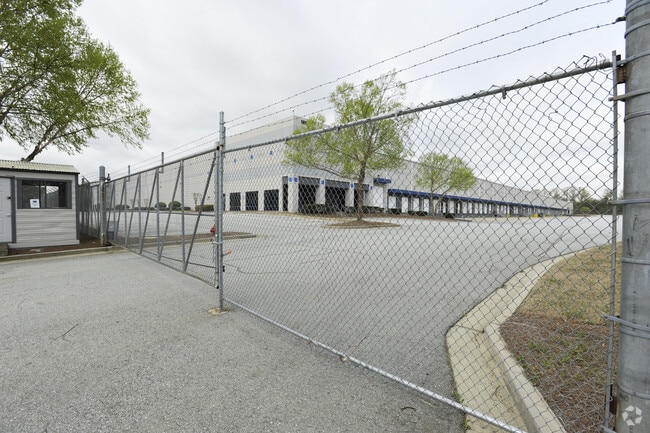
185 Southside Industrial Pky Se
14-0064-0003-172-8
KA CRANE WW LOGIS F/C 2/22
Warehouse
Fulton
X
Georgia
13063C0019F
28.39 AC
2024
Airport/North Clayton
2025
Atlanta
007200
Atlanta-Sandy Springs-Roswell, GA
474,830 SF
DEMOGRAPHICS near 185 Southside Industrial Pky Se
1 Mile
3 Mile
5 Mile
2024 Total Population
1,612
47,731
157,242
2029 Population
1,660
48,943
160,856
Pop Growth 2024-2029
+ 2.98%
+ 2.54%
+ 2.30%
Average Age
36
36
36
2024 Total Households
537
17,524
59,820
HH Growth 2024-2029
+ 2.61%
+ 2.69%
+ 2.49%
Median Household Inc
$39,515
$41,178
$43,972
Avg Household Size
2.70
2.60
2.50
2024 Avg HH Vehicles
1.00
1.00
1.00
Median Home Value
$157,894
$150,306
$182,887
Median Year Built
1968
1971
1974
Nearby Places
Map Layers
Map Styles
 Street
 Aerial
- Restaurants
- Banks
- Shops
- Fitness
- Groceries
PUBLIC TRANSPORTATION
AIRPORT
Hartsfield - Jackson Atlanta International
DRIVE
WALK
Distance
Hartsfield - Jackson Atlanta International
9 min
3.3 mi
Nearby Properties
Address
Land Use
TOTAL SIZE
Lot Size
Zoning
Address
Land Use
TOTAL SIZE
Lot Size
Zoning
116,750 SF
997.24 AC
HI
Address
Land Use
TOTAL SIZE
Lot Size
Zoning
63,992 SF
174.80 AC
HI
Address
Land Use
TOTAL SIZE
Lot Size
Zoning
200,000 SF
34.20 AC
HI
Address
Land Use
TOTAL SIZE
Lot Size
Zoning
318.25 AC
HI
Address
Land Use
TOTAL SIZE
Lot Size
Zoning
274.75 AC
HI
Address
Land Use
TOTAL SIZE
Lot Size
Zoning
965,840 SF
1.50 AC
C
Address
Land Use
TOTAL SIZE
Lot Size
Zoning
65,458 SF
174.39 AC
C1
Address
Land Use
TOTAL SIZE
Lot Size
Zoning
1,113,792 SF
3.68 AC
CR
Address
Land Use
TOTAL SIZE
Lot Size
Zoning
54 AC
I2
Address
Land Use
TOTAL SIZE
Lot Size
Zoning
368,274 SF
171.85 AC
I1
Address
Land Use
TOTAL SIZE
Lot Size
Zoning
386,354 SF
10.03 AC
CR
Address
Land Use
TOTAL SIZE
Lot Size
Zoning
113,364 SF
2.19 AC
I
Address
Land Use
TOTAL SIZE
Lot Size
Zoning
105.66 AC
HI
Address
Land Use
TOTAL SIZE
Lot Size
Zoning
513,124 SF
19.05 AC
I2
Address
Land Use
TOTAL SIZE
Lot Size
Zoning
278,866 SF
7.59 AC
CR
Address
Land Use
TOTAL SIZE
Lot Size
Zoning
298,264 SF
0.90 AC
C
Address
Land Use
TOTAL SIZE
Lot Size
Zoning
165,096 SF
137.54 AC
M1
Address
Land Use
TOTAL SIZE
Lot Size
Zoning
210,538 SF
101.40 AC
X
Address
Land Use
TOTAL SIZE
Lot Size
Zoning
382,918 SF
13.04 AC
CR
Address
Land Use
TOTAL SIZE
Lot Size
Zoning
668,070 SF
0.49 AC
C1
Address
Land Use
TOTAL SIZE
Lot Size
Zoning
265,437 SF
4.74 AC
CL
Address
Land Use
TOTAL SIZE
Lot Size
Zoning
1,254,472 SF
0.49 AC
C1
Address
Land Use
TOTAL SIZE
Lot Size
Zoning
96,028 SF
21.02 AC
I
Address
Land Use
TOTAL SIZE
Lot Size
Zoning
193,760 SF
14.46 AC
CR
Address
Land Use
TOTAL SIZE
Lot Size
Zoning
298,674 SF
14.35 AC
I
Address
Land Use
TOTAL SIZE
Lot Size
Zoning
59,807 SF
43.70 AC
X
Address
Land Use
TOTAL SIZE
Lot Size
Zoning
508,896 SF
0.15 AC
CR
Address
Land Use
TOTAL SIZE
Lot Size
Zoning
123,747 SF
3.98 AC
Address
Land Use
TOTAL SIZE
Lot Size
Zoning
12 AC
R4
Address
Land Use
TOTAL SIZE
Lot Size
Zoning
45.64 AC
HI
The World's #1 Commercial Real Estate Marketplace
Connect with us
© 2025 CoStar Group
The information above has been obtained from sources believed reliable. While we do not doubt its accuracy we have not verified it and make no guarantee, warranty or representation about it. It is your responsibility to independently confirm its accuracy and completeness. Any projections, opinions, assumptions, or estimates used are for example only and do not represent the current or future performance of the property. The value of this transaction to you depends on tax and other factors which should be evaluated by your tax, financial, and legal advisors. You and your advisors should conduct a careful, independent investigation of the property to determine to your satisfaction the suitability of the property for your needs.