Property Record
1850 Apple Valley Dr, Augusta, GA 30906


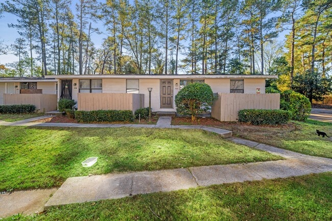

Property Detail
1850 Apple Valley Dr
1341120000
1850 APPLE VALLEY DR
Commercialacreage
Richmond
B-2
Georgia
B and X Area of moderate flood hazard, usually the area between the limits of the 100-year and 500-year floods.
4.89 AC
2025
Southside
2025
Augusta/Richmond County
010511
Augusta-Richmond County, GA-SC
4,608 SF
NEARBY LISTINGS FOR SALE OR LEASE
-
-
View all Augusta listings for sale on LoopNet.com
DEMOGRAPHICS near 1850 Apple Valley Dr
1 mile
3 mile
5 mile
2025 Total Population
4,279
27,482
79,436
2030 Population
4,215
27,225
79,149
Pop Growth 2025-2030
(1.50%)
(0.94%)
(0.36%)
Average Age
38
38
39
2025 Total Households
1,268
10,307
30,665
HH Growth 2025-2030
(1.89%)
(0.85%)
(0.13%)
Median Household Inc
$36,128
$42,328
$44,598
Avg Household Size
2.70
2.50
2.50
2025 Avg HH Vehicles
2.00
2.00
2.00
Median Home Value
$95,364
$139,254
$152,825
Median Year Built
1965
1971
1973
Nearby Places
Map Layers
Map Styles
 Street
 Aerial
Layers
 Traffic
 Biking
Places
Listings with unknown addresses are not visible on the map
- Restaurants
- Banks
- Shops
- Fitness
- Groceries
PUBLIC TRANSPORTATION
AIRPORT
Augusta Regional at Bush Field
Drive
Walk
Distance
Augusta Regional at Bush Field
11 min
3.9 mi
SALE & LEASE HISTORY
LISTING DATE
SALE/LEASE

Jul 27, 2017
For Sale
Nearby Properties
Address
Land Use
TOTAL SIZE
Lot Size
Zoning
Address
Land Use
TOTAL SIZE
Lot Size
Zoning
297,455 SF
45.93 AC
A
Address
Land Use
TOTAL SIZE
Lot Size
Zoning
1,428 SF
75.91 AC
R-1A
Address
Land Use
TOTAL SIZE
Lot Size
Zoning
78,943 SF
1,319.60 AC
HI
Address
Land Use
TOTAL SIZE
Lot Size
Zoning
193,026 SF
97.24 AC
R-1
Address
Land Use
TOTAL SIZE
Lot Size
Zoning
39,200 SF
310.85 AC
A_R-1A
Address
Land Use
TOTAL SIZE
Lot Size
Zoning
99,046 SF
29.96 AC
R-1A
Address
Land Use
TOTAL SIZE
Lot Size
Zoning
87,976 SF
765.88 AC
R-1
Address
Land Use
TOTAL SIZE
Lot Size
Zoning
241,284 SF
20.61 AC
R-1A
Address
Land Use
TOTAL SIZE
Lot Size
Zoning
449,636 SF
31.57 AC
Address
Land Use
TOTAL SIZE
Lot Size
Zoning
225,664 SF
57.13 AC
LI
Address
Land Use
TOTAL SIZE
Lot Size
Zoning
3,387 SF
16.91 AC
B-2
Address
Land Use
TOTAL SIZE
Lot Size
Zoning
56,631 SF
11.62 AC
R-1A, B-2
Address
Land Use
TOTAL SIZE
Lot Size
Zoning
552,852 SF
215.52 AC
A_HI
Address
Land Use
TOTAL SIZE
Lot Size
Zoning
4,507 SF
56.06 AC
HI
Address
Land Use
TOTAL SIZE
Lot Size
Zoning
14,850 SF
132.49 AC
A,R
Address
Land Use
TOTAL SIZE
Lot Size
Zoning
18,000 SF
27.80 AC
B-2
Address
Land Use
TOTAL SIZE
Lot Size
Zoning
38,412 SF
22.51 AC
R-1A
Address
Land Use
TOTAL SIZE
Lot Size
Zoning
24,304 SF
11 AC
R-1A
Address
Land Use
TOTAL SIZE
Lot Size
Zoning
403,560 SF
27.99 AC
HI_LI
Address
Land Use
TOTAL SIZE
Lot Size
Zoning
16,790 SF
22.07 AC
B-2
Address
Land Use
TOTAL SIZE
Lot Size
Zoning
70,251 SF
9.17 AC
R-1B
Address
Land Use
TOTAL SIZE
Lot Size
Zoning
29,952 SF
13.76 AC
R-3B_B-2
Address
Land Use
TOTAL SIZE
Lot Size
Zoning
136,260 SF
14.42 AC
LI_R-1
Address
Land Use
TOTAL SIZE
Lot Size
Zoning
57,408 SF
7.20 AC
R-3B
Address
Land Use
TOTAL SIZE
Lot Size
Zoning
128,882 SF
21.09 AC
B-2
Address
Land Use
TOTAL SIZE
Lot Size
Zoning
403,560 SF
27.99 AC
HI_LI
Address
Land Use
TOTAL SIZE
Lot Size
Zoning
298,532 SF
20.39 AC
HI
Address
Land Use
TOTAL SIZE
Lot Size
Zoning
78,454 SF
10.63 AC
B-2
Address
Land Use
TOTAL SIZE
Lot Size
Zoning
443,388 SF
38.88 AC
HI
Address
Land Use
TOTAL SIZE
Lot Size
Zoning
107,996 SF
9.91 AC
R-3B
The World's #1 Commercial Real Estate Marketplace
Connect with us
© 2026 CoStar Group
The information above has been obtained from sources believed reliable. While we do not doubt its accuracy we have not verified it and make no guarantee, warranty or representation about it. It is your responsibility to independently confirm its accuracy and completeness. Any projections, opinions, assumptions, or estimates used are for example only and do not represent the current or future performance of the property. The value of this transaction to you depends on tax and other factors which should be evaluated by your tax, financial, and legal advisors. You and your advisors should conduct a careful, independent investigation of the property to determine to your satisfaction the suitability of the property for your needs.