Property Record
1850 Bataan Memorial E, Las Cruces, NM 88011


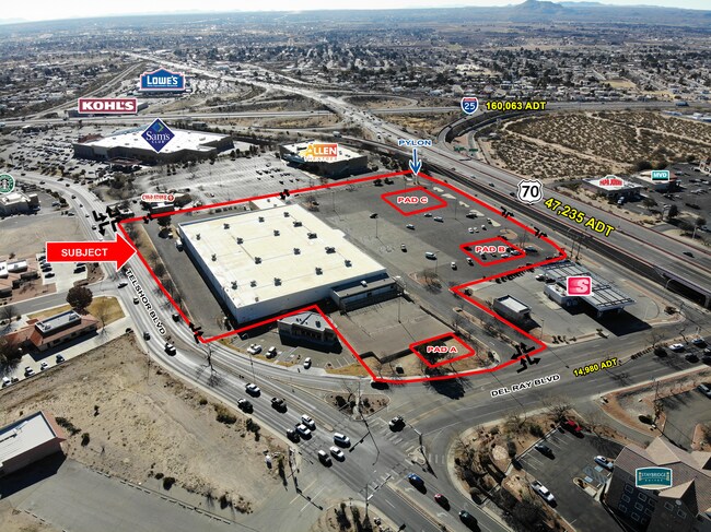
Property Detail
1850 Bataan Memorial E
02-21185
SUBD: COOGAN - GREER SUBDIVISION NO 2 REPLAT NO 1 (BK 17 PG 214-215 - 9214974) LOT: PC 1-A S: 32 T: 22S R: 2E
Commercialacreage
DONA ANA
C2
New Mexico
B and X Area of moderate flood hazard, usually the area between the limits of the 100-year and 500-year floods.
1-a
2025
9.37 AC
2025
Las Cruces/Alamogordo
001206
Other Market Areas
95,071 SF
Las Cruces, NM
NEARBY LISTINGS FOR SALE OR LEASE
DEMOGRAPHICS near 1850 Bataan Memorial E
1 mile
3 mile
5 mile
2025 Total Population
8,597
69,492
131,172
2030 Population
8,976
72,814
137,189
Pop Growth 2025-2030
+ 4.41%
+ 4.78%
+ 4.59%
Average Age
40
40
39
2025 Total Households
3,666
28,151
52,359
HH Growth 2025-2030
+ 4.53%
+ 4.93%
+ 4.69%
Median Household Inc
$63,977
$57,859
$56,432
Avg Household Size
2.30
2.40
2.40
2025 Avg HH Vehicles
2.00
2.00
2.00
Median Home Value
$246,261
$248,274
$241,775
Median Year Built
1994
1994
1990
Nearby Places
Map Layers
Map Styles
 Street
 Aerial
Layers
 Traffic
 Biking
Places
Listings with unknown addresses are not visible on the map
- Restaurants
- Banks
- Shops
- Fitness
- Groceries
SALE & LEASE HISTORY
LISTING DATE
SALE/LEASE

Mar 01, 2022
For Lease
Jul 20, 2017
For Lease
Nearby Properties
Address
Land Use
TOTAL SIZE
Lot Size
Zoning
Address
Land Use
TOTAL SIZE
Lot Size
Zoning
266,671 SF
23.96 AC
PUD
Address
Land Use
TOTAL SIZE
Lot Size
Zoning
106,866 SF
10.61 AC
R1
Address
Land Use
TOTAL SIZE
Lot Size
Zoning
280,731 SF
15.55 AC
PUD
Address
Land Use
TOTAL SIZE
Lot Size
Zoning
29,466 SF
1.33 AC
C2
Address
Land Use
TOTAL SIZE
Lot Size
Zoning
78,452 SF
60 AC
A2
Address
Land Use
TOTAL SIZE
Lot Size
Zoning
66,410 SF
7 AC
PUD
Address
Land Use
TOTAL SIZE
Lot Size
Zoning
6,232 SF
22.74 AC
C2
Address
Land Use
TOTAL SIZE
Lot Size
Zoning
154,592 SF
14.12 AC
A2
Address
Land Use
TOTAL SIZE
Lot Size
Zoning
170,972 SF
16.38 AC
R4
Address
Land Use
TOTAL SIZE
Lot Size
Zoning
195,560 SF
25.05 AC
PUD
Address
Land Use
TOTAL SIZE
Lot Size
Zoning
135,605 SF
6 AC
PUD
Address
Land Use
TOTAL SIZE
Lot Size
Zoning
98,015 SF
7.85 AC
A1
Address
Land Use
TOTAL SIZE
Lot Size
Zoning
394,043 SF
26.74 AC
C2
Address
Land Use
TOTAL SIZE
Lot Size
Zoning
139,122 SF
6.12 AC
C2
Address
Land Use
TOTAL SIZE
Lot Size
Zoning
49,295 SF
6.29 AC
R3
Address
Land Use
TOTAL SIZE
Lot Size
Zoning
7,483 SF
16.15 AC
PUD
Address
Land Use
TOTAL SIZE
Lot Size
Zoning
65,535 SF
5.64 AC
R1
Address
Land Use
TOTAL SIZE
Lot Size
Zoning
14.47 AC
R4
Address
Land Use
TOTAL SIZE
Lot Size
Zoning
78,845 SF
14.81 AC
A2
Address
Land Use
TOTAL SIZE
Lot Size
Zoning
132,179 SF
14.24 AC
M1
Address
Land Use
TOTAL SIZE
Lot Size
Zoning
42,295 SF
7.45 AC
C2
Address
Land Use
TOTAL SIZE
Lot Size
Zoning
44,506 SF
C2
Address
Land Use
TOTAL SIZE
Lot Size
Zoning
119,985 SF
6 AC
R1
Address
Land Use
TOTAL SIZE
Lot Size
Zoning
136,629 SF
15.78 AC
C2
Address
Land Use
TOTAL SIZE
Lot Size
Zoning
79,362 SF
5.90 AC
C2
Address
Land Use
TOTAL SIZE
Lot Size
Zoning
62,645 SF
5.50 AC
R3
Address
Land Use
TOTAL SIZE
Lot Size
Zoning
17,812 SF
2.65 AC
CBD
Address
Land Use
TOTAL SIZE
Lot Size
Zoning
136,377 SF
42.51 AC
A2
Address
Land Use
TOTAL SIZE
Lot Size
Zoning
102,505 SF
6.44 AC
PUD
The World's #1 Commercial Real Estate Marketplace
Connect with us
© 2026 CoStar Group
The information above has been obtained from sources believed reliable. While we do not doubt its accuracy we have not verified it and make no guarantee, warranty or representation about it. It is your responsibility to independently confirm its accuracy and completeness. Any projections, opinions, assumptions, or estimates used are for example only and do not represent the current or future performance of the property. The value of this transaction to you depends on tax and other factors which should be evaluated by your tax, financial, and legal advisors. You and your advisors should conduct a careful, independent investigation of the property to determine to your satisfaction the suitability of the property for your needs.