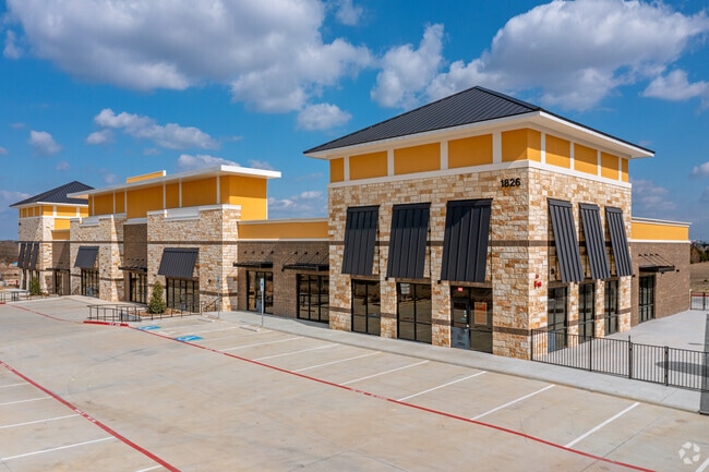
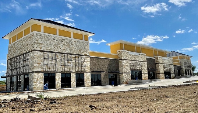
Property Record
1850 Cannon Dr, Mansfield, TX 76063


NEARBY LISTINGS FOR SALE OR LEASE
Property Detail
1850 Cannon Dr
Dallas-Fort Worth-Arlington, TX
Bratton, Thomas Survey
03767027
BRATTON, THOMAS SURVEY ABSTRACT 162 TRACT 2B
Residentialacreage
Tarrant
X
Texas
48139C0025G
2.74 AC
2024
SE Outlying Tarrant
2025
Dallas/Ft Worth
111312
DEMOGRAPHICS near 1850 Cannon Dr
1 Mile
3 Mile
5 Mile
2024 Total Population
4,591
76,615
160,578
2029 Population
4,912
82,407
171,324
Pop Growth 2024-2029
+ 6.99%
+ 7.56%
+ 6.69%
Average Age
43
36
36
2024 Total Households
1,531
25,177
51,041
HH Growth 2024-2029
+ 7.05%
+ 7.71%
+ 6.89%
Median Household Inc
$149,291
$102,152
$101,026
Avg Household Size
2.90
3.00
3.10
2024 Avg HH Vehicles
2.00
2.00
2.00
Median Home Value
$423,498
$315,584
$300,881
Median Year Built
1998
2004
2004
Nearby Places
Map Layers
Map Styles
 Street
 Aerial
- Restaurants
- Banks
- Shops
- Fitness
- Groceries
PUBLIC TRANSPORTATION
AIRPORT
Dallas-Fort Worth International
DRIVE
WALK
Distance
Dallas-Fort Worth International
38 min
26.0 mi
Dallas Love Field
DRIVE
WALK
Distance
Dallas Love Field
49 min
34.6 mi
Freight Ports
Port of Shreveport
DRIVE
WALK
Distance
Port of Shreveport
240 min
220.3 mi
SALE & LEASE HISTORY
LISTING DATE
SALE/LEASE

Feb 16, 2021
For Lease
Aug 08, 2017
For Lease
Nearby Properties
Address
Land Use
TOTAL SIZE
Lot Size
Zoning
Address
Land Use
TOTAL SIZE
Lot Size
Zoning
565,115 SF
27.71 AC
Address
Land Use
TOTAL SIZE
Lot Size
Zoning
447,960 SF
29.42 AC
Address
Land Use
TOTAL SIZE
Lot Size
Zoning
512,471 SF
69.41 AC
Address
Land Use
TOTAL SIZE
Lot Size
Zoning
22.94 AC
Address
Land Use
TOTAL SIZE
Lot Size
Zoning
426,667 SF
12.87 AC
Address
Land Use
TOTAL SIZE
Lot Size
Zoning
339,196 SF
12.48 AC
Address
Land Use
TOTAL SIZE
Lot Size
Zoning
352,649 SF
17.16 AC
Address
Land Use
TOTAL SIZE
Lot Size
Zoning
312,848 SF
17.20 AC
Address
Land Use
TOTAL SIZE
Lot Size
Zoning
348,951 SF
18.66 AC
Address
Land Use
TOTAL SIZE
Lot Size
Zoning
317,142 SF
11.40 AC
Address
Land Use
TOTAL SIZE
Lot Size
Zoning
383,484 SF
10.97 AC
Address
Land Use
TOTAL SIZE
Lot Size
Zoning
413,000 SF
19.16 AC
Address
Land Use
TOTAL SIZE
Lot Size
Zoning
298,988 SF
7.16 AC
Address
Land Use
TOTAL SIZE
Lot Size
Zoning
273,381 SF
8.32 AC
Address
Land Use
TOTAL SIZE
Lot Size
Zoning
276,467 SF
7.61 AC
Address
Land Use
TOTAL SIZE
Lot Size
Zoning
246,204 SF
15.16 AC
Address
Land Use
TOTAL SIZE
Lot Size
Zoning
258,908 SF
22.41 AC
Address
Land Use
TOTAL SIZE
Lot Size
Zoning
249,922 SF
17.26 AC
Address
Land Use
TOTAL SIZE
Lot Size
Zoning
255,134 SF
21.62 AC
Address
Land Use
TOTAL SIZE
Lot Size
Zoning
79,330 SF
23.78 AC
Address
Land Use
TOTAL SIZE
Lot Size
Zoning
353,016 SF
8.08 AC
Address
Land Use
TOTAL SIZE
Lot Size
Zoning
209,307 SF
15.34 AC
Address
Land Use
TOTAL SIZE
Lot Size
Zoning
330,444 SF
9.74 AC
Address
Land Use
TOTAL SIZE
Lot Size
Zoning
325,213 SF
8.20 AC
Address
Land Use
TOTAL SIZE
Lot Size
Zoning
724,286 SF
48.41 AC
Address
Land Use
TOTAL SIZE
Lot Size
Zoning
208,630 SF
8.62 AC
Address
Land Use
TOTAL SIZE
Lot Size
Zoning
98,664 SF
5.47 AC
Address
Land Use
TOTAL SIZE
Lot Size
Zoning
165,932 SF
10.70 AC
Address
Land Use
TOTAL SIZE
Lot Size
Zoning
234,580 SF
65.82 AC
Address
Land Use
TOTAL SIZE
Lot Size
Zoning
200,443 SF
14.01 AC
The World's #1 Commercial Real Estate Marketplace
Connect with us
© 2026 CoStar Group
The information above has been obtained from sources believed reliable. While we do not doubt its accuracy we have not verified it and make no guarantee, warranty or representation about it. It is your responsibility to independently confirm its accuracy and completeness. Any projections, opinions, assumptions, or estimates used are for example only and do not represent the current or future performance of the property. The value of this transaction to you depends on tax and other factors which should be evaluated by your tax, financial, and legal advisors. You and your advisors should conduct a careful, independent investigation of the property to determine to your satisfaction the suitability of the property for your needs.