Property Record
1850 E Euclid Ave, Des Moines, IA 50313
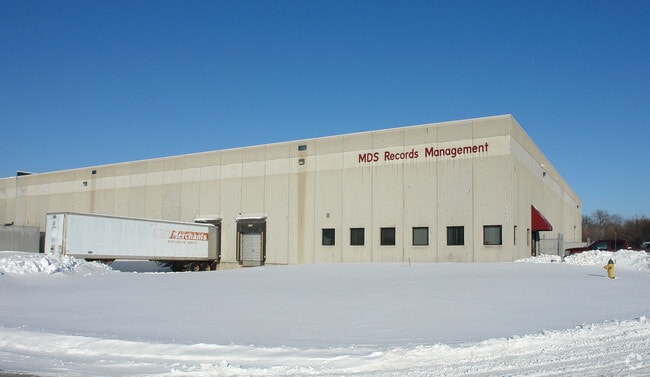

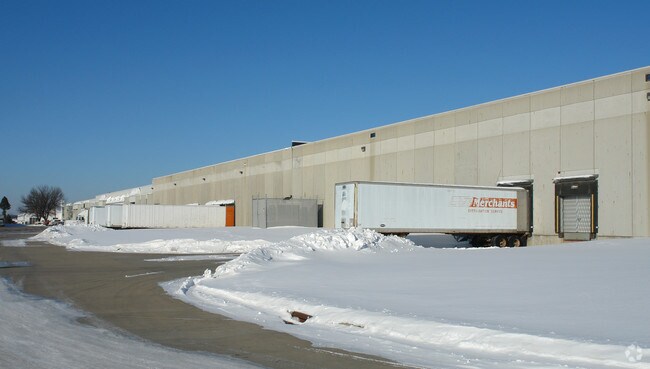
Property Detail
1850 E Euclid Ave
110-06593000000
BEG 1127.1F W & 572.59F S OF NE COR THN WLY 1006.47F NLY 612.32F ELY 909.67F SELY 580F TO POB NE 1/4 SEC 25-79-24
Warehouse
Polk
M-1
Iowa
B and X Area of moderate flood hazard, usually the area between the limits of the 100-year and 500-year floods.
13.28 AC
2024
Northeast
2025
Des Moines
000300
Des Moines-West Des Moines, IA
196,335 SF
NEARBY LISTINGS FOR SALE OR LEASE
DEMOGRAPHICS near 1850 E Euclid Ave
1 mile
3 mile
5 mile
2025 Total Population
7,044
70,215
167,423
2030 Population
7,333
72,830
175,238
Pop Growth 2025-2030
+ 4.10%
+ 3.72%
+ 4.67%
Average Age
37
38
38
2025 Total Households
2,558
26,673
69,259
HH Growth 2025-2030
+ 4.57%
+ 3.91%
+ 5.01%
Median Household Inc
$52,056
$55,454
$59,501
Avg Household Size
2.30
2.40
2.30
2025 Avg HH Vehicles
2.00
2.00
2.00
Median Home Value
$154,012
$156,617
$194,587
Median Year Built
1960
1954
1963
Nearby Places
Map Layers
Map Styles
 Street
 Aerial
Transit
 Traffic
 Biking
Places
Listings with unknown addresses are not visible on the map
- Restaurants
- Banks
- Shops
- Fitness
- Groceries
PUBLIC TRANSPORTATION
AIRPORT
Des Moines International
Drive
Walk
Distance
Des Moines International
19 min
10.4 mi
Freight Ports
Port Milwaukee
Drive
Walk
Distance
Port Milwaukee
411 min
370.3 mi
Nearby Properties
Address
Land Use
TOTAL SIZE
Lot Size
Zoning
Address
Land Use
TOTAL SIZE
Lot Size
Zoning
2,157,357 SF
23.95 AC
PUD
Address
Land Use
TOTAL SIZE
Lot Size
Zoning
428,582 SF
6.87 AC
C-0
Address
Land Use
TOTAL SIZE
Lot Size
Zoning
481,030 SF
31.92 AC
PUD
Address
Land Use
TOTAL SIZE
Lot Size
Zoning
675,000 SF
65.27 AC
Address
Land Use
TOTAL SIZE
Lot Size
Zoning
600,000 SF
40.15 AC
Address
Land Use
TOTAL SIZE
Lot Size
Zoning
402,849 SF
0.83 AC
C-3
Address
Land Use
TOTAL SIZE
Lot Size
Zoning
312,500 SF
38.14 AC
Address
Land Use
TOTAL SIZE
Lot Size
Zoning
320,429 SF
22.34 AC
R3
Address
Land Use
TOTAL SIZE
Lot Size
Zoning
123,535 SF
0.63 AC
Address
Land Use
TOTAL SIZE
Lot Size
Zoning
529,161 SF
33.60 AC
HI
Address
Land Use
TOTAL SIZE
Lot Size
Zoning
126,935 SF
28.61 AC
Address
Land Use
TOTAL SIZE
Lot Size
Zoning
130,496 SF
39.96 AC
HI
Address
Land Use
TOTAL SIZE
Lot Size
Zoning
275,000 SF
16.17 AC
HI
Address
Land Use
TOTAL SIZE
Lot Size
Zoning
603,502 SF
33.03 AC
M-1
Address
Land Use
TOTAL SIZE
Lot Size
Zoning
1,838,971 SF
76.24 AC
HI
Address
Land Use
TOTAL SIZE
Lot Size
Zoning
90,325 SF
5.49 AC
PUD
Address
Land Use
TOTAL SIZE
Lot Size
Zoning
82,202 SF
9.48 AC
PUD
Address
Land Use
TOTAL SIZE
Lot Size
Zoning
170,872 SF
25 AC
Address
Land Use
TOTAL SIZE
Lot Size
Zoning
184,320 SF
9.68 AC
Address
Land Use
TOTAL SIZE
Lot Size
Zoning
162,240 SF
9.19 AC
Address
Land Use
TOTAL SIZE
Lot Size
Zoning
79,991 SF
4.55 AC
M-1
Address
Land Use
TOTAL SIZE
Lot Size
Zoning
274,160 SF
19.99 AC
M-1
Address
Land Use
TOTAL SIZE
Lot Size
Zoning
123,337 SF
2.52 AC
Address
Land Use
TOTAL SIZE
Lot Size
Zoning
181,492 SF
12.32 AC
M1
Address
Land Use
TOTAL SIZE
Lot Size
Zoning
79,823 SF
11.47 AC
M2
Address
Land Use
TOTAL SIZE
Lot Size
Zoning
71,666 SF
18.40 AC
R1-80
Address
Land Use
TOTAL SIZE
Lot Size
Zoning
198,500 SF
11.79 AC
M-1
Address
Land Use
TOTAL SIZE
Lot Size
Zoning
57,792 SF
C-1
Address
Land Use
TOTAL SIZE
Lot Size
Zoning
199,180 SF
9.64 AC
M-1
Address
Land Use
TOTAL SIZE
Lot Size
Zoning
83,885 SF
1.57 AC
PUD
The World's #1 Commercial Real Estate Marketplace
Connect with us
© 2026 CoStar Group
The information above has been obtained from sources believed reliable. While we do not doubt its accuracy we have not verified it and make no guarantee, warranty or representation about it. It is your responsibility to independently confirm its accuracy and completeness. Any projections, opinions, assumptions, or estimates used are for example only and do not represent the current or future performance of the property. The value of this transaction to you depends on tax and other factors which should be evaluated by your tax, financial, and legal advisors. You and your advisors should conduct a careful, independent investigation of the property to determine to your satisfaction the suitability of the property for your needs.