Property Record
1850 Pruneridge Ave, Santa Clara, CA 95050
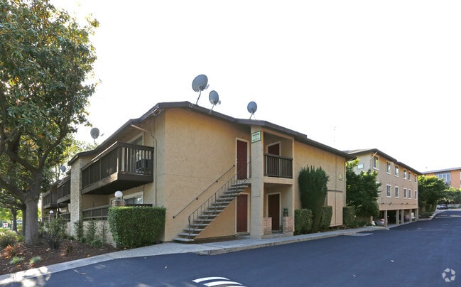


Property Detail
1850 Pruneridge Ave
303-16-080
Santa Clara
Multifamilydwelling
California
R3
20,21
D Areas with possible but undetermined flood hazards.
1.18 AC
2024
Forest-Pruneridge
2025
South Bay/San Jose
505902
San Jose-Sunnyvale-Santa Clara, CA
21,590 SF
NEARBY LISTINGS FOR SALE OR LEASE
DEMOGRAPHICS near 1850 Pruneridge Ave
1 mile
3 mile
5 mile
2025 Total Population
25,974
251,599
619,740
2030 Population
26,807
258,399
636,020
Pop Growth 2025-2030
+ 3.21%
+ 2.70%
+ 2.63%
Average Age
41
39
39
2025 Total Households
10,608
94,515
228,078
HH Growth 2025-2030
+ 3.12%
+ 2.73%
+ 2.72%
Median Household Inc
$146,478
$139,240
$150,527
Avg Household Size
2.40
2.50
2.60
2025 Avg HH Vehicles
2.00
2.00
2.00
Median Home Value
$1,119,962
$1,110,970
$1,115,272
Median Year Built
1964
1970
1971
Nearby Places
Map Layers
Map Styles
 Street
 Aerial
Layers
 Traffic
 Biking
Places
Listings with unknown addresses are not visible on the map
- Restaurants
- Banks
- Shops
- Fitness
- Groceries
PUBLIC TRANSPORTATION
COMMUTER RAIL
University-Santa Clara (ACE Train - Caltrain (Caltrain), Capitol Corridor - Caltrain (Caltrain), Limited - Caltrain (Caltrain), Local Weekday - Caltrain (Caltrain), Local Weekend - Caltrain (Caltrain))
Drive
Walk
Distance
University-Santa Clara (ACE Train - Caltrain (Caltrain), Capitol Corridor - Caltrain (Caltrain), Limited - Caltrain (Caltrain), Local Weekday - Caltrain (Caltrain), Local Weekend - Caltrain (Caltrain))
5 min
2.4 mi
Santa Clara Caltrain Station Northbound (Limited - Caltrain (Caltrain), Local Weekday - Caltrain (Caltrain), Local Weekend - Caltrain (Caltrain))
Drive
Walk
Distance
Santa Clara Caltrain Station Northbound (Limited - Caltrain (Caltrain), Local Weekday - Caltrain (Caltrain), Local Weekend - Caltrain (Caltrain))
6 min
2.4 mi
AIRPORT
Norman Y Mineta San Jose International
Drive
Walk
Distance
Norman Y Mineta San Jose International
7 min
3.0 mi
Freight Ports
Port of Redwood City
Drive
Walk
Distance
Port of Redwood City
31 min
23.6 mi
Nearby Properties
Address
Land Use
TOTAL SIZE
Lot Size
Zoning
Address
Land Use
TOTAL SIZE
Lot Size
Zoning
576,892 SF
8.28 AC
APD
Address
Land Use
TOTAL SIZE
Lot Size
Zoning
360,000 SF
18.81 AC
MH
Address
Land Use
TOTAL SIZE
Lot Size
Zoning
9.11 AC
ML
Address
Land Use
TOTAL SIZE
Lot Size
Zoning
194,790 SF
5.30 AC
APDCI
Address
Land Use
TOTAL SIZE
Lot Size
Zoning
1,121,228 SF
7.68 AC
RM(PD
Address
Land Use
TOTAL SIZE
Lot Size
Zoning
2.99 AC
MH
Address
Land Use
TOTAL SIZE
Lot Size
Zoning
833,956 SF
55.15 AC
PD
Address
Land Use
TOTAL SIZE
Lot Size
Zoning
146,390 SF
9.04 AC
MP
Address
Land Use
TOTAL SIZE
Lot Size
Zoning
4.56 AC
CP
Address
Land Use
TOTAL SIZE
Lot Size
Zoning
500,000 SF
41.05 AC
MH
Address
Land Use
TOTAL SIZE
Lot Size
Zoning
2.99 AC
MH
Address
Land Use
TOTAL SIZE
Lot Size
Zoning
457,162 SF
3.97 AC
A(PD)
Address
Land Use
TOTAL SIZE
Lot Size
Zoning
486,104 SF
5.43 AC
ML
Address
Land Use
TOTAL SIZE
Lot Size
Zoning
617,814 SF
21.96 AC
CG
Address
Land Use
TOTAL SIZE
Lot Size
Zoning
67,435 SF
11.93 AC
C2
Address
Land Use
TOTAL SIZE
Lot Size
Zoning
203,784 SF
13.61 AC
MH
Address
Land Use
TOTAL SIZE
Lot Size
Zoning
3.40 AC
APD
Address
Land Use
TOTAL SIZE
Lot Size
Zoning
2.99 AC
MH
Address
Land Use
TOTAL SIZE
Lot Size
Zoning
298,461 SF
5.45 AC
C3H
Address
Land Use
TOTAL SIZE
Lot Size
Zoning
4.75 AC
CP-PD
Address
Land Use
TOTAL SIZE
Lot Size
Zoning
346,857 SF
4.26 AC
PD-MC
Address
Land Use
TOTAL SIZE
Lot Size
Zoning
234,622 SF
1.89 AC
A(PD)
Address
Land Use
TOTAL SIZE
Lot Size
Zoning
194,549 SF
2.76 AC
APDCI
Address
Land Use
TOTAL SIZE
Lot Size
Zoning
116,953 SF
8.61 AC
C-2
Address
Land Use
TOTAL SIZE
Lot Size
Zoning
491,622 SF
4.18 AC
A(PD)
Address
Land Use
TOTAL SIZE
Lot Size
Zoning
342,432 SF
3.99 AC
PD-MC
Address
Land Use
TOTAL SIZE
Lot Size
Zoning
299,278 SF
3.67 AC
M1
Address
Land Use
TOTAL SIZE
Lot Size
Zoning
16.11 AC
CG
Address
Land Use
TOTAL SIZE
Lot Size
Zoning
279,360 SF
9.04 AC
R3
The World's #1 Commercial Real Estate Marketplace
Connect with us
© 2026 CoStar Group
The information above has been obtained from sources believed reliable. While we do not doubt its accuracy we have not verified it and make no guarantee, warranty or representation about it. It is your responsibility to independently confirm its accuracy and completeness. Any projections, opinions, assumptions, or estimates used are for example only and do not represent the current or future performance of the property. The value of this transaction to you depends on tax and other factors which should be evaluated by your tax, financial, and legal advisors. You and your advisors should conduct a careful, independent investigation of the property to determine to your satisfaction the suitability of the property for your needs.