Property Record
18500 Henderson Rd, Tracy, CA 95391

Property Detail
18500 Henderson Rd
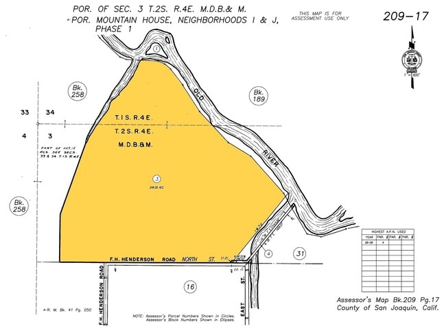
209-170-03
08-FM PT 209-170-02/PT TO 04 RM 41-050
Residentialacreage
SAN JOAQUIN
PF
California
A Areas with a 1% annual chance of flooding and a 26% chance of flooding over the life of a 30-year mortgage.
249.59 AC
2025
Tracy/Manteca
2025
Stockton/Modesto
005223
Stockton-Lodi, CA
NEARBY LISTINGS FOR SALE OR LEASE
DEMOGRAPHICS near 18500 Henderson Rd
1 mile
3 mile
5 mile
2025 Total Population
96
30,018
49,146
2030 Population
103
32,020
52,097
Pop Growth 2025-2030
+ 7.29%
+ 6.67%
+ 6.00%
Average Age
36
34
36
2025 Total Households
27
8,309
13,902
HH Growth 2025-2030
+ 7.41%
+ 6.78%
+ 6.12%
Median Household Inc
$158,333
$178,996
$157,590
Avg Household Size
3.50
3.60
3.50
2025 Avg HH Vehicles
3.00
2.00
3.00
Median Home Value
$874,999
$859,852
$825,717
Median Year Built
2010
2010
2008
Nearby Places
Map Layers
Map Styles
 Street
 Aerial
Layers
 Traffic
 Biking
Places
Listings with unknown addresses are not visible on the map
- Restaurants
- Banks
- Shops
- Fitness
- Groceries
PUBLIC TRANSPORTATION
COMMUTER RAIL
Tracy Station (ACE Train - Altamont Corridor Express)
Drive
Walk
Distance
Tracy Station (ACE Train - Altamont Corridor Express)
19 min
9.7 mi
AIRPORT
Stockton Metro
Drive
Walk
Distance
Stockton Metro
35 min
24.8 mi
Freight Ports
Port of Stockton
Drive
Walk
Distance
Port of Stockton
38 min
28.1 mi
Nearby Properties
Address
Land Use
TOTAL SIZE
Lot Size
Zoning
Address
Land Use
TOTAL SIZE
Lot Size
Zoning
15.20 AC
RH
Address
Land Use
TOTAL SIZE
Lot Size
Zoning
407.40 AC
RL
Address
Land Use
TOTAL SIZE
Lot Size
Zoning
Address
Land Use
TOTAL SIZE
Lot Size
Zoning
960 SF
31.71 AC
RL
Address
Land Use
TOTAL SIZE
Lot Size
Zoning
1,380 SF
1,354.10 AC
AG80
Address
Land Use
TOTAL SIZE
Lot Size
Zoning
148,645 SF
7.15 AC
IP
Address
Land Use
TOTAL SIZE
Lot Size
Zoning
139,273 SF
7.34 AC
IP
Address
Land Use
TOTAL SIZE
Lot Size
Zoning
91,612 SF
6.20 AC
IP
Address
Land Use
TOTAL SIZE
Lot Size
Zoning
8.80 AC
RH
Address
Land Use
TOTAL SIZE
Lot Size
Zoning
80.44 AC
AG40
Address
Land Use
TOTAL SIZE
Lot Size
Zoning
82,567 SF
4.45 AC
IP
Address
Land Use
TOTAL SIZE
Lot Size
Zoning
1,320 SF
96.99 AC
AG40
Address
Land Use
TOTAL SIZE
Lot Size
Zoning
1,776 SF
639.11 AC
AG80
Address
Land Use
TOTAL SIZE
Lot Size
Zoning
157.60 AC
AG40
Address
Land Use
TOTAL SIZE
Lot Size
Zoning
28,250 SF
1.95 AC
CO
Address
Land Use
TOTAL SIZE
Lot Size
Zoning
900 SF
1,171.28 AC
AG80
Address
Land Use
TOTAL SIZE
Lot Size
Zoning
55,545 SF
1.28 AC
Address
Land Use
TOTAL SIZE
Lot Size
Zoning
5,126 SF
349 AC
Address
Land Use
TOTAL SIZE
Lot Size
Zoning
1.36 AC
Address
Land Use
TOTAL SIZE
Lot Size
Zoning
50,990 SF
2.59 AC
IP
Address
Land Use
TOTAL SIZE
Lot Size
Zoning
15.59 AC
Address
Land Use
TOTAL SIZE
Lot Size
Zoning
11,881 SF
1 AC
CN
Address
Land Use
TOTAL SIZE
Lot Size
Zoning
3,399 SF
215.02 AC
A2
The World's #1 Commercial Real Estate Marketplace
Connect with us
© 2026 CoStar Group
The information above has been obtained from sources believed reliable. While we do not doubt its accuracy we have not verified it and make no guarantee, warranty or representation about it. It is your responsibility to independently confirm its accuracy and completeness. Any projections, opinions, assumptions, or estimates used are for example only and do not represent the current or future performance of the property. The value of this transaction to you depends on tax and other factors which should be evaluated by your tax, financial, and legal advisors. You and your advisors should conduct a careful, independent investigation of the property to determine to your satisfaction the suitability of the property for your needs.