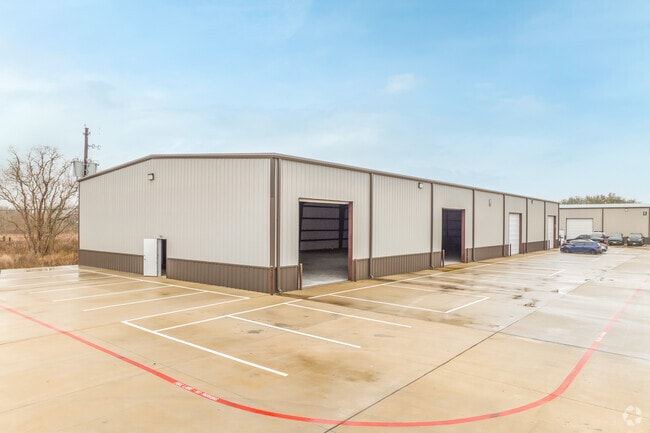
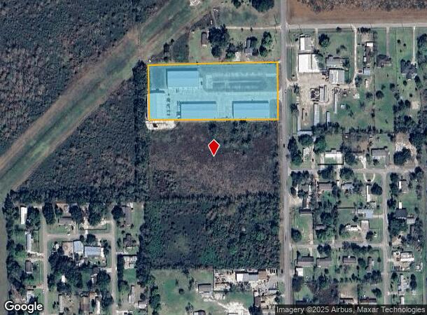
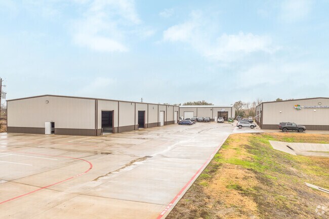
Property Record
18500 Pearland Sites Rd, Pearland, TX 77584
NEARBY LISTINGS FOR SALE OR LEASE
Property Detail
18500 Pearland Sites Rd
0293-0004-112
H T & B R R
Commercialnec
A0293 H T & B R R TRACT 1 (COOPER PARK) ACRES 3.973
X
Brazoria
48039C0040K
Texas
2024
3.97 AC
2025
South Hwy 35
660902
Houston
44,800 SF
Houston-Pasadena-The Woodlands, TX
DEMOGRAPHICS near 18500 Pearland Sites Rd
1 Mile
3 Mile
5 Mile
2024 Total Population
3,016
22,623
97,503
2029 Population
3,398
25,082
107,262
Pop Growth 2024-2029
+ 12.67%
+ 10.87%
+ 10.01%
Average Age
34
36
37
2024 Total Households
863
7,052
32,853
HH Growth 2024-2029
+ 12.86%
+ 11.00%
+ 10.16%
Median Household Inc
$65,860
$99,406
$99,293
Avg Household Size
3.20
3.10
2.90
2024 Avg HH Vehicles
2.00
2.00
2.00
Median Home Value
$217,187
$281,200
$281,722
Median Year Built
1997
2001
1996
Nearby Places
Map Layers
Map Styles
 Street
 Aerial
- Restaurants
- Banks
- Shops
- Fitness
- Groceries
PUBLIC TRANSPORTATION
AIRPORT
William P Hobby
DRIVE
WALK
Distance
William P Hobby
24 min
11.1 mi
Freight Ports
Port of Houston
DRIVE
WALK
Distance
Port of Houston
35 min
19.2 mi
SALE & LEASE HISTORY
LISTING DATE
SALE/LEASE

Jan 14, 2025
For Lease
Aug 25, 2025
For Lease
Nearby Properties
Address
Land Use
TOTAL SIZE
Lot Size
Zoning
Address
Land Use
TOTAL SIZE
Lot Size
Zoning
40.52 AC
0017
Address
Land Use
TOTAL SIZE
Lot Size
Zoning
83.37 AC
0004
Address
Land Use
TOTAL SIZE
Lot Size
Zoning
64.56 AC
0016
Address
Land Use
TOTAL SIZE
Lot Size
Zoning
7.42 AC
Address
Land Use
TOTAL SIZE
Lot Size
Zoning
113,376 SF
9.80 AC
Address
Land Use
TOTAL SIZE
Lot Size
Zoning
19.61 AC
Address
Land Use
TOTAL SIZE
Lot Size
Zoning
67,000 SF
28.97 AC
Address
Land Use
TOTAL SIZE
Lot Size
Zoning
Address
Land Use
TOTAL SIZE
Lot Size
Zoning
67,130 SF
17.70 AC
0151
Address
Land Use
TOTAL SIZE
Lot Size
Zoning
27,648 SF
3.23 AC
0009
Address
Land Use
TOTAL SIZE
Lot Size
Zoning
153,736 SF
9.25 AC
Address
Land Use
TOTAL SIZE
Lot Size
Zoning
24,000 SF
3.53 AC
0001
Address
Land Use
TOTAL SIZE
Lot Size
Zoning
41.07 AC
Address
Land Use
TOTAL SIZE
Lot Size
Zoning
162,100 SF
24.51 AC
0056
Address
Land Use
TOTAL SIZE
Lot Size
Zoning
34,250 SF
6.67 AC
Address
Land Use
TOTAL SIZE
Lot Size
Zoning
47,260 SF
9.80 AC
0146
Address
Land Use
TOTAL SIZE
Lot Size
Zoning
128.92 AC
0028
Address
Land Use
TOTAL SIZE
Lot Size
Zoning
3,504 SF
187.33 AC
0027
Address
Land Use
TOTAL SIZE
Lot Size
Zoning
12,209 SF
2.46 AC
Address
Land Use
TOTAL SIZE
Lot Size
Zoning
37,575 SF
1.27 AC
0011
Address
Land Use
TOTAL SIZE
Lot Size
Zoning
29,230 SF
2.97 AC
Address
Land Use
TOTAL SIZE
Lot Size
Zoning
45,089 SF
5 AC
0007
Address
Land Use
TOTAL SIZE
Lot Size
Zoning
21,152 SF
34.11 AC
0007
Address
Land Use
TOTAL SIZE
Lot Size
Zoning
1,830 SF
31.44 AC
Address
Land Use
TOTAL SIZE
Lot Size
Zoning
13.29 AC
Address
Land Use
TOTAL SIZE
Lot Size
Zoning
36,899 SF
4 AC
Address
Land Use
TOTAL SIZE
Lot Size
Zoning
22,502 SF
4.97 AC
Address
Land Use
TOTAL SIZE
Lot Size
Zoning
167 SF
24.55 AC
Address
Land Use
TOTAL SIZE
Lot Size
Zoning
The World's #1 Commercial Real Estate Marketplace
Connect with us
© 2026 CoStar Group
The information above has been obtained from sources believed reliable. While we do not doubt its accuracy we have not verified it and make no guarantee, warranty or representation about it. It is your responsibility to independently confirm its accuracy and completeness. Any projections, opinions, assumptions, or estimates used are for example only and do not represent the current or future performance of the property. The value of this transaction to you depends on tax and other factors which should be evaluated by your tax, financial, and legal advisors. You and your advisors should conduct a careful, independent investigation of the property to determine to your satisfaction the suitability of the property for your needs.