Property Record
1865 E Buckhill Rd, Burlington, NC 27215
NEARBY LISTINGS FOR SALE OR LEASE
Property Detail
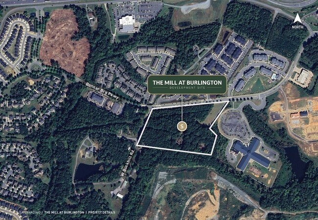
1865 E Buckhill Rd
Burlington, NC
Property Of W Ollie Payne
106787
Alamance
Sfr
North Carolina
X
4.69 AC
3710884400L
West Burlington/Airport
3,284 SF
Greensboro/Winston-Salem
DEMOGRAPHICS near 1865 E Buckhill Rd
1 Mile
3 Mile
5 Mile
2024 Total Population
5,567
29,418
68,634
2029 Population
6,245
31,621
72,926
Pop Growth 2024-2029
+ 12.18%
+ 7.49%
+ 6.25%
Average Age
38
41
40
2024 Total Households
2,248
12,181
27,371
HH Growth 2024-2029
+ 12.28%
+ 7.74%
+ 6.43%
Median Household Inc
$80,501
$75,232
$68,761
Avg Household Size
2.40
2.30
2.30
2024 Avg HH Vehicles
2.00
2.00
2.00
Median Home Value
$284,906
$267,674
$236,118
Median Year Built
2010
2002
1993
Nearby Places
Map Layers
Map Styles
 Street
 Aerial
- Restaurants
- Banks
- Shops
- Fitness
- Groceries
PUBLIC TRANSPORTATION
COMMUTER RAIL
Burlington Station (Piedmont - North Carolina by Train (NC Train))
DRIVE
WALK
Distance
Burlington Station (Piedmont - North Carolina by Train (NC Train))
13 min
6.6 mi
AIRPORT
Piedmont Triad International
DRIVE
WALK
Distance
Piedmont Triad International
42 min
27.9 mi
Freight Ports
Virginia Port Authority - Richmond
DRIVE
WALK
Distance
Virginia Port Authority - Richmond
209 min
181.9 mi
SALE & LEASE HISTORY
LISTING DATE
SALE/LEASE

Jul 10, 2025
For Sale
Jul 08, 2025
For Sale
Jan 08, 2019
For Sale
Nearby Properties
Address
Land Use
TOTAL SIZE
Lot Size
Zoning
Address
Land Use
TOTAL SIZE
Lot Size
Zoning
350,000 SF
64.18 AC
O I
Address
Land Use
TOTAL SIZE
Lot Size
Zoning
81,153 SF
62.10 AC
X 1
Address
Land Use
TOTAL SIZE
Lot Size
Zoning
26,280 SF
14.34 AC
R 15
Address
Land Use
TOTAL SIZE
Lot Size
Zoning
41,892 SF
21.63 AC
CR
Address
Land Use
TOTAL SIZE
Lot Size
Zoning
26,280 SF
11.24 AC
CR
Address
Land Use
TOTAL SIZE
Lot Size
Zoning
51,381 SF
34.69 AC
CB
Address
Land Use
TOTAL SIZE
Lot Size
Zoning
10,368 SF
13.60 AC
MFA
Address
Land Use
TOTAL SIZE
Lot Size
Zoning
8,090 SF
12.97 AC
TOWN CEN
Address
Land Use
TOTAL SIZE
Lot Size
Zoning
27,803 SF
8.80 AC
CR
Address
Land Use
TOTAL SIZE
Lot Size
Zoning
47,520 SF
6.10 AC
B 2
Address
Land Use
TOTAL SIZE
Lot Size
Zoning
23,265 SF
20.45 AC
MF A
Address
Land Use
TOTAL SIZE
Lot Size
Zoning
399,195 SF
24.84 AC
RM-12
Address
Land Use
TOTAL SIZE
Lot Size
Zoning
135,186 SF
15.60 AC
CR
Address
Land Use
TOTAL SIZE
Lot Size
Zoning
28,812 SF
15.63 AC
MFA
Address
Land Use
TOTAL SIZE
Lot Size
Zoning
84,783 SF
32.88 AC
CB
Address
Land Use
TOTAL SIZE
Lot Size
Zoning
29,120 SF
56.82 AC
X 1
Address
Land Use
TOTAL SIZE
Lot Size
Zoning
298,682 SF
21.54 AC
CR
Address
Land Use
TOTAL SIZE
Lot Size
Zoning
257,796 SF
17.91 AC
CU-HI
Address
Land Use
TOTAL SIZE
Lot Size
Zoning
203,832 SF
36.10 AC
B 2
Address
Land Use
TOTAL SIZE
Lot Size
Zoning
10,384 SF
16.51 AC
B2
Address
Land Use
TOTAL SIZE
Lot Size
Zoning
14,760 SF
13.07 AC
MFA
Address
Land Use
TOTAL SIZE
Lot Size
Zoning
10,604 SF
24.43 AC
R 9
Address
Land Use
TOTAL SIZE
Lot Size
Zoning
53,012 SF
18.58 AC
B 2
Address
Land Use
TOTAL SIZE
Lot Size
Zoning
90,767 SF
36.47 AC
I 1
Address
Land Use
TOTAL SIZE
Lot Size
Zoning
81,726 SF
18.01 AC
R 15
Address
Land Use
TOTAL SIZE
Lot Size
Zoning
11,766 SF
97.16 AC
PI
Address
Land Use
TOTAL SIZE
Lot Size
Zoning
29,057 SF
10.99 AC
B2
Address
Land Use
TOTAL SIZE
Lot Size
Zoning
90,083 SF
2.33 AC
CB
Address
Land Use
TOTAL SIZE
Lot Size
Zoning
26,280 SF
9.64 AC
R15
Address
Land Use
TOTAL SIZE
Lot Size
Zoning
43,680 SF
5.77 AC
The World's #1 Commercial Real Estate Marketplace
Connect with us
© 2026 CoStar Group
The information above has been obtained from sources believed reliable. While we do not doubt its accuracy we have not verified it and make no guarantee, warranty or representation about it. It is your responsibility to independently confirm its accuracy and completeness. Any projections, opinions, assumptions, or estimates used are for example only and do not represent the current or future performance of the property. The value of this transaction to you depends on tax and other factors which should be evaluated by your tax, financial, and legal advisors. You and your advisors should conduct a careful, independent investigation of the property to determine to your satisfaction the suitability of the property for your needs.