Property Record
1851 E Mayfield Rd, Arlington, TX 76014


Property Detail
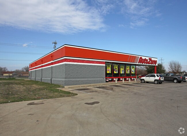
1851 E Mayfield Rd
Dallas-Fort Worth-Arlington, TX
HARVEST HILLS III ADDITION BLOCK 10R LOT 2B
06770002
Tarrant
Commercialnec
Texas
AE The base floodplain where base flood elevations are provided. AE Zones are now used on new format FIRMs instead of A1-A30 Zones.
2b
2024
0.86 AC
2025
South Arlington
111522
Dallas/Ft Worth
7,784 SF
NEARBY LISTINGS FOR SALE OR LEASE
DEMOGRAPHICS near 1851 E Mayfield Rd
1 mile
3 mile
5 mile
2024 Total Population
22,084
151,335
351,440
2029 Population
23,070
158,962
368,050
Pop Growth 2024-2029
+ 4.46%
+ 5.04%
+ 4.73%
Average Age
35
35
36
2024 Total Households
6,864
50,836
119,214
HH Growth 2024-2029
+ 4.66%
+ 5.19%
+ 4.89%
Median Household Inc
$65,644
$62,696
$68,794
Avg Household Size
3.10
2.90
2.80
2024 Avg HH Vehicles
2.00
2.00
2.00
Median Home Value
$243,698
$256,390
$283,816
Median Year Built
1982
1983
1985
Nearby Places
Map Layers
Map Styles
 Street
 Aerial
Transit
 Traffic
 Biking
Places
Listings with unknown addresses are not visible on the map
- Restaurants
- Banks
- Shops
- Fitness
- Groceries
PUBLIC TRANSPORTATION
AIRPORT
Dallas-Fort Worth International
Drive
Walk
Distance
Dallas-Fort Worth International
26 min
17.4 mi
Dallas Love Field
Drive
Walk
Distance
Dallas Love Field
38 min
25.4 mi
Nearby Properties
Address
Land Use
TOTAL SIZE
Lot Size
Zoning
Address
Land Use
TOTAL SIZE
Lot Size
Zoning
1,342,617 SF
40.67 AC
Address
Land Use
TOTAL SIZE
Lot Size
Zoning
569,876 SF
47.80 AC
Address
Land Use
TOTAL SIZE
Lot Size
Zoning
804,384 SF
48.38 AC
Address
Land Use
TOTAL SIZE
Lot Size
Zoning
799,893 SF
19.43 AC
Address
Land Use
TOTAL SIZE
Lot Size
Zoning
529,992 SF
35.21 AC
Address
Land Use
TOTAL SIZE
Lot Size
Zoning
456,473 SF
32.79 AC
Address
Land Use
TOTAL SIZE
Lot Size
Zoning
1,114,563 SF
89.72 AC
Address
Land Use
TOTAL SIZE
Lot Size
Zoning
368,004 SF
13.89 AC
Address
Land Use
TOTAL SIZE
Lot Size
Zoning
422,300 SF
2.50 AC
Address
Land Use
TOTAL SIZE
Lot Size
Zoning
347,421 SF
4.47 AC
Address
Land Use
TOTAL SIZE
Lot Size
Zoning
377,463 SF
19.50 AC
Address
Land Use
TOTAL SIZE
Lot Size
Zoning
753,721 SF
42.65 AC
Address
Land Use
TOTAL SIZE
Lot Size
Zoning
206,650 SF
18.92 AC
Address
Land Use
TOTAL SIZE
Lot Size
Zoning
402,935 SF
20.72 AC
Address
Land Use
TOTAL SIZE
Lot Size
Zoning
375,213 SF
17.77 AC
Address
Land Use
TOTAL SIZE
Lot Size
Zoning
298,234 SF
23.39 AC
Address
Land Use
TOTAL SIZE
Lot Size
Zoning
280,000 SF
10.85 AC
Address
Land Use
TOTAL SIZE
Lot Size
Zoning
821,502 SF
45.37 AC
Address
Land Use
TOTAL SIZE
Lot Size
Zoning
352,999 SF
60.81 AC
Address
Land Use
TOTAL SIZE
Lot Size
Zoning
315,359 SF
15 AC
Address
Land Use
TOTAL SIZE
Lot Size
Zoning
229,000 SF
8.01 AC
Address
Land Use
TOTAL SIZE
Lot Size
Zoning
387,500 SF
13.54 AC
Z313
Address
Land Use
TOTAL SIZE
Lot Size
Zoning
193,680 SF
8.25 AC
Address
Land Use
TOTAL SIZE
Lot Size
Zoning
296,092 SF
7.66 AC
Address
Land Use
TOTAL SIZE
Lot Size
Zoning
816,040 SF
41.89 AC
Address
Land Use
TOTAL SIZE
Lot Size
Zoning
254,690 SF
12.18 AC
Address
Land Use
TOTAL SIZE
Lot Size
Zoning
252,416 SF
15.86 AC
Address
Land Use
TOTAL SIZE
Lot Size
Zoning
162,537 SF
19.70 AC
Address
Land Use
TOTAL SIZE
Lot Size
Zoning
337,690 SF
20.71 AC
Address
Land Use
TOTAL SIZE
Lot Size
Zoning
228,210 SF
12.28 AC
Z190
The World's #1 Commercial Real Estate Marketplace
Connect with us
© 2026 CoStar Group
The information above has been obtained from sources believed reliable. While we do not doubt its accuracy we have not verified it and make no guarantee, warranty or representation about it. It is your responsibility to independently confirm its accuracy and completeness. Any projections, opinions, assumptions, or estimates used are for example only and do not represent the current or future performance of the property. The value of this transaction to you depends on tax and other factors which should be evaluated by your tax, financial, and legal advisors. You and your advisors should conduct a careful, independent investigation of the property to determine to your satisfaction the suitability of the property for your needs.