Property Record
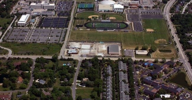
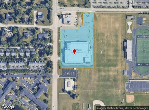
1851 Landwehr Rd, Glenview, IL 60026
NEARBY LISTINGS FOR SALE OR LEASE
Property Detail
1851 Landwehr Rd
04-29-201-006-0000
Owners Subdivision
Taxexempt
Cook
X
Illinois
17031C0228J
5 AC
0
Near North
2024
Chicago
801607
Chicago-Naperville-Elgin, IL-IN-WI
DEMOGRAPHICS near 1851 Landwehr Rd
1 Mile
3 Mile
5 Mile
2024 Total Population
11,473
102,355
287,529
2029 Population
11,212
99,654
279,829
Pop Growth 2024-2029
(2.27%)
(2.64%)
(2.68%)
Average Age
44
44
44
2024 Total Households
4,110
38,134
109,088
HH Growth 2024-2029
(2.58%)
(2.88%)
(2.96%)
Median Household Inc
$109,143
$91,238
$94,601
Avg Household Size
2.60
2.60
2.50
2024 Avg HH Vehicles
2.00
2.00
2.00
Median Home Value
$614,064
$447,854
$384,951
Median Year Built
1977
1973
1970
Nearby Places
Map Layers
Map Styles
 Street
 Aerial
- Restaurants
- Banks
- Shops
- Fitness
- Groceries
PUBLIC TRANSPORTATION
COMMUTER RAIL
Prospect Heights Station (North Central Service - Northeast Illinois Regional Commuter Railroad (Metra))
DRIVE
WALK
Distance
Prospect Heights Station (North Central Service - Northeast Illinois Regional Commuter Railroad (Metra))
6 min
3.1 mi
North Glenview Station (Milwaukee District North Line - Northeast Illinois Regional Commuter Railroad (Metra))
DRIVE
WALK
Distance
North Glenview Station (Milwaukee District North Line - Northeast Illinois Regional Commuter Railroad (Metra))
8 min
4.1 mi
AIRPORT
Chicago O'Hare International
DRIVE
WALK
Distance
Chicago O'Hare International
19 min
12.4 mi
Chicago Midway International
DRIVE
WALK
Distance
Chicago Midway International
43 min
23.9 mi
Freight Ports
Port Milwaukee
DRIVE
WALK
Distance
Port Milwaukee
80 min
67.8 mi
Nearby Properties
Address
Land Use
TOTAL SIZE
Lot Size
Zoning
Address
Land Use
TOTAL SIZE
Lot Size
Zoning
Address
Land Use
TOTAL SIZE
Lot Size
Zoning
8.04 AC
Address
Land Use
TOTAL SIZE
Lot Size
Zoning
22.72 AC
Address
Land Use
TOTAL SIZE
Lot Size
Zoning
206,160 SF
9.44 AC
Address
Land Use
TOTAL SIZE
Lot Size
Zoning
443,916 SF
5.61 AC
Address
Land Use
TOTAL SIZE
Lot Size
Zoning
32.61 AC
Address
Land Use
TOTAL SIZE
Lot Size
Zoning
188,728 SF
Address
Land Use
TOTAL SIZE
Lot Size
Zoning
449,568 SF
22.73 AC
Address
Land Use
TOTAL SIZE
Lot Size
Zoning
611,799 SF
17.61 AC
Address
Land Use
TOTAL SIZE
Lot Size
Zoning
20.79 AC
Address
Land Use
TOTAL SIZE
Lot Size
Zoning
6.32 AC
Address
Land Use
TOTAL SIZE
Lot Size
Zoning
76,014 SF
2.81 AC
Address
Land Use
TOTAL SIZE
Lot Size
Zoning
8.89 AC
Address
Land Use
TOTAL SIZE
Lot Size
Zoning
142,300 SF
13.16 AC
Address
Land Use
TOTAL SIZE
Lot Size
Zoning
183,952 SF
4.33 AC
Address
Land Use
TOTAL SIZE
Lot Size
Zoning
276,112 SF
10.02 AC
Address
Land Use
TOTAL SIZE
Lot Size
Zoning
89,080 SF
6.81 AC
Address
Land Use
TOTAL SIZE
Lot Size
Zoning
65,401 SF
5.05 AC
Address
Land Use
TOTAL SIZE
Lot Size
Zoning
Address
Land Use
TOTAL SIZE
Lot Size
Zoning
405,484 SF
Address
Land Use
TOTAL SIZE
Lot Size
Zoning
251,385 SF
17.46 AC
Address
Land Use
TOTAL SIZE
Lot Size
Zoning
134,236 SF
8.41 AC
Address
Land Use
TOTAL SIZE
Lot Size
Zoning
Address
Land Use
TOTAL SIZE
Lot Size
Zoning
31.61 AC
Address
Land Use
TOTAL SIZE
Lot Size
Zoning
151,781 SF
12.74 AC
Address
Land Use
TOTAL SIZE
Lot Size
Zoning
148,663 SF
13.77 AC
Address
Land Use
TOTAL SIZE
Lot Size
Zoning
73,815 SF
4.35 AC
Address
Land Use
TOTAL SIZE
Lot Size
Zoning
267,170 SF
7.11 AC
Address
Land Use
TOTAL SIZE
Lot Size
Zoning
552,862 SF
45.76 AC
Address
Land Use
TOTAL SIZE
Lot Size
Zoning
91,505 SF
4.86 AC
The World's #1 Commercial Real Estate Marketplace
Connect with us
© 2025 CoStar Group
The information above has been obtained from sources believed reliable. While we do not doubt its accuracy we have not verified it and make no guarantee, warranty or representation about it. It is your responsibility to independently confirm its accuracy and completeness. Any projections, opinions, assumptions, or estimates used are for example only and do not represent the current or future performance of the property. The value of this transaction to you depends on tax and other factors which should be evaluated by your tax, financial, and legal advisors. You and your advisors should conduct a careful, independent investigation of the property to determine to your satisfaction the suitability of the property for your needs.