Property Record
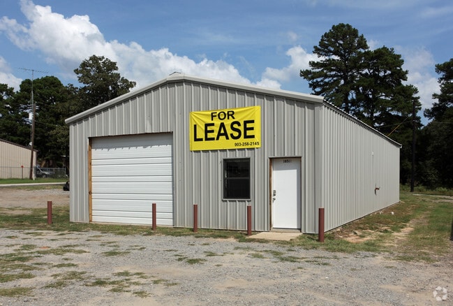
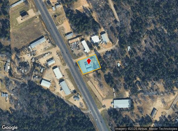
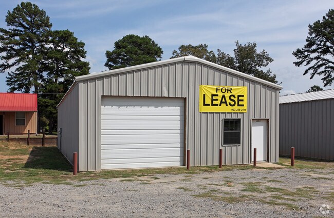
18510 Us Highway 69 N, Lindale, TX 75771
NEARBY LISTINGS FOR SALE OR LEASE
-
-
View all Lindale listings for sale on LoopNet.com
Property Detail
18510 Us Highway 69 N
1-00000-1118-00-002220
A1118 J Sanders
Publicstorage
ABST A1118 J SANDERSTRACT 2V
X
Smith
48499C0450C
Texas
2024
0.76 AC
2025
Tyler & Longview
001404
Other Market Areas
2,400 SF
Tyler, TX
DEMOGRAPHICS near 18510 Us Highway 69 N
1 Mile
3 Mile
5 Mile
2024 Total Population
780
10,777
19,745
2029 Population
861
11,756
21,569
Pop Growth 2024-2029
+ 10.38%
+ 9.08%
+ 9.24%
Average Age
37
38
41
2024 Total Households
271
3,887
7,316
HH Growth 2024-2029
+ 9.96%
+ 8.49%
+ 8.67%
Median Household Inc
$75,291
$74,292
$77,469
Avg Household Size
2.70
2.70
2.60
2024 Avg HH Vehicles
2.00
2.00
2.00
Median Home Value
$256,976
$213,053
$236,286
Median Year Built
1995
1994
1993
Nearby Places
- Restaurants
- Banks
- Shops
- Fitness
- Groceries
PUBLIC TRANSPORTATION
AIRPORT
Tyler Pounds Regional
DRIVE
WALK
Distance
Tyler Pounds Regional
23 min
17.4 mi
Freight Ports
Port of Shreveport
DRIVE
WALK
Distance
Port of Shreveport
126 min
113.9 mi
Nearby Properties
Address
Land Use
TOTAL SIZE
Lot Size
Zoning
Address
Land Use
TOTAL SIZE
Lot Size
Zoning
74,983 SF
5.44 AC
Address
Land Use
TOTAL SIZE
Lot Size
Zoning
13,776 SF
3.64 AC
Address
Land Use
TOTAL SIZE
Lot Size
Zoning
44,616 SF
3.30 AC
Address
Land Use
TOTAL SIZE
Lot Size
Zoning
44,299 SF
9.36 AC
Address
Land Use
TOTAL SIZE
Lot Size
Zoning
26.50 AC
Address
Land Use
TOTAL SIZE
Lot Size
Zoning
66,065 SF
2.56 AC
Address
Land Use
TOTAL SIZE
Lot Size
Zoning
104,953 SF
6.37 AC
Address
Land Use
TOTAL SIZE
Lot Size
Zoning
19.02 AC
Address
Land Use
TOTAL SIZE
Lot Size
Zoning
3,063 SF
0.27 AC
Address
Land Use
TOTAL SIZE
Lot Size
Zoning
29,024 SF
1.27 AC
Address
Land Use
TOTAL SIZE
Lot Size
Zoning
5.75 AC
Address
Land Use
TOTAL SIZE
Lot Size
Zoning
16,625 SF
5.82 AC
Address
Land Use
TOTAL SIZE
Lot Size
Zoning
59,382 SF
3.21 AC
Address
Land Use
TOTAL SIZE
Lot Size
Zoning
16,950 SF
10.48 AC
Address
Land Use
TOTAL SIZE
Lot Size
Zoning
32,107 SF
5.53 AC
Address
Land Use
TOTAL SIZE
Lot Size
Zoning
35,870 SF
3.19 AC
Address
Land Use
TOTAL SIZE
Lot Size
Zoning
4.68 AC
Address
Land Use
TOTAL SIZE
Lot Size
Zoning
10,000 SF
1 AC
Address
Land Use
TOTAL SIZE
Lot Size
Zoning
6,981 SF
1.68 AC
Address
Land Use
TOTAL SIZE
Lot Size
Zoning
1,988 SF
3.04 AC
Address
Land Use
TOTAL SIZE
Lot Size
Zoning
15,419 SF
0.54 AC
Address
Land Use
TOTAL SIZE
Lot Size
Zoning
15,232 SF
4.37 AC
Address
Land Use
TOTAL SIZE
Lot Size
Zoning
44,147 SF
Address
Land Use
TOTAL SIZE
Lot Size
Zoning
22,770 SF
3.45 AC
Address
Land Use
TOTAL SIZE
Lot Size
Zoning
Address
Land Use
TOTAL SIZE
Lot Size
Zoning
11,200 SF
42.75 AC
Address
Land Use
TOTAL SIZE
Lot Size
Zoning
3,928 SF
1.20 AC
Address
Land Use
TOTAL SIZE
Lot Size
Zoning
14,260 SF
5.39 AC
Address
Land Use
TOTAL SIZE
Lot Size
Zoning
13,118 SF
0.64 AC
Address
Land Use
TOTAL SIZE
Lot Size
Zoning
8,560 SF
0.54 AC
The World's #1 Commercial Real Estate Marketplace
Connect with us
© 2025 CoStar Group
The information above has been obtained from sources believed reliable. While we do not doubt its accuracy we have not verified it and make no guarantee, warranty or representation about it. It is your responsibility to independently confirm its accuracy and completeness. Any projections, opinions, assumptions, or estimates used are for example only and do not represent the current or future performance of the property. The value of this transaction to you depends on tax and other factors which should be evaluated by your tax, financial, and legal advisors. You and your advisors should conduct a careful, independent investigation of the property to determine to your satisfaction the suitability of the property for your needs.