Property Record
18520 Webster St, Spring Hill, KS 66083


Current Lease Availabilities
NEARBY LISTINGS FOR SALE OR LEASE
Property Detail
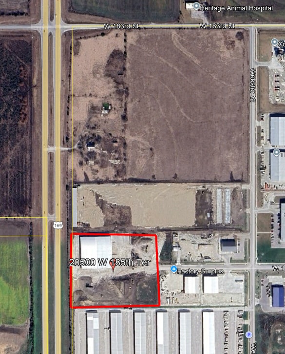
18520 Webster St
Kansas City, MO-KS
Cummins Property Second Plat
EP20710000-0001
CUMMINS PROPERTY SECOND PLAT, LOT 1
Warehouse
Johnson
X
Kansas
20121C0055D
1
2024
3 AC
2025
Olathe
053801
Kansas City
7,500 SF
DEMOGRAPHICS near 18520 Webster St
1 mile
3 mile
5 mile
2024 Total Population
1,056
8,615
47,834
2029 Population
1,163
9,441
50,916
Pop Growth 2024-2029
+ 10.13%
+ 9.59%
+ 6.44%
Average Age
41
38
37
2024 Total Households
380
2,933
16,013
HH Growth 2024-2029
+ 10.26%
+ 9.72%
+ 6.76%
Median Household Inc
$84,429
$110,948
$107,335
Avg Household Size
2.70
2.90
2.90
2024 Avg HH Vehicles
2.00
2.00
2.00
Median Home Value
$355,737
$352,956
$307,305
Median Year Built
1999
2006
2002
Nearby Places
Map Layers
Map Styles
 Street
 Aerial
Transit
 Traffic
 Biking
Places
Listings with unknown addresses are not visible on the map
- Restaurants
- Banks
- Shops
- Fitness
- Groceries
Nearby Properties
Address
Land Use
TOTAL SIZE
Lot Size
Zoning
Address
Land Use
TOTAL SIZE
Lot Size
Zoning
1,060,732 SF
57.62 AC
MP-2
Address
Land Use
TOTAL SIZE
Lot Size
Zoning
71,086 SF
22.76 AC
R-3
Address
Land Use
TOTAL SIZE
Lot Size
Zoning
327,169 SF
141.81 AC
R-R
Address
Land Use
TOTAL SIZE
Lot Size
Zoning
720,320 SF
39.19 AC
MP-2
Address
Land Use
TOTAL SIZE
Lot Size
Zoning
508,664 SF
29.46 AC
MP-2
Address
Land Use
TOTAL SIZE
Lot Size
Zoning
320,835 SF
57.95 AC
M-2
Address
Land Use
TOTAL SIZE
Lot Size
Zoning
499,084 SF
28.99 AC
RUR
Address
Land Use
TOTAL SIZE
Lot Size
Zoning
102,280 SF
30.53 AC
RP-4
Address
Land Use
TOTAL SIZE
Lot Size
Zoning
70,643 SF
18.45 AC
RP-1
Address
Land Use
TOTAL SIZE
Lot Size
Zoning
320,891 SF
39.07 AC
M-2
Address
Land Use
TOTAL SIZE
Lot Size
Zoning
244,992 SF
15.75 AC
MP-2
Address
Land Use
TOTAL SIZE
Lot Size
Zoning
212,032 SF
9.53 AC
RUR
Address
Land Use
TOTAL SIZE
Lot Size
Zoning
71,221 SF
14.16 AC
Address
Land Use
TOTAL SIZE
Lot Size
Zoning
137,532 SF
12.02 AC
M-2
Address
Land Use
TOTAL SIZE
Lot Size
Zoning
65,691 SF
11.51 AC
RP-1
Address
Land Use
TOTAL SIZE
Lot Size
Zoning
127,880 SF
5.77 AC
M-2
Address
Land Use
TOTAL SIZE
Lot Size
Zoning
688,460 SF
116.12 AC
MP-2
Address
Land Use
TOTAL SIZE
Lot Size
Zoning
601,670 SF
37.16 AC
MP-2
Address
Land Use
TOTAL SIZE
Lot Size
Zoning
24,144 SF
11.10 AC
RP-3
Address
Land Use
TOTAL SIZE
Lot Size
Zoning
446,772 SF
28.49 AC
MP-2
Address
Land Use
TOTAL SIZE
Lot Size
Zoning
436,174 SF
22.56 AC
MP-2
Address
Land Use
TOTAL SIZE
Lot Size
Zoning
483,903 SF
63.47 AC
M-1
Address
Land Use
TOTAL SIZE
Lot Size
Zoning
533,662 SF
24.67 AC
MP-2
Address
Land Use
TOTAL SIZE
Lot Size
Zoning
41,250 SF
6.01 AC
R-R
Address
Land Use
TOTAL SIZE
Lot Size
Zoning
56,252 SF
77.39 AC
AG
Address
Land Use
TOTAL SIZE
Lot Size
Zoning
136,176 SF
8.26 AC
RP-3
Address
Land Use
TOTAL SIZE
Lot Size
Zoning
92.22 AC
R-1
Address
Land Use
TOTAL SIZE
Lot Size
Zoning
72,000 SF
13.82 AC
R-R
Address
Land Use
TOTAL SIZE
Lot Size
Zoning
10,440 SF
155.35 AC
RP-1
Address
Land Use
TOTAL SIZE
Lot Size
Zoning
197,026 SF
25.84 AC
M-2
The World's #1 Commercial Real Estate Marketplace
Connect with us
© 2026 CoStar Group
The information above has been obtained from sources believed reliable. While we do not doubt its accuracy we have not verified it and make no guarantee, warranty or representation about it. It is your responsibility to independently confirm its accuracy and completeness. Any projections, opinions, assumptions, or estimates used are for example only and do not represent the current or future performance of the property. The value of this transaction to you depends on tax and other factors which should be evaluated by your tax, financial, and legal advisors. You and your advisors should conduct a careful, independent investigation of the property to determine to your satisfaction the suitability of the property for your needs.