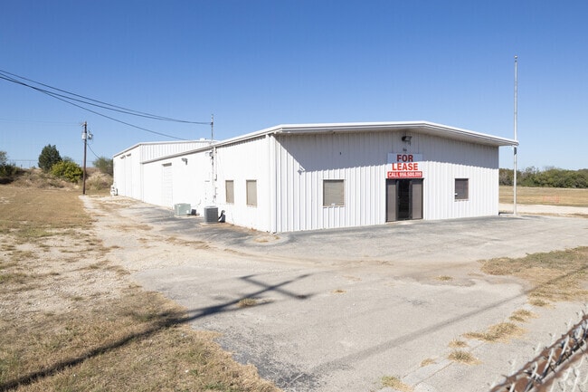
Property Record
18523 Interstate 35 N, Schertz, TX 78154
NEARBY LISTINGS FOR SALE OR LEASE
Property Detail
18523 Interstate 35 N
2G0244-0000-01600-0-00
Martin & Walker
Industrialgeneral
ABS: 244 SUR: MARTIN & WALKER 1.5680 AC.
X
Guadalupe
48029C0285F
Texas
2023
2.80 AC
2025
Guadalupe County
210711
San Antonio
9,000 SF
San Antonio-New Braunfels, TX
DEMOGRAPHICS near 18523 Interstate 35 N
1 Mile
3 Mile
5 Mile
2024 Total Population
2,385
51,555
104,476
2029 Population
2,734
59,314
119,268
Pop Growth 2024-2029
+ 14.63%
+ 15.05%
+ 14.16%
Average Age
36
38
38
2024 Total Households
747
17,138
36,953
HH Growth 2024-2029
+ 14.73%
+ 15.33%
+ 14.13%
Median Household Inc
$115,066
$110,057
$94,947
Avg Household Size
3.20
3.00
2.80
2024 Avg HH Vehicles
2.00
2.00
2.00
Median Home Value
$277,429
$275,104
$262,274
Median Year Built
2007
2004
2003
Nearby Places
Map Layers
Map Styles
 Street
 Aerial
- Restaurants
- Banks
- Shops
- Fitness
- Groceries
PUBLIC TRANSPORTATION
AIRPORT
San Antonio International
DRIVE
WALK
Distance
San Antonio International
20 min
15.7 mi
Freight Ports
Calhoun Port
DRIVE
WALK
Distance
Calhoun Port
182 min
151.4 mi
SALE & LEASE HISTORY
LISTING DATE
SALE/LEASE

Sep 23, 2024
For Lease
Sep 23, 2016
For Sale
Apr 04, 2025
For Sale
Nearby Properties
Address
Land Use
TOTAL SIZE
Lot Size
Zoning
Address
Land Use
TOTAL SIZE
Lot Size
Zoning
566,929 SF
89.66 AC
Address
Land Use
TOTAL SIZE
Lot Size
Zoning
95,470 SF
35.26 AC
Address
Land Use
TOTAL SIZE
Lot Size
Zoning
Address
Land Use
TOTAL SIZE
Lot Size
Zoning
151,529 SF
18.40 AC
Address
Land Use
TOTAL SIZE
Lot Size
Zoning
55,640 SF
24.17 AC
Address
Land Use
TOTAL SIZE
Lot Size
Zoning
511,000 SF
32.40 AC
Address
Land Use
TOTAL SIZE
Lot Size
Zoning
430,320 SF
25.03 AC
Address
Land Use
TOTAL SIZE
Lot Size
Zoning
7,176 SF
24.22 AC
Address
Land Use
TOTAL SIZE
Lot Size
Zoning
358,036 SF
20.77 AC
Address
Land Use
TOTAL SIZE
Lot Size
Zoning
223,965 SF
14.45 AC
Address
Land Use
TOTAL SIZE
Lot Size
Zoning
86,124 SF
9.37 AC
Address
Land Use
TOTAL SIZE
Lot Size
Zoning
73,813 SF
17.33 AC
Address
Land Use
TOTAL SIZE
Lot Size
Zoning
312,696 SF
18.01 AC
Address
Land Use
TOTAL SIZE
Lot Size
Zoning
308,264 SF
26.51 AC
Address
Land Use
TOTAL SIZE
Lot Size
Zoning
307,240 SF
20.16 AC
Address
Land Use
TOTAL SIZE
Lot Size
Zoning
112,870 SF
13.32 AC
Address
Land Use
TOTAL SIZE
Lot Size
Zoning
576 SF
41.86 AC
Address
Land Use
TOTAL SIZE
Lot Size
Zoning
321,016 SF
18.67 AC
Address
Land Use
TOTAL SIZE
Lot Size
Zoning
126,334 SF
30.38 AC
Address
Land Use
TOTAL SIZE
Lot Size
Zoning
103,044 SF
13.50 AC
Address
Land Use
TOTAL SIZE
Lot Size
Zoning
30,994 SF
29.09 AC
Address
Land Use
TOTAL SIZE
Lot Size
Zoning
267,716 SF
21.11 AC
Address
Land Use
TOTAL SIZE
Lot Size
Zoning
19,650 SF
32.94 AC
Address
Land Use
TOTAL SIZE
Lot Size
Zoning
102,924 SF
14.23 AC
Address
Land Use
TOTAL SIZE
Lot Size
Zoning
202,165 SF
23.97 AC
Address
Land Use
TOTAL SIZE
Lot Size
Zoning
85,117 SF
11 AC
Address
Land Use
TOTAL SIZE
Lot Size
Zoning
197,100 SF
11.43 AC
Address
Land Use
TOTAL SIZE
Lot Size
Zoning
215,765 SF
14.98 AC
Address
Land Use
TOTAL SIZE
Lot Size
Zoning
263,165 SF
4.81 AC
Address
Land Use
TOTAL SIZE
Lot Size
Zoning
77,652 SF
15.08 AC
The World's #1 Commercial Real Estate Marketplace
Connect with us
© 2025 CoStar Group
The information above has been obtained from sources believed reliable. While we do not doubt its accuracy we have not verified it and make no guarantee, warranty or representation about it. It is your responsibility to independently confirm its accuracy and completeness. Any projections, opinions, assumptions, or estimates used are for example only and do not represent the current or future performance of the property. The value of this transaction to you depends on tax and other factors which should be evaluated by your tax, financial, and legal advisors. You and your advisors should conduct a careful, independent investigation of the property to determine to your satisfaction the suitability of the property for your needs.