Property Record
18530 Buchanan St Ne, Cedar, MN 55011
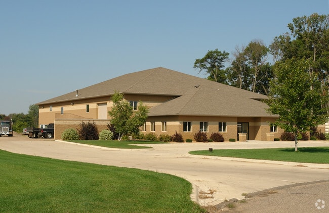

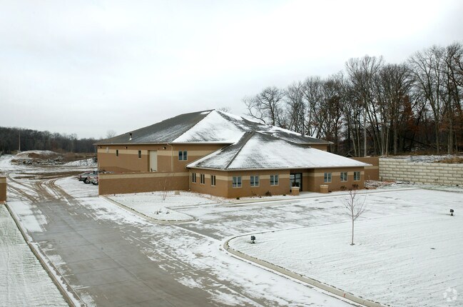
Property Detail
18530 Buchanan St Ne
32-33-23-23-0010
THE S 675.14 FT OF SW1/4 OF NW1/4 OF SEC 32 TWP 33 RGE 23, EX N 337.42 FT THEREOF, ALSO EX E 33 FT THEREOF, SUBJ TO EASE OF R
Industrialgeneral
Anoka
A Areas with a 1% annual chance of flooding and a 26% chance of flooding over the life of a 30-year mortgage.
Minnesota
2026
10.04 AC
2026
North Central
050110
Minneapolis/St Paul
11,094 SF
Minneapolis-St. Paul-Bloomington, MN-WI
NEARBY LISTINGS FOR SALE OR LEASE
DEMOGRAPHICS near 18530 Buchanan St Ne
1 mile
3 mile
5 mile
2025 Total Population
1,115
9,242
30,635
2030 Population
1,167
9,604
31,697
Pop Growth 2025-2030
+ 4.66%
+ 3.92%
+ 3.47%
Average Age
42
42
41
2025 Total Households
415
3,351
10,581
HH Growth 2025-2030
+ 4.82%
+ 3.97%
+ 3.53%
Median Household Inc
$85,964
$102,223
$122,741
Avg Household Size
2.70
2.70
2.90
2025 Avg HH Vehicles
3.00
3.00
3.00
Median Home Value
$422,388
$397,956
$425,173
Median Year Built
1992
1986
1991
Nearby Places
Map Layers
Map Styles
 Street
 Aerial
Layers
 Traffic
 Biking
Places
Listings with unknown addresses are not visible on the map
- Restaurants
- Banks
- Shops
- Fitness
- Groceries
PUBLIC TRANSPORTATION
AIRPORT
Minneapolis-St Paul International/Wold-Chamberlain
Drive
Walk
Distance
Minneapolis-St Paul International/Wold-Chamberlain
54 min
38.7 mi
Nearby Properties
Address
Land Use
TOTAL SIZE
Lot Size
Zoning
Address
Land Use
TOTAL SIZE
Lot Size
Zoning
5.98 AC
Address
Land Use
TOTAL SIZE
Lot Size
Zoning
Address
Land Use
TOTAL SIZE
Lot Size
Zoning
63,671 SF
40 AC
Address
Land Use
TOTAL SIZE
Lot Size
Zoning
102,360 SF
6.06 AC
Address
Land Use
TOTAL SIZE
Lot Size
Zoning
Address
Land Use
TOTAL SIZE
Lot Size
Zoning
53,180 SF
30.46 AC
Address
Land Use
TOTAL SIZE
Lot Size
Zoning
50,500 SF
27.20 AC
Address
Land Use
TOTAL SIZE
Lot Size
Zoning
28,600 SF
4.37 AC
Address
Land Use
TOTAL SIZE
Lot Size
Zoning
Address
Land Use
TOTAL SIZE
Lot Size
Zoning
22,656 SF
12.10 AC
Address
Land Use
TOTAL SIZE
Lot Size
Zoning
22,185 SF
Address
Land Use
TOTAL SIZE
Lot Size
Zoning
Address
Land Use
TOTAL SIZE
Lot Size
Zoning
62,624 SF
12 AC
Address
Land Use
TOTAL SIZE
Lot Size
Zoning
Address
Land Use
TOTAL SIZE
Lot Size
Zoning
1,120 SF
6.02 AC
Address
Land Use
TOTAL SIZE
Lot Size
Zoning
Address
Land Use
TOTAL SIZE
Lot Size
Zoning
Address
Land Use
TOTAL SIZE
Lot Size
Zoning
14,742 SF
34.67 AC
Address
Land Use
TOTAL SIZE
Lot Size
Zoning
22,292 SF
5.40 AC
Address
Land Use
TOTAL SIZE
Lot Size
Zoning
6,883 SF
2.63 AC
Address
Land Use
TOTAL SIZE
Lot Size
Zoning
22,400 SF
5.60 AC
Address
Land Use
TOTAL SIZE
Lot Size
Zoning
23,920 SF
2.83 AC
Address
Land Use
TOTAL SIZE
Lot Size
Zoning
17,100 SF
2.09 AC
Address
Land Use
TOTAL SIZE
Lot Size
Zoning
5,290 SF
2.80 AC
Address
Land Use
TOTAL SIZE
Lot Size
Zoning
17,144 SF
2.35 AC
Address
Land Use
TOTAL SIZE
Lot Size
Zoning
19,800 SF
2.32 AC
Address
Land Use
TOTAL SIZE
Lot Size
Zoning
66,271 SF
8.15 AC
Address
Land Use
TOTAL SIZE
Lot Size
Zoning
10,560 SF
7.50 AC
The World's #1 Commercial Real Estate Marketplace
Connect with us
© 2026 CoStar Group
The information above has been obtained from sources believed reliable. While we do not doubt its accuracy we have not verified it and make no guarantee, warranty or representation about it. It is your responsibility to independently confirm its accuracy and completeness. Any projections, opinions, assumptions, or estimates used are for example only and do not represent the current or future performance of the property. The value of this transaction to you depends on tax and other factors which should be evaluated by your tax, financial, and legal advisors. You and your advisors should conduct a careful, independent investigation of the property to determine to your satisfaction the suitability of the property for your needs.