Property Record
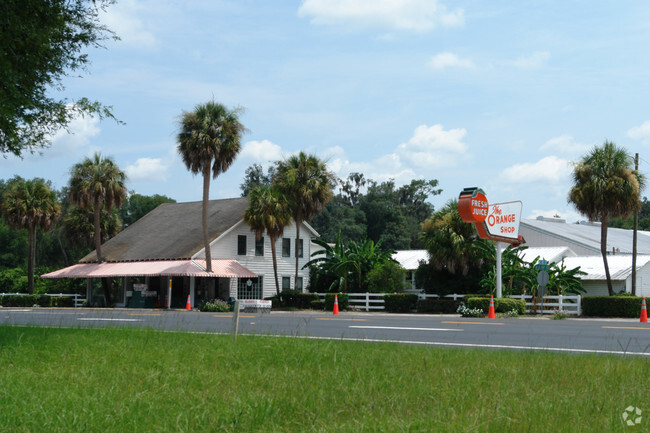
18545 N Us Highway 301, Citra, FL 32113


NEARBY LISTINGS FOR SALE OR LEASE
Property Detail
18545 N Us Highway 301
03370-000-00
SEC 28 TWP 12 RGE 22 COM NE COR S 520.33 FT W 452.42 FT S 1771.98 FT S 196.93 FT W 300 FT TO POB N 515.50 FT W 516.26 FT S WITH E ROW US 301 TO INT CENTERLINE OF EAST-WEST PAVED RD E 528.67 FT TO POB
Storebuilding
Marion
X
Florida
12083C0165D
6.18 AC
2025
Outlying Marion County
2025
Ocala
000201
Ocala, FL
11,548 SF
DEMOGRAPHICS near 18545 N Us Highway 301
1 Mile
3 Mile
5 Mile
2024 Total Population
546
3,638
6,007
2029 Population
622
4,153
6,807
Pop Growth 2024-2029
+ 13.92%
+ 14.16%
+ 13.32%
Average Age
43
43
44
2024 Total Households
219
1,462
2,457
HH Growth 2024-2029
+ 14.16%
+ 14.02%
+ 13.19%
Median Household Inc
$27,567
$35,333
$42,819
Avg Household Size
2.40
2.40
2.40
2024 Avg HH Vehicles
2.00
2.00
2.00
Median Home Value
$303,205
$127,659
$168,288
Median Year Built
1983
1985
1986
Nearby Places
Map Layers
Map Styles
 Street
 Aerial
- Restaurants
- Banks
- Shops
- Fitness
- Groceries
PUBLIC TRANSPORTATION
AIRPORT
Gainesville Regional
DRIVE
WALK
Distance
Gainesville Regional
44 min
31.4 mi
Nearby Properties
Address
Land Use
TOTAL SIZE
Lot Size
Zoning
Address
Land Use
TOTAL SIZE
Lot Size
Zoning
40,022 SF
61 AC
A1
Address
Land Use
TOTAL SIZE
Lot Size
Zoning
320 AC
A1
Address
Land Use
TOTAL SIZE
Lot Size
Zoning
12,691 SF
2.26 AC
B4
Address
Land Use
TOTAL SIZE
Lot Size
Zoning
21,000 SF
8.95 AC
B4
Address
Land Use
TOTAL SIZE
Lot Size
Zoning
768 SF
6.26 AC
RR
Address
Land Use
TOTAL SIZE
Lot Size
Zoning
12,500 SF
7.75 AC
B5
Address
Land Use
TOTAL SIZE
Lot Size
Zoning
22,080 SF
3.05 AC
B4
Address
Land Use
TOTAL SIZE
Lot Size
Zoning
8,381 SF
1.82 AC
A1
Address
Land Use
TOTAL SIZE
Lot Size
Zoning
7,131 SF
294 AC
A1
Address
Land Use
TOTAL SIZE
Lot Size
Zoning
8,320 SF
1.09 AC
B4
Address
Land Use
TOTAL SIZE
Lot Size
Zoning
4,242 SF
25.77 AC
A1
Address
Land Use
TOTAL SIZE
Lot Size
Zoning
5,400 SF
3 AC
B2
Address
Land Use
TOTAL SIZE
Lot Size
Zoning
5,474 SF
6.45 AC
RC1
Address
Land Use
TOTAL SIZE
Lot Size
Zoning
5,225 SF
560.95 AC
A1
Address
Land Use
TOTAL SIZE
Lot Size
Zoning
4,965 SF
1.53 AC
B4
Address
Land Use
TOTAL SIZE
Lot Size
Zoning
6,158 SF
3.50 AC
B4
Address
Land Use
TOTAL SIZE
Lot Size
Zoning
3,360 SF
0.65 AC
B4
Address
Land Use
TOTAL SIZE
Lot Size
Zoning
6,224 SF
10 AC
M1
Address
Land Use
TOTAL SIZE
Lot Size
Zoning
8,000 SF
1 AC
B4
Address
Land Use
TOTAL SIZE
Lot Size
Zoning
2,440 SF
1.59 AC
BH
Address
Land Use
TOTAL SIZE
Lot Size
Zoning
10,550 SF
4.07 AC
B4
Address
Land Use
TOTAL SIZE
Lot Size
Zoning
2,060 SF
9.22 AC
A1
Address
Land Use
TOTAL SIZE
Lot Size
Zoning
6,238 SF
2.38 AC
B4
Address
Land Use
TOTAL SIZE
Lot Size
Zoning
2,999 SF
21.35 AC
A1
Address
Land Use
TOTAL SIZE
Lot Size
Zoning
2,113 SF
5 AC
A1
Address
Land Use
TOTAL SIZE
Lot Size
Zoning
1,044 SF
3.32 AC
PRV
Address
Land Use
TOTAL SIZE
Lot Size
Zoning
3,242 SF
3.30 AC
B4
Address
Land Use
TOTAL SIZE
Lot Size
Zoning
5,593 SF
4.11 AC
A1
Address
Land Use
TOTAL SIZE
Lot Size
Zoning
5,900 SF
65.09 AC
A1
The World's #1 Commercial Real Estate Marketplace
Connect with us
© 2025 CoStar Group
The information above has been obtained from sources believed reliable. While we do not doubt its accuracy we have not verified it and make no guarantee, warranty or representation about it. It is your responsibility to independently confirm its accuracy and completeness. Any projections, opinions, assumptions, or estimates used are for example only and do not represent the current or future performance of the property. The value of this transaction to you depends on tax and other factors which should be evaluated by your tax, financial, and legal advisors. You and your advisors should conduct a careful, independent investigation of the property to determine to your satisfaction the suitability of the property for your needs.