Property Record
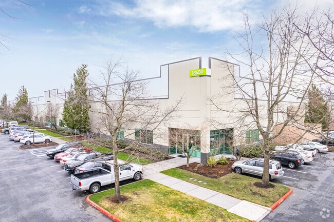
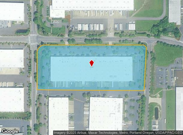
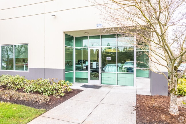
18550 Ne Riverside Pkwy, Portland, OR 97230

Current Lease Availabilities
NEARBY LISTINGS FOR SALE OR LEASE
Property Detail
18550 Ne Riverside Pkwy
Portland-Vancouver-Hillsboro, OR-WA
Southshore Corporate Pk
R273768
SOUTHSHORE CORPORATE PK, LOT 2, LAND & IMPS SEE R520700 (R781600101) FOR OTHER IMPS & R646281 (R781600102) FOR MACH & EQUIP, ENTERPRISE ZONE, POTENTIAL ADDITIONAL TAX
Industrialgeneral
Multnomah
X
Oregon
53011C0550D
2
2025
9.34 AC
2025
East Columbia Corridor
010200
Portland
164,050 SF
DEMOGRAPHICS near 18550 Ne Riverside Pkwy
1 Mile
3 Mile
5 Mile
2024 Total Population
1,101
77,409
267,994
2029 Population
1,073
76,713
268,195
Pop Growth 2024-2029
(2.54%)
(0.90%)
+ 0.08%
Average Age
48
39
40
2024 Total Households
432
27,690
98,747
HH Growth 2024-2029
(2.78%)
(1.22%)
(0.04%)
Median Household Inc
$106,971
$64,961
$67,257
Avg Household Size
2.50
2.70
2.60
2024 Avg HH Vehicles
2.00
2.00
2.00
Median Home Value
$421,600
$400,201
$404,648
Median Year Built
1998
1983
1982
Nearby Places
- Restaurants
- Banks
- Shops
- Fitness
- Groceries
PUBLIC TRANSPORTATION
AIRPORT
Portland International
DRIVE
WALK
Distance
Portland International
14 min
6.9 mi
Freight Ports
Port of Portland
DRIVE
WALK
Distance
Port of Portland
23 min
15.3 mi
Nearby Properties
Address
Land Use
TOTAL SIZE
Lot Size
Zoning
Address
Land Use
TOTAL SIZE
Lot Size
Zoning
21.39 AC
NULL
Address
Land Use
TOTAL SIZE
Lot Size
Zoning
3,800 SF
27.96 AC
LI
Address
Land Use
TOTAL SIZE
Lot Size
Zoning
Address
Land Use
TOTAL SIZE
Lot Size
Zoning
64.20 AC
HI
Address
Land Use
TOTAL SIZE
Lot Size
Zoning
137.54 AC
GI
Address
Land Use
TOTAL SIZE
Lot Size
Zoning
365,000 SF
38.87 AC
GI
Address
Land Use
TOTAL SIZE
Lot Size
Zoning
260,995 SF
6.49 AC
RTC
Address
Land Use
TOTAL SIZE
Lot Size
Zoning
698,484 SF
34.21 AC
GI
Address
Land Use
TOTAL SIZE
Lot Size
Zoning
109,231 SF
7.87 AC
HI
Address
Land Use
TOTAL SIZE
Lot Size
Zoning
8.69 AC
NULL
Address
Land Use
TOTAL SIZE
Lot Size
Zoning
60,788 SF
10.21 AC
GI
Address
Land Use
TOTAL SIZE
Lot Size
Zoning
174,510 SF
9.76 AC
BP
Address
Land Use
TOTAL SIZE
Lot Size
Zoning
126,012 SF
7.04 AC
MF-18
Address
Land Use
TOTAL SIZE
Lot Size
Zoning
378,000 SF
18.91 AC
LI
Address
Land Use
TOTAL SIZE
Lot Size
Zoning
21.39 AC
HI
Address
Land Use
TOTAL SIZE
Lot Size
Zoning
489,695 SF
23.76 AC
IG2P
Address
Land Use
TOTAL SIZE
Lot Size
Zoning
175,276 SF
13.05 AC
IG2
Address
Land Use
TOTAL SIZE
Lot Size
Zoning
191,466 SF
34.68 AC
R/CSP
Address
Land Use
TOTAL SIZE
Lot Size
Zoning
492,161 SF
28.13 AC
IG2
Address
Land Use
TOTAL SIZE
Lot Size
Zoning
219,470 SF
9.77 AC
R_MF
Address
Land Use
TOTAL SIZE
Lot Size
Zoning
Address
Land Use
TOTAL SIZE
Lot Size
Zoning
118,460 SF
28.10 AC
BP
Address
Land Use
TOTAL SIZE
Lot Size
Zoning
357,603 SF
22.69 AC
GI
Address
Land Use
TOTAL SIZE
Lot Size
Zoning
86,138 SF
5.93 AC
R7
Address
Land Use
TOTAL SIZE
Lot Size
Zoning
304,649 SF
14.13 AC
GI
Address
Land Use
TOTAL SIZE
Lot Size
Zoning
11,000 SF
8.60 AC
IG2
Address
Land Use
TOTAL SIZE
Lot Size
Zoning
733,232 SF
37.41 AC
NULL
Address
Land Use
TOTAL SIZE
Lot Size
Zoning
Address
Land Use
TOTAL SIZE
Lot Size
Zoning
296,622 SF
27.67 AC
LI
Address
Land Use
TOTAL SIZE
Lot Size
Zoning
121,144 SF
2.30 AC
RM3
The World's #1 Commercial Real Estate Marketplace
Connect with us
© 2025 CoStar Group
The information above has been obtained from sources believed reliable. While we do not doubt its accuracy we have not verified it and make no guarantee, warranty or representation about it. It is your responsibility to independently confirm its accuracy and completeness. Any projections, opinions, assumptions, or estimates used are for example only and do not represent the current or future performance of the property. The value of this transaction to you depends on tax and other factors which should be evaluated by your tax, financial, and legal advisors. You and your advisors should conduct a careful, independent investigation of the property to determine to your satisfaction the suitability of the property for your needs.