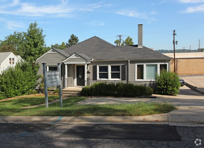
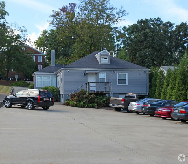
Property Record
1856 Lancaster Rd, Birmingham, AL 35209

Property Detail
1856 Lancaster Rd
28-00-18-2-001-002.000
LOT 28 SMYTHES ADD TO MAYFAIR
Financialbuilding
Jefferson
C1
Alabama
B and X Area of moderate flood hazard, usually the area between the limits of the 100-year and 500-year floods.
28
2024
0.19 AC
2025
Midtown
010702
Birmingham
2,708 SF
Birmingham, AL
NEARBY LISTINGS FOR SALE OR LEASE
DEMOGRAPHICS near 1856 Lancaster Rd
1 mile
3 mile
5 mile
2025 Total Population
10,700
79,173
183,484
2030 Population
10,624
78,473
182,161
Pop Growth 2025-2030
(0.71%)
(0.88%)
(0.72%)
Average Age
34
37
38
2025 Total Households
3,354
34,809
79,666
HH Growth 2025-2030
(1.70%)
(0.84%)
(0.76%)
Median Household Inc
$137,646
$73,506
$67,196
Avg Household Size
2.50
2.00
2.10
2025 Avg HH Vehicles
2.00
2.00
2.00
Median Home Value
$752,669
$605,397
$430,552
Median Year Built
1958
1970
1970
Nearby Places
Map Layers
Map Styles
 Street
 Aerial
Layers
 Traffic
 Biking
Places
Listings with unknown addresses are not visible on the map
- Restaurants
- Banks
- Shops
- Fitness
- Groceries
PUBLIC TRANSPORTATION
COMMUTER RAIL
Drive
Walk
Distance
6 min
3.8 mi
AIRPORT
Birmingham-Shuttlesworth International
Drive
Walk
Distance
Birmingham-Shuttlesworth International
12 min
7.6 mi
Nearby Properties
Address
Land Use
TOTAL SIZE
Lot Size
Zoning
Address
Land Use
TOTAL SIZE
Lot Size
Zoning
296,284 SF
12 AC
OI
Address
Land Use
TOTAL SIZE
Lot Size
Zoning
189,447 SF
4 AC
B4
Address
Land Use
TOTAL SIZE
Lot Size
Zoning
978,879 SF
44 AC
I3
Address
Land Use
TOTAL SIZE
Lot Size
Zoning
239,334 SF
4 AC
B6
Address
Land Use
TOTAL SIZE
Lot Size
Zoning
31,980 SF
100 AC
I3/P
Address
Land Use
TOTAL SIZE
Lot Size
Zoning
261,311 SF
21 AC
C1
Address
Land Use
TOTAL SIZE
Lot Size
Zoning
154,474 SF
12.50 AC
R-D
Address
Land Use
TOTAL SIZE
Lot Size
Zoning
46,161 SF
1 AC
M1-B
Address
Land Use
TOTAL SIZE
Lot Size
Zoning
95,993 SF
3.67 AC
M1
Address
Land Use
TOTAL SIZE
Lot Size
Zoning
229,669 SF
2.75 AC
B4
Address
Land Use
TOTAL SIZE
Lot Size
Zoning
109,411 SF
3 AC
B4
Address
Land Use
TOTAL SIZE
Lot Size
Zoning
1,666 SF
2 AC
M1
Address
Land Use
TOTAL SIZE
Lot Size
Zoning
30,453 SF
0.87 AC
B2
Address
Land Use
TOTAL SIZE
Lot Size
Zoning
200,927 SF
19 AC
PMUD
Address
Land Use
TOTAL SIZE
Lot Size
Zoning
51,699 SF
1 AC
PCD-
Address
Land Use
TOTAL SIZE
Lot Size
Zoning
81,807 SF
6 AC
C1
Address
Land Use
TOTAL SIZE
Lot Size
Zoning
143,200 SF
23.49 AC
R3/O
Address
Land Use
TOTAL SIZE
Lot Size
Zoning
109,819 SF
2.91 AC
M2
Address
Land Use
TOTAL SIZE
Lot Size
Zoning
62,350 SF
1.29 AC
B-4
Address
Land Use
TOTAL SIZE
Lot Size
Zoning
156,986 SF
1.29 AC
M1
Address
Land Use
TOTAL SIZE
Lot Size
Zoning
311,982 SF
30 AC
R6
Address
Land Use
TOTAL SIZE
Lot Size
Zoning
329,064 SF
9 AC
I3
Address
Land Use
TOTAL SIZE
Lot Size
Zoning
97,377 SF
1.63 AC
M1
Address
Land Use
TOTAL SIZE
Lot Size
Zoning
62,543 SF
1.78 AC
R-D
Address
Land Use
TOTAL SIZE
Lot Size
Zoning
69,981 SF
5 AC
B2
Address
Land Use
TOTAL SIZE
Lot Size
Zoning
92,332 SF
8.40 AC
Address
Land Use
TOTAL SIZE
Lot Size
Zoning
33,209 SF
3 AC
C4B
Address
Land Use
TOTAL SIZE
Lot Size
Zoning
65,685 SF
10 AC
B2
Address
Land Use
TOTAL SIZE
Lot Size
Zoning
61,663 SF
1 AC
M1
Address
Land Use
TOTAL SIZE
Lot Size
Zoning
331,413 SF
14 AC
R6
The World's #1 Commercial Real Estate Marketplace
Connect with us
© 2026 CoStar Group
The information above has been obtained from sources believed reliable. While we do not doubt its accuracy we have not verified it and make no guarantee, warranty or representation about it. It is your responsibility to independently confirm its accuracy and completeness. Any projections, opinions, assumptions, or estimates used are for example only and do not represent the current or future performance of the property. The value of this transaction to you depends on tax and other factors which should be evaluated by your tax, financial, and legal advisors. You and your advisors should conduct a careful, independent investigation of the property to determine to your satisfaction the suitability of the property for your needs.