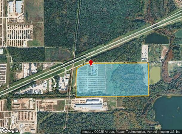
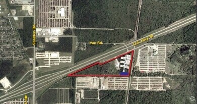
Property Record
0 Highway 90, Houston, TX 77049

NEARBY LISTINGS FOR SALE OR LEASE
Property Detail
0 Highway 90
Houston-Pasadena-The Woodlands, TX
Abst 483 J Jones
0431490010349
PT TRS 20C & 20D (AG-USE) ABST 483 J JONES
Agriculturalland
Harris
AE
Texas
48201C0730M
61.57 AC
2024
Northeast Hwy 90
2025
Houston
252201
DEMOGRAPHICS near 0 Highway 90
1 Mile
3 Mile
5 Mile
2024 Total Population
49
6,654
80,101
2029 Population
52
6,740
81,722
Pop Growth 2024-2029
+ 6.12%
+ 1.29%
+ 2.02%
Average Age
37
34
34
2024 Total Households
17
2,056
24,801
HH Growth 2024-2029
+ 5.88%
+ 1.22%
+ 1.96%
Median Household Inc
$106,250
$64,225
$67,679
Avg Household Size
2.90
3.20
3.20
2024 Avg HH Vehicles
2.00
2.00
2.00
Median Home Value
$237,500
$186,007
$190,770
Median Year Built
1992
1993
1998
Nearby Places
Map Layers
Map Styles
 Street
 Aerial
- Restaurants
- Banks
- Shops
- Fitness
- Groceries
PUBLIC TRANSPORTATION
AIRPORT
George Bush Intcntl/Houston
DRIVE
WALK
Distance
George Bush Intcntl/Houston
33 min
21.4 mi
William P Hobby
DRIVE
WALK
Distance
William P Hobby
41 min
23.5 mi
Freight Ports
Port of Houston
DRIVE
WALK
Distance
Port of Houston
28 min
15.5 mi
SALE & LEASE HISTORY
LISTING DATE
SALE/LEASE

Sep 25, 2016
For Lease
Nearby Properties
Address
Land Use
TOTAL SIZE
Lot Size
Zoning
Address
Land Use
TOTAL SIZE
Lot Size
Zoning
Address
Land Use
TOTAL SIZE
Lot Size
Zoning
330.90 AC
Address
Land Use
TOTAL SIZE
Lot Size
Zoning
409.44 AC
Address
Land Use
TOTAL SIZE
Lot Size
Zoning
1,056.36 AC
Address
Land Use
TOTAL SIZE
Lot Size
Zoning
183.58 AC
Address
Land Use
TOTAL SIZE
Lot Size
Zoning
36.04 AC
Address
Land Use
TOTAL SIZE
Lot Size
Zoning
315.64 AC
Address
Land Use
TOTAL SIZE
Lot Size
Zoning
338.08 AC
Address
Land Use
TOTAL SIZE
Lot Size
Zoning
263,162 SF
75.07 AC
Address
Land Use
TOTAL SIZE
Lot Size
Zoning
Address
Land Use
TOTAL SIZE
Lot Size
Zoning
434,978 SF
37.08 AC
Address
Land Use
TOTAL SIZE
Lot Size
Zoning
430,841 SF
193.79 AC
Address
Land Use
TOTAL SIZE
Lot Size
Zoning
5.68 AC
Address
Land Use
TOTAL SIZE
Lot Size
Zoning
315.64 AC
Address
Land Use
TOTAL SIZE
Lot Size
Zoning
330,927 SF
82.08 AC
Address
Land Use
TOTAL SIZE
Lot Size
Zoning
392.95 AC
Address
Land Use
TOTAL SIZE
Lot Size
Zoning
260,792 SF
206.39 AC
Address
Land Use
TOTAL SIZE
Lot Size
Zoning
174,606 SF
55.34 AC
Address
Land Use
TOTAL SIZE
Lot Size
Zoning
634,459 SF
469.92 AC
Address
Land Use
TOTAL SIZE
Lot Size
Zoning
392.95 AC
Address
Land Use
TOTAL SIZE
Lot Size
Zoning
158,856 SF
16.04 AC
Address
Land Use
TOTAL SIZE
Lot Size
Zoning
71,892 SF
82.98 AC
Address
Land Use
TOTAL SIZE
Lot Size
Zoning
113,290 SF
30.61 AC
Address
Land Use
TOTAL SIZE
Lot Size
Zoning
188,510 SF
80.78 AC
Address
Land Use
TOTAL SIZE
Lot Size
Zoning
120,468 SF
37.05 AC
Address
Land Use
TOTAL SIZE
Lot Size
Zoning
239,419 SF
33 AC
Address
Land Use
TOTAL SIZE
Lot Size
Zoning
66,450 SF
18 AC
Address
Land Use
TOTAL SIZE
Lot Size
Zoning
252,516 SF
74.53 AC
Address
Land Use
TOTAL SIZE
Lot Size
Zoning
124,140 SF
9.29 AC
Address
Land Use
TOTAL SIZE
Lot Size
Zoning
167,548 SF
192.19 AC
The World's #1 Commercial Real Estate Marketplace
Connect with us
© 2026 CoStar Group
The information above has been obtained from sources believed reliable. While we do not doubt its accuracy we have not verified it and make no guarantee, warranty or representation about it. It is your responsibility to independently confirm its accuracy and completeness. Any projections, opinions, assumptions, or estimates used are for example only and do not represent the current or future performance of the property. The value of this transaction to you depends on tax and other factors which should be evaluated by your tax, financial, and legal advisors. You and your advisors should conduct a careful, independent investigation of the property to determine to your satisfaction the suitability of the property for your needs.