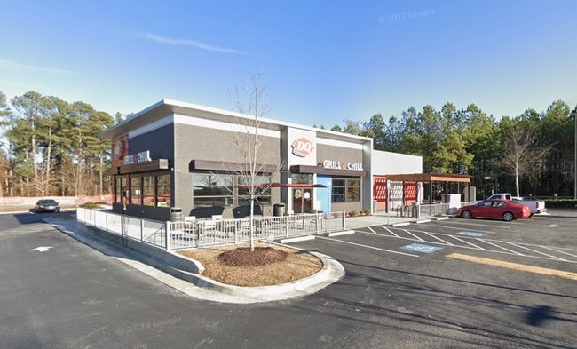
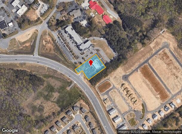
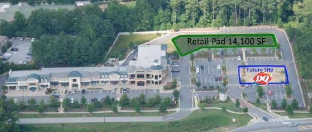
Property Record
1858 Auburn Rd, Dacula, GA 30019
NEARBY LISTINGS FOR SALE OR LEASE
Property Detail
1858 Auburn Rd
3-001C-257
TR3 VERANDA AT FORT DANIEL
Restaurantdrivein
Gwinnett
X
Georgia
13135C0036F
1.02 AC
2025
Lawrenceville/Lilburn
2025
Atlanta
050620
Atlanta-Sandy Springs-Roswell, GA
3,476 SF
DEMOGRAPHICS near 1858 Auburn Rd
1 Mile
3 Mile
5 Mile
2024 Total Population
9,814
58,826
138,330
2029 Population
10,242
61,759
146,359
Pop Growth 2024-2029
+ 4.36%
+ 4.99%
+ 5.80%
Average Age
37
38
38
2024 Total Households
2,960
18,175
44,109
HH Growth 2024-2029
+ 4.46%
+ 5.12%
+ 5.97%
Median Household Inc
$99,323
$104,093
$97,788
Avg Household Size
3.30
3.10
3.10
2024 Avg HH Vehicles
3.00
2.00
2.00
Median Home Value
$322,804
$341,477
$329,638
Median Year Built
2002
2003
2002
Nearby Places
Map Layers
Map Styles
 Street
 Aerial
- Restaurants
- Banks
- Shops
- Fitness
- Groceries
SALE & LEASE HISTORY
LISTING DATE
SALE/LEASE

Sep 25, 2018
For Sale
Sep 24, 2016
For Sale
Jun 01, 2020
For Sale
Nearby Properties
Address
Land Use
TOTAL SIZE
Lot Size
Zoning
Address
Land Use
TOTAL SIZE
Lot Size
Zoning
473,883 SF
85.71 AC
RA200
Address
Land Use
TOTAL SIZE
Lot Size
Zoning
891.66 AC
R100
Address
Land Use
TOTAL SIZE
Lot Size
Zoning
1,113,809 SF
57.50 AC
M1
Address
Land Use
TOTAL SIZE
Lot Size
Zoning
403,129 SF
126.91 AC
RA200
Address
Land Use
TOTAL SIZE
Lot Size
Zoning
394,831 SF
16.37 AC
RM24
Address
Land Use
TOTAL SIZE
Lot Size
Zoning
684,003 SF
60.84 AC
M1
Address
Land Use
TOTAL SIZE
Lot Size
Zoning
619,498 SF
51.81 AC
M1
Address
Land Use
TOTAL SIZE
Lot Size
Zoning
335,641 SF
28.90 AC
RM10
Address
Land Use
TOTAL SIZE
Lot Size
Zoning
348,358 SF
7.80 AC
H7
Address
Land Use
TOTAL SIZE
Lot Size
Zoning
280,168 SF
29.08 AC
M1
Address
Land Use
TOTAL SIZE
Lot Size
Zoning
233,266 SF
17.39 AC
RA200
Address
Land Use
TOTAL SIZE
Lot Size
Zoning
352,952 SF
16.97 AC
RM10
Address
Land Use
TOTAL SIZE
Lot Size
Zoning
250,960 SF
17.55 AC
OI
Address
Land Use
TOTAL SIZE
Lot Size
Zoning
101,343 SF
44.33 AC
R1400
Address
Land Use
TOTAL SIZE
Lot Size
Zoning
158,307 SF
26.77 AC
R75
Address
Land Use
TOTAL SIZE
Lot Size
Zoning
138,229 SF
7.97 AC
OI
Address
Land Use
TOTAL SIZE
Lot Size
Zoning
23,126 SF
88.56 AC
RA200
Address
Land Use
TOTAL SIZE
Lot Size
Zoning
124,425 SF
20.73 AC
RA200
Address
Land Use
TOTAL SIZE
Lot Size
Zoning
329,765 SF
33.06 AC
C2
Address
Land Use
TOTAL SIZE
Lot Size
Zoning
110,356 SF
20.42 AC
RA200
Address
Land Use
TOTAL SIZE
Lot Size
Zoning
97,824 SF
13.71 AC
M1
Address
Land Use
TOTAL SIZE
Lot Size
Zoning
93,702 SF
5.66 AC
C2
Address
Land Use
TOTAL SIZE
Lot Size
Zoning
256,065 SF
34.36 AC
M1
Address
Land Use
TOTAL SIZE
Lot Size
Zoning
116,332 SF
4.83 AC
OI
Address
Land Use
TOTAL SIZE
Lot Size
Zoning
84,890 SF
20.02 AC
RA200
Address
Land Use
TOTAL SIZE
Lot Size
Zoning
41,757 SF
19.66 AC
RA200
Address
Land Use
TOTAL SIZE
Lot Size
Zoning
206,107 SF
24.93 AC
C2
Address
Land Use
TOTAL SIZE
Lot Size
Zoning
117,207 SF
12.97 AC
C2
Address
Land Use
TOTAL SIZE
Lot Size
Zoning
89,487 SF
11.15 AC
C2
Address
Land Use
TOTAL SIZE
Lot Size
Zoning
91,115 SF
5.20 AC
C2
The World's #1 Commercial Real Estate Marketplace
Connect with us
© 2025 CoStar Group
The information above has been obtained from sources believed reliable. While we do not doubt its accuracy we have not verified it and make no guarantee, warranty or representation about it. It is your responsibility to independently confirm its accuracy and completeness. Any projections, opinions, assumptions, or estimates used are for example only and do not represent the current or future performance of the property. The value of this transaction to you depends on tax and other factors which should be evaluated by your tax, financial, and legal advisors. You and your advisors should conduct a careful, independent investigation of the property to determine to your satisfaction the suitability of the property for your needs.