Property Record
1859 Tim Holt Dr, Harrah, OK 73045
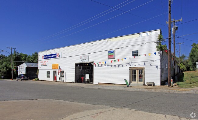


Property Detail
1859 Tim Holt Dr
Oklahoma City, OK
NAVARRES ADDITION 005 000 LOTS 17 THRU 24
198299030
Oklahoma
Shipyard
Oklahoma
AE The base floodplain where base flood elevations are provided. AE Zones are now used on new format FIRMs instead of A1-A30 Zones.
17-24
0
0.64 AC
2025
East Oklahoma County
109003
Oklahoma City
9,000 SF
NEARBY LISTINGS FOR SALE OR LEASE
DEMOGRAPHICS near 1859 Tim Holt Dr
1 mile
3 mile
5 mile
2024 Total Population
2,009
7,092
18,458
2029 Population
2,075
7,327
18,966
Pop Growth 2024-2029
+ 3.29%
+ 3.31%
+ 2.75%
Average Age
41
40
41
2024 Total Households
795
2,711
6,647
HH Growth 2024-2029
+ 3.52%
+ 3.54%
+ 3.02%
Median Household Inc
$60,877
$76,974
$88,417
Avg Household Size
2.40
2.50
2.60
2024 Avg HH Vehicles
2.00
2.00
2.00
Median Home Value
$267,999
$262,322
$276,506
Median Year Built
1980
1987
1990
Nearby Places
Map Layers
Map Styles
 Street
 Aerial
Transit
 Traffic
 Biking
Places
Listings with unknown addresses are not visible on the map
- Restaurants
- Banks
- Shops
- Fitness
- Groceries
PUBLIC TRANSPORTATION
AIRPORT
Will Rogers World
Drive
Walk
Distance
Will Rogers World
47 min
35.5 mi
Freight Ports
Tulsa Port Of Catoosa
Drive
Walk
Distance
Tulsa Port Of Catoosa
118 min
110.5 mi
SALE & LEASE HISTORY
LISTING DATE
SALE/LEASE

Sep 23, 2016
For Sale
Nearby Properties
Address
Land Use
TOTAL SIZE
Lot Size
Zoning
Address
Land Use
TOTAL SIZE
Lot Size
Zoning
28,054 SF
2.01 AC
Address
Land Use
TOTAL SIZE
Lot Size
Zoning
52,620 SF
2.48 AC
Address
Land Use
TOTAL SIZE
Lot Size
Zoning
99,544 SF
7.91 AC
Address
Land Use
TOTAL SIZE
Lot Size
Zoning
37,136 SF
6.76 AC
Address
Land Use
TOTAL SIZE
Lot Size
Zoning
1,012 SF
5 AC
Address
Land Use
TOTAL SIZE
Lot Size
Zoning
42,340 SF
8.07 AC
Address
Land Use
TOTAL SIZE
Lot Size
Zoning
6,946 SF
42.63 AC
Address
Land Use
TOTAL SIZE
Lot Size
Zoning
15,180 SF
1.84 AC
Address
Land Use
TOTAL SIZE
Lot Size
Zoning
21,660 SF
2.70 AC
Address
Land Use
TOTAL SIZE
Lot Size
Zoning
77,668 SF
4.98 AC
Address
Land Use
TOTAL SIZE
Lot Size
Zoning
21,348 SF
1.34 AC
Address
Land Use
TOTAL SIZE
Lot Size
Zoning
31,640 SF
5.19 AC
Address
Land Use
TOTAL SIZE
Lot Size
Zoning
21,918 SF
3.19 AC
Address
Land Use
TOTAL SIZE
Lot Size
Zoning
15,624 SF
1.59 AC
Address
Land Use
TOTAL SIZE
Lot Size
Zoning
1,344 SF
0.14 AC
Address
Land Use
TOTAL SIZE
Lot Size
Zoning
15,880 SF
31 AC
Address
Land Use
TOTAL SIZE
Lot Size
Zoning
19,083 SF
6.03 AC
Address
Land Use
TOTAL SIZE
Lot Size
Zoning
28,212 SF
7.61 AC
Address
Land Use
TOTAL SIZE
Lot Size
Zoning
1,794 SF
9.26 AC
Address
Land Use
TOTAL SIZE
Lot Size
Zoning
19,286 SF
2.27 AC
Address
Land Use
TOTAL SIZE
Lot Size
Zoning
12,000 SF
10.02 AC
Address
Land Use
TOTAL SIZE
Lot Size
Zoning
14,080 SF
31.57 AC
Address
Land Use
TOTAL SIZE
Lot Size
Zoning
1,898 SF
0.47 AC
Address
Land Use
TOTAL SIZE
Lot Size
Zoning
4,000 SF
1.02 AC
Address
Land Use
TOTAL SIZE
Lot Size
Zoning
9,220 SF
9.99 AC
Address
Land Use
TOTAL SIZE
Lot Size
Zoning
9,140 SF
0.96 AC
Address
Land Use
TOTAL SIZE
Lot Size
Zoning
5,870 SF
2.12 AC
Address
Land Use
TOTAL SIZE
Lot Size
Zoning
2,705 SF
0.32 AC
Address
Land Use
TOTAL SIZE
Lot Size
Zoning
15,150 SF
3.55 AC
The World's #1 Commercial Real Estate Marketplace
Connect with us
© 2026 CoStar Group
The information above has been obtained from sources believed reliable. While we do not doubt its accuracy we have not verified it and make no guarantee, warranty or representation about it. It is your responsibility to independently confirm its accuracy and completeness. Any projections, opinions, assumptions, or estimates used are for example only and do not represent the current or future performance of the property. The value of this transaction to you depends on tax and other factors which should be evaluated by your tax, financial, and legal advisors. You and your advisors should conduct a careful, independent investigation of the property to determine to your satisfaction the suitability of the property for your needs.