Property Record
186 Varner Rd, Palm Desert, CA 92211

Property Detail
186 Varner Rd
626-150-010
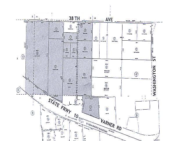
31.54 ACRES M/L IN POR W 1/2 OF SEC 1 T5S R6E FOR TOTAL DESCRIPTION SEE ASSESSORS MAPS
Desertorbarrenland
RIVERSIDE
SPZONE
California
AO River or stream flood hazard areas, and areas with a 1% or greater chance of shallow flooding each year. These areas have a 26% chance of flooding over the life of a 30-year mortgage.
22.50 AC
2024
Coachella Valley
2025
Inland Empire (California)
044520
Riverside-San Bernardino-Ontario, CA
NEARBY LISTINGS FOR SALE OR LEASE
DEMOGRAPHICS near 186 Varner Rd
1 mile
3 mile
5 mile
2025 Total Population
2,871
45,984
119,163
2030 Population
3,147
49,534
127,982
Pop Growth 2025-2030
+ 9.61%
+ 7.72%
+ 7.40%
Average Age
49
53
52
2025 Total Households
1,295
21,785
54,488
HH Growth 2025-2030
+ 9.34%
+ 7.73%
+ 7.36%
Median Household Inc
$153,596
$93,200
$91,501
Avg Household Size
2.20
2.10
2.10
2025 Avg HH Vehicles
2.00
2.00
2.00
Median Home Value
$686,268
$662,963
$643,528
Median Year Built
1991
1992
1993
Nearby Places
Map Layers
Map Styles
 Street
 Aerial
Layers
 Traffic
 Biking
Places
Listings with unknown addresses are not visible on the map
- Restaurants
- Banks
- Shops
- Fitness
- Groceries
PUBLIC TRANSPORTATION
AIRPORT
Palm Springs International
Drive
Walk
Distance
Palm Springs International
22 min
15.9 mi
Freight Ports
Port of San Diego
Drive
Walk
Distance
Port of San Diego
167 min
140.0 mi
SALE & LEASE HISTORY
LISTING DATE
SALE/LEASE

Sep 24, 2016
For Sale
Oct 31, 2017
For Sale
Nearby Properties
Address
Land Use
TOTAL SIZE
Lot Size
Zoning
Address
Land Use
TOTAL SIZE
Lot Size
Zoning
34,292 SF
34.67 AC
R112M
Address
Land Use
TOTAL SIZE
Lot Size
Zoning
110,000 SF
39.46 AC
Address
Land Use
TOTAL SIZE
Lot Size
Zoning
99,290 SF
14.97 AC
Address
Land Use
TOTAL SIZE
Lot Size
Zoning
15.90 AC
Address
Land Use
TOTAL SIZE
Lot Size
Zoning
32,576 SF
19.40 AC
CBOOK
Address
Land Use
TOTAL SIZE
Lot Size
Zoning
160,365 SF
6.98 AC
PC2
Address
Land Use
TOTAL SIZE
Lot Size
Zoning
110,354 SF
14.15 AC
RH
Address
Land Use
TOTAL SIZE
Lot Size
Zoning
166,750 SF
10.69 AC
PR-5
Address
Land Use
TOTAL SIZE
Lot Size
Zoning
284,977 SF
23.95 AC
Address
Land Use
TOTAL SIZE
Lot Size
Zoning
139,456 SF
8.02 AC
R-3
Address
Land Use
TOTAL SIZE
Lot Size
Zoning
208,171 SF
16.83 AC
CBOOK
Address
Land Use
TOTAL SIZE
Lot Size
Zoning
96,384 SF
9.90 AC
SPZONE
Address
Land Use
TOTAL SIZE
Lot Size
Zoning
131,298 SF
10.06 AC
CPS
Address
Land Use
TOTAL SIZE
Lot Size
Zoning
158,234 SF
7.38 AC
IP
Address
Land Use
TOTAL SIZE
Lot Size
Zoning
70,397 SF
3.20 AC
M
Address
Land Use
TOTAL SIZE
Lot Size
Zoning
38,644 SF
18.57 AC
Address
Land Use
TOTAL SIZE
Lot Size
Zoning
58,147 SF
1.96 AC
Address
Land Use
TOTAL SIZE
Lot Size
Zoning
53,250 SF
6.62 AC
Address
Land Use
TOTAL SIZE
Lot Size
Zoning
45,962 SF
5.62 AC
Address
Land Use
TOTAL SIZE
Lot Size
Zoning
110,235 SF
8.42 AC
Address
Land Use
TOTAL SIZE
Lot Size
Zoning
106,160 SF
9.02 AC
MIX
Address
Land Use
TOTAL SIZE
Lot Size
Zoning
26,000 SF
1.96 AC
Address
Land Use
TOTAL SIZE
Lot Size
Zoning
35,880 SF
7.37 AC
Address
Land Use
TOTAL SIZE
Lot Size
Zoning
85,102 SF
61.12 AC
Address
Land Use
TOTAL SIZE
Lot Size
Zoning
59,416 SF
3.38 AC
W2
Address
Land Use
TOTAL SIZE
Lot Size
Zoning
16,588 SF
3.80 AC
R2A3500
Address
Land Use
TOTAL SIZE
Lot Size
Zoning
18,348 SF
5.92 AC
R3
Address
Land Use
TOTAL SIZE
Lot Size
Zoning
49,530 SF
5.61 AC
The World's #1 Commercial Real Estate Marketplace
Connect with us
© 2026 CoStar Group
The information above has been obtained from sources believed reliable. While we do not doubt its accuracy we have not verified it and make no guarantee, warranty or representation about it. It is your responsibility to independently confirm its accuracy and completeness. Any projections, opinions, assumptions, or estimates used are for example only and do not represent the current or future performance of the property. The value of this transaction to you depends on tax and other factors which should be evaluated by your tax, financial, and legal advisors. You and your advisors should conduct a careful, independent investigation of the property to determine to your satisfaction the suitability of the property for your needs.