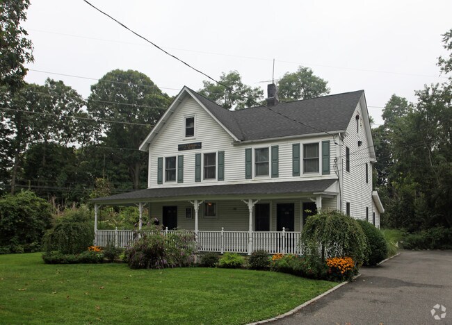
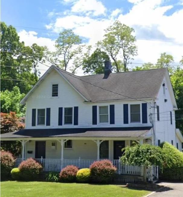
Property Record
186 W Main St, Smithtown, NY 11787
Current Lease Availabilities
NEARBY LISTINGS FOR SALE OR LEASE
Property Detail
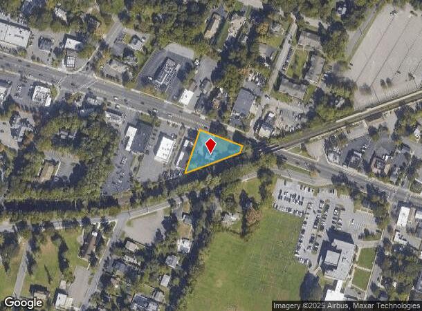
186 W Main St
Nassau County-Suffolk County, NY
Suffolk
0800-076-00-05-00-009-001
New York
Townhouserowhouse
0.52 AC
X
Western Suffolk
36103C0652H
Long Island (New York)
DEMOGRAPHICS near 186 W Main St
1 Mile
3 Mile
5 Mile
2024 Total Population
5,875
65,063
188,682
2029 Population
5,791
64,128
185,579
Pop Growth 2024-2029
(1.43%)
(1.44%)
(1.64%)
Average Age
43
43
42
2024 Total Households
1,939
22,012
60,448
HH Growth 2024-2029
(1.81%)
(1.75%)
(1.84%)
Median Household Inc
$161,972
$146,173
$129,948
Avg Household Size
2.80
2.80
3.00
2024 Avg HH Vehicles
2.00
2.00
2.00
Median Home Value
$662,698
$646,819
$564,132
Median Year Built
1964
1967
1967
Nearby Places
Map Layers
Map Styles
 Street
 Aerial
- Restaurants
- Banks
- Shops
- Fitness
- Groceries
PUBLIC TRANSPORTATION
TRANSIT/SUBWAY
Smithtown Station (Port Jefferson Branch - Long Island Rail Road)
DRIVE
WALK
Distance
Smithtown Station (Port Jefferson Branch - Long Island Rail Road)
1 min
5 min
0.2 mi
COMMUTER RAIL
Smithtown Station (Port Jefferson Branch - Long Island Rail Road)
DRIVE
WALK
Distance
Smithtown Station (Port Jefferson Branch - Long Island Rail Road)
2 min
5 min
0.2 mi
St James Station (Port Jefferson Branch - Long Island Rail Road)
DRIVE
WALK
Distance
St James Station (Port Jefferson Branch - Long Island Rail Road)
7 min
3.8 mi
AIRPORT
Long Island MacArthur
DRIVE
WALK
Distance
Long Island MacArthur
19 min
10.6 mi
Freight Ports
Port of New Haven
DRIVE
WALK
Distance
Port of New Haven
126 min
49.4 mi
Nearby Properties
Address
Land Use
TOTAL SIZE
Lot Size
Zoning
Address
Land Use
TOTAL SIZE
Lot Size
Zoning
301 SF
3.70 AC
Address
Land Use
TOTAL SIZE
Lot Size
Zoning
97.50 AC
AAA
Address
Land Use
TOTAL SIZE
Lot Size
Zoning
57.30 AC
AAA
Address
Land Use
TOTAL SIZE
Lot Size
Zoning
24.96 AC
Address
Land Use
TOTAL SIZE
Lot Size
Zoning
24.70 AC
AAA
Address
Land Use
TOTAL SIZE
Lot Size
Zoning
15 AC
AA
Address
Land Use
TOTAL SIZE
Lot Size
Zoning
8.02 AC
NULL
Address
Land Use
TOTAL SIZE
Lot Size
Zoning
12.80 AC
AAA
Address
Land Use
TOTAL SIZE
Lot Size
Zoning
8.35 AC
IND1
Address
Land Use
TOTAL SIZE
Lot Size
Zoning
9.90 AC
CA
Address
Land Use
TOTAL SIZE
Lot Size
Zoning
10.30 AC
CA
Address
Land Use
TOTAL SIZE
Lot Size
Zoning
4.60 AC
GSE
Address
Land Use
TOTAL SIZE
Lot Size
Zoning
6.48 AC
CA
Address
Land Use
TOTAL SIZE
Lot Size
Zoning
4.52 AC
CA
Address
Land Use
TOTAL SIZE
Lot Size
Zoning
0.28 AC
VILLA
Address
Land Use
TOTAL SIZE
Lot Size
Zoning
4.91 AC
AAA
Address
Land Use
TOTAL SIZE
Lot Size
Zoning
67.94 AC
Address
Land Use
TOTAL SIZE
Lot Size
Zoning
7.10 AC
IND1
Address
Land Use
TOTAL SIZE
Lot Size
Zoning
35.70 AC
Address
Land Use
TOTAL SIZE
Lot Size
Zoning
3.81 AC
BUS2
Address
Land Use
TOTAL SIZE
Lot Size
Zoning
7.86 AC
BUS2
Address
Land Use
TOTAL SIZE
Lot Size
Zoning
14.50 AC
Address
Land Use
TOTAL SIZE
Lot Size
Zoning
3.73 AC
BUS2
Address
Land Use
TOTAL SIZE
Lot Size
Zoning
4.80 AC
CA
Address
Land Use
TOTAL SIZE
Lot Size
Zoning
2.82 AC
IND1
Address
Land Use
TOTAL SIZE
Lot Size
Zoning
18.20 AC
Address
Land Use
TOTAL SIZE
Lot Size
Zoning
6.20 AC
IND1
Address
Land Use
TOTAL SIZE
Lot Size
Zoning
3.13 AC
Address
Land Use
TOTAL SIZE
Lot Size
Zoning
35.49 AC
AAA
Address
Land Use
TOTAL SIZE
Lot Size
Zoning
3.48 AC
BUS1
The World's #1 Commercial Real Estate Marketplace
Connect with us
© 2025 CoStar Group
The information above has been obtained from sources believed reliable. While we do not doubt its accuracy we have not verified it and make no guarantee, warranty or representation about it. It is your responsibility to independently confirm its accuracy and completeness. Any projections, opinions, assumptions, or estimates used are for example only and do not represent the current or future performance of the property. The value of this transaction to you depends on tax and other factors which should be evaluated by your tax, financial, and legal advisors. You and your advisors should conduct a careful, independent investigation of the property to determine to your satisfaction the suitability of the property for your needs.