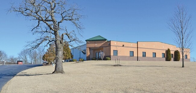
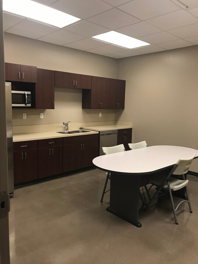
Property Record
1860 E Pump Station Rd, Fayetteville, AR 72701


NEARBY LISTINGS FOR SALE OR LEASE
Property Detail
1860 E Pump Station Rd
Fayetteville-Springdale-Rogers, AR-MO
Fayetteville Indust. Park Final Replat
765-19948-000
PT LOT 10 4.059 AC FURTHER DESCRIBED FROM 2020-24037 AS: PART OF LOT NUMBERED (10) OF THE FINAL REPLAT OF THE FAYETTEVILLE IN
Lightindustrial
Washington
X
Arkansas
05143C0217G
10,10
2025
4.06 AC
2025
Greater Fayetteville
011107
Fayetteville/Springdale/Rogers
19,600 SF
DEMOGRAPHICS near 1860 E Pump Station Rd
1 Mile
3 Mile
5 Mile
2024 Total Population
1,994
36,167
78,463
2029 Population
2,265
39,431
85,666
Pop Growth 2024-2029
+ 13.59%
+ 9.02%
+ 9.18%
Average Age
35
33
34
2024 Total Households
840
13,245
32,172
HH Growth 2024-2029
+ 13.93%
+ 10.68%
+ 10.01%
Median Household Inc
$39,781
$49,680
$53,208
Avg Household Size
2.30
2.20
2.10
2024 Avg HH Vehicles
2.00
2.00
2.00
Median Home Value
$202,027
$318,529
$288,486
Median Year Built
2005
1995
1992
Nearby Places
Map Layers
Map Styles
 Street
 Aerial
- Restaurants
- Banks
- Shops
- Fitness
- Groceries
PUBLIC TRANSPORTATION
AIRPORT
Northwest Arkansas Ntl
DRIVE
WALK
Distance
Northwest Arkansas Ntl
49 min
26.3 mi
Freight Ports
Tulsa Port of Inola
DRIVE
WALK
Distance
Tulsa Port of Inola
117 min
94.4 mi
SALE & LEASE HISTORY
LISTING DATE
SALE/LEASE

Mar 03, 2021
For Lease
Feb 19, 2020
For Lease
Feb 19, 2020
For Sale
Aug 19, 2020
For Lease
Nearby Properties
Address
Land Use
TOTAL SIZE
Lot Size
Zoning
Address
Land Use
TOTAL SIZE
Lot Size
Zoning
27,060 SF
26.31 AC
Address
Land Use
TOTAL SIZE
Lot Size
Zoning
316,846 SF
2.31 AC
I1
Address
Land Use
TOTAL SIZE
Lot Size
Zoning
63,080 SF
3.42 AC
Address
Land Use
TOTAL SIZE
Lot Size
Zoning
45,300 SF
16.38 AC
Address
Land Use
TOTAL SIZE
Lot Size
Zoning
145,586 SF
2.18 AC
R3
Address
Land Use
TOTAL SIZE
Lot Size
Zoning
19,544 SF
18.79 AC
Address
Land Use
TOTAL SIZE
Lot Size
Zoning
193,590 SF
8.67 AC
I1
Address
Land Use
TOTAL SIZE
Lot Size
Zoning
371,436 SF
29.18 AC
I2
Address
Land Use
TOTAL SIZE
Lot Size
Zoning
36,104 SF
8.36 AC
I1
Address
Land Use
TOTAL SIZE
Lot Size
Zoning
191,928 SF
0.81 AC
C4
Address
Land Use
TOTAL SIZE
Lot Size
Zoning
62,644 SF
0.49 AC
R3
Address
Land Use
TOTAL SIZE
Lot Size
Zoning
48,120 SF
0.53 AC
R3
Address
Land Use
TOTAL SIZE
Lot Size
Zoning
86,794 SF
0.33 AC
Address
Land Use
TOTAL SIZE
Lot Size
Zoning
78,284 SF
0.43 AC
Address
Land Use
TOTAL SIZE
Lot Size
Zoning
325,150 SF
23.71 AC
I2
Address
Land Use
TOTAL SIZE
Lot Size
Zoning
99,793 SF
6.98 AC
Address
Land Use
TOTAL SIZE
Lot Size
Zoning
302,144 SF
30.99 AC
AA1
Address
Land Use
TOTAL SIZE
Lot Size
Zoning
663,900 SF
46.74 AC
I2
Address
Land Use
TOTAL SIZE
Lot Size
Zoning
40,501 SF
1.13 AC
R0
Address
Land Use
TOTAL SIZE
Lot Size
Zoning
206,047 SF
26.94 AC
R1
Address
Land Use
TOTAL SIZE
Lot Size
Zoning
49,883 SF
1.38 AC
R2
Address
Land Use
TOTAL SIZE
Lot Size
Zoning
75,456 SF
4.25 AC
I1
Address
Land Use
TOTAL SIZE
Lot Size
Zoning
174,848 SF
27.32 AC
R1
Address
Land Use
TOTAL SIZE
Lot Size
Zoning
22,230 SF
0.44 AC
Address
Land Use
TOTAL SIZE
Lot Size
Zoning
46,181 SF
0.39 AC
R3
Address
Land Use
TOTAL SIZE
Lot Size
Zoning
53,160 SF
4.40 AC
Address
Land Use
TOTAL SIZE
Lot Size
Zoning
76,485 SF
2.32 AC
Address
Land Use
TOTAL SIZE
Lot Size
Zoning
84,944 SF
2.50 AC
I1
Address
Land Use
TOTAL SIZE
Lot Size
Zoning
53,484 SF
6.86 AC
Address
Land Use
TOTAL SIZE
Lot Size
Zoning
217,682 SF
8.28 AC
The World's #1 Commercial Real Estate Marketplace
Connect with us
© 2026 CoStar Group
The information above has been obtained from sources believed reliable. While we do not doubt its accuracy we have not verified it and make no guarantee, warranty or representation about it. It is your responsibility to independently confirm its accuracy and completeness. Any projections, opinions, assumptions, or estimates used are for example only and do not represent the current or future performance of the property. The value of this transaction to you depends on tax and other factors which should be evaluated by your tax, financial, and legal advisors. You and your advisors should conduct a careful, independent investigation of the property to determine to your satisfaction the suitability of the property for your needs.