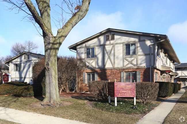
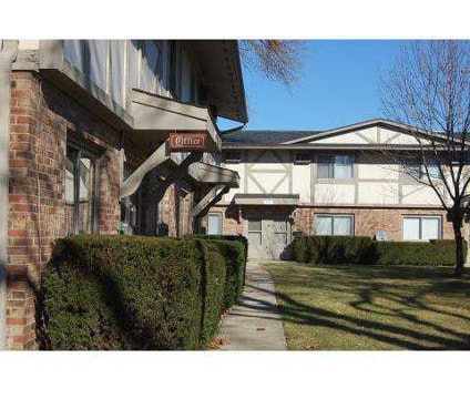
Property Record
1861 Lilac Ln, Aurora, IL 60506

Save to a Folder
{{folder.Name}}
{{folder.ListingIds.length}} Properties
{{folder.ListingIds.length}} Property
Create a New Folder
Property Detail
1861 Lilac Ln
Chicago-Naperville-Elgin, IL-IN
FORDON PARK SUBDN UNIT 4 LOTS 265-273 & LOTS 294-303
15-18-452-021
KANE
Commercialacreage
Illinois
B and X Area of moderate flood hazard, usually the area between the limits of the 100-year and 500-year floods.
265-2
2025
3.06 AC
2025
Edgelawn Randall
853005
Chicago
98,716 SF
NEARBY LISTINGS FOR SALE OR LEASE
DEMOGRAPHICS near 1861 Lilac Ln
1 mile
3 mile
5 mile
2025 Total Population
15,859
66,820
182,513
2030 Population
15,971
67,520
185,521
Pop Growth 2025-2030
+ 0.71%
+ 1.05%
+ 1.65%
Average Age
40
39
38
2025 Total Households
5,796
23,093
61,018
HH Growth 2025-2030
+ 0.62%
+ 1.03%
+ 1.73%
Median Household Inc
$74,198
$73,536
$84,021
Avg Household Size
2.70
2.70
2.90
2025 Avg HH Vehicles
2.00
2.00
2.00
Median Home Value
$258,456
$257,500
$268,800
Median Year Built
1973
1969
1977
Nearby Places
Map Layers
Map Styles
 Street
 Aerial
Layers
 Traffic
 Biking
Places
Listings with unknown addresses are not visible on the map
- Restaurants
- Banks
- Shops
- Fitness
- Groceries
PUBLIC TRANSPORTATION
COMMUTER RAIL
Aurora (Burlington Northern - Metra)
Drive
Walk
Distance
Aurora (Burlington Northern - Metra)
10 min
3.6 mi
AIRPORT
Chicago O'Hare International
Drive
Walk
Distance
Chicago O'Hare International
58 min
40.3 mi
Freight Ports
Port Milwaukee
Drive
Walk
Distance
Port Milwaukee
139 min
112.0 mi
Nearby Properties
Address
Land Use
TOTAL SIZE
Lot Size
Zoning
Address
Land Use
TOTAL SIZE
Lot Size
Zoning
Address
Land Use
TOTAL SIZE
Lot Size
Zoning
Address
Land Use
TOTAL SIZE
Lot Size
Zoning
28.95 AC
Address
Land Use
TOTAL SIZE
Lot Size
Zoning
530,523 SF
37.65 AC
Address
Land Use
TOTAL SIZE
Lot Size
Zoning
18.81 AC
Address
Land Use
TOTAL SIZE
Lot Size
Zoning
28.35 AC
Address
Land Use
TOTAL SIZE
Lot Size
Zoning
Address
Land Use
TOTAL SIZE
Lot Size
Zoning
19.80 AC
Address
Land Use
TOTAL SIZE
Lot Size
Zoning
Address
Land Use
TOTAL SIZE
Lot Size
Zoning
18.48 AC
Address
Land Use
TOTAL SIZE
Lot Size
Zoning
25.58 AC
Address
Land Use
TOTAL SIZE
Lot Size
Zoning
840,912 SF
49.56 AC
Address
Land Use
TOTAL SIZE
Lot Size
Zoning
Address
Land Use
TOTAL SIZE
Lot Size
Zoning
394,560 SF
19.34 AC
Address
Land Use
TOTAL SIZE
Lot Size
Zoning
Address
Land Use
TOTAL SIZE
Lot Size
Zoning
Address
Land Use
TOTAL SIZE
Lot Size
Zoning
622,072 SF
6.04 AC
Address
Land Use
TOTAL SIZE
Lot Size
Zoning
20.56 AC
Address
Land Use
TOTAL SIZE
Lot Size
Zoning
8.22 AC
Address
Land Use
TOTAL SIZE
Lot Size
Zoning
255,500 SF
17.64 AC
Address
Land Use
TOTAL SIZE
Lot Size
Zoning
320,874 SF
1.49 AC
Address
Land Use
TOTAL SIZE
Lot Size
Zoning
989,724 SF
49.41 AC
Address
Land Use
TOTAL SIZE
Lot Size
Zoning
Address
Land Use
TOTAL SIZE
Lot Size
Zoning
83,424 SF
Address
Land Use
TOTAL SIZE
Lot Size
Zoning
Address
Land Use
TOTAL SIZE
Lot Size
Zoning
301,468 SF
44.12 AC
Address
Land Use
TOTAL SIZE
Lot Size
Zoning
169,918 SF
20 AC
Address
Land Use
TOTAL SIZE
Lot Size
Zoning
180,348 SF
14.33 AC
Address
Land Use
TOTAL SIZE
Lot Size
Zoning
15.58 AC
The World's #1 Commercial Real Estate Marketplace
Connect with us
© 2026 CoStar Group
The information above has been obtained from sources believed reliable. While we do not doubt its accuracy we have not verified it and make no guarantee, warranty or representation about it. It is your responsibility to independently confirm its accuracy and completeness. Any projections, opinions, assumptions, or estimates used are for example only and do not represent the current or future performance of the property. The value of this transaction to you depends on tax and other factors which should be evaluated by your tax, financial, and legal advisors. You and your advisors should conduct a careful, independent investigation of the property to determine to your satisfaction the suitability of the property for your needs.